Click on the icon ![]() in the top-right corner to view the map in full screen.
in the top-right corner to view the map in full screen.
Show/Hide layers as needed.
After clicking on the image,
click on the icon ![]() in the top-left corner to display the map legend.
in the top-left corner to display the map legend.
Show/Hide layers as needed.
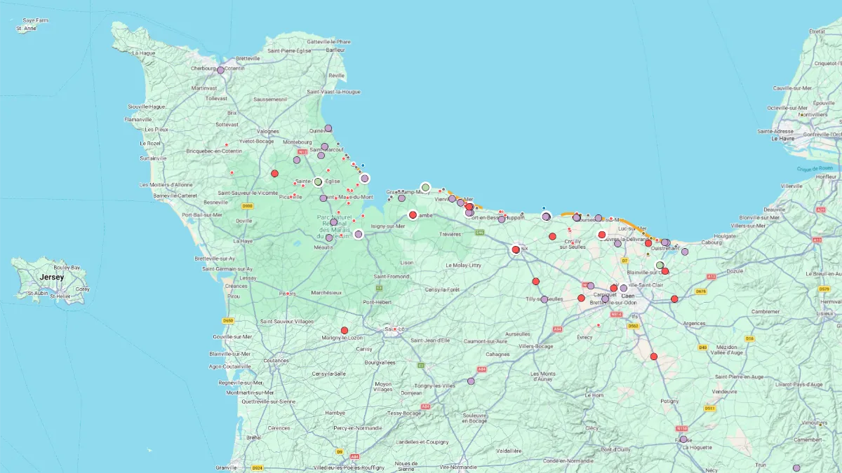
Explore the key Normandy D-Day landing sites with this interactive D-Day Sites Map.
It highlights the main beaches, cemeteries, museums, bunkers, harbor remains, tanks, memorials, churches, and specific World War II landmarks linked to the Allied landings.
Use the map to locate major US, UK, Canadian, and German sites across the Normandy coast, from historic battle areas and military cemeteries to preserved defenses and remembrance places.
Whether you are planning a D-Day history trip, a Normandy road trip, or a battlefield tour, this map helps you discover the most important places to visit.
FRANCE TRAVEL GUIDE 👉 Home Page