




Provence Tourist Map: Image and PDF
Provence Tourist Map Image
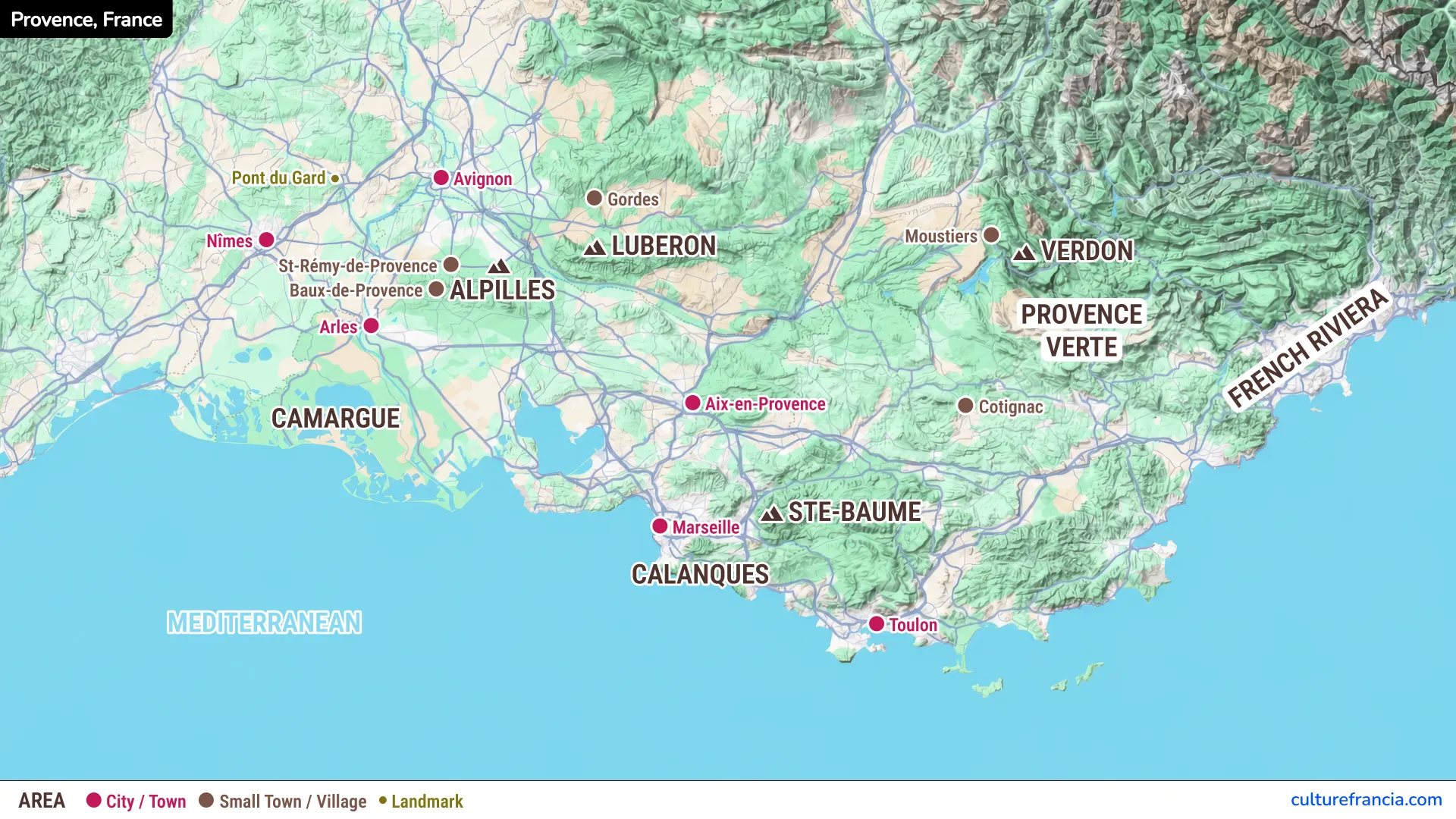
This map of Provence, France marks cities in pink, villages in brown, and landmarks in olive green. It also shows the Luberon, Alpilles, Camargue, Verdon, and Calanques, making it easy to visualize the region.
Download the Provence Tourist Map PDF
Open the Provence Tourist Map PDF
Prefer paper? Save our printable Provence map PDF to your phone or print a copy. Handy for comparing destinations without switching between browser tabs.
Interactive Map of Provence
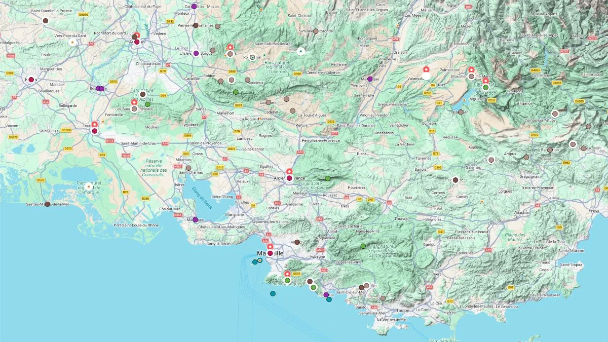
Click on the icon  in the top-right corner to view the map in full screen.
Show/Hide layers as needed.
After clicking on the image,
click on the icon  in the top-left corner to display the map legend.
Show/Hide layers as needed.
An interactive map of Provence helps you examine places more closely. Use it to explore potential stops, then check a navigation app for driving directions and realistic travel times.
Where Is Provence on the Map?
Provence lies in southeastern France, between the Rhône Valley, the Alps, and the Mediterranean. Its historical boundaries differ from those of the larger Provence-Alpes-Côte d’Azur region.
Provence’s Location and Main Regions
The Luberon, Alpilles, and Provence Verte capture the charm of inland Provence. The Camargue stretches toward the sea, while Verdon’s deep gorges dominate the northeast of our tourist map.
Major Cities and Towns in Provence
Avignon, Arles, Aix-en-Provence, and Marseille anchor any Provence map with cities. Toulon lies farther east. Nîmes also appears, although it is in neighboring Occitanie.
Top Attractions on the Provence Tourist Map
For a rewarding itinerary, group nearby attractions instead of crisscrossing the region.
Avignon, Arles, and the Roman Heritage
Avignon’s Palais des Papes recalls the city’s papal past. Arles has a magnificent Roman amphitheater, while the Pont du Gard, just beyond Provence, is an exceptional ancient aqueduct.
Luberon and Alpilles: Hilltop Villages
Gordes surveys the Luberon countryside from its rocky perch. Westward, Les Baux-de-Provence rises above the Alpilles, near Saint-Rémy-de-Provence and its inviting streets.
Camargue and the Mediterranean Coast
The Camargue’s wetlands and lagoons are a world apart from Provence’s hilltop villages. Look out for flamingos, white horses, and vast skies.
Verdon Gorge and Provence Verte
Verdon Gorge is famous for cliffs and turquoise waters. Nearby Moustiers-Sainte-Marie is well worth a stop. Farther south, Cotignac introduces the wooded landscapes of Provence Verte.
Aix-en-Provence, Marseille, and the Calanques
Aix-en-Provence charms with fountains and café terraces; Marseille buzzes around its historic port. Between Marseille and Cassis, the Calanques reveal dramatic limestone cliffs and sheltered coves.
How to Use the Map to Plan Your Provence Trip
The trick is turning your wish list into a sensible route.
Choosing Which Areas to Visit
Focus on two or three neighboring areas. Pair the Luberon with the Alpilles for villages, Marseille with the Calanques for coast and culture, or Camargue with Arles for nature and heritage.
Planning Driving Routes and Day Trips
Check driving times, not just distances. Narrow, winding roads often slow the journey. Drawing on our experience planning trips across France, we recommend leaving room for spontaneous stops, whether it’s a market, viewpoint, or charming village along the way.