




Monaco Tourist Map
Image: Monaco Tourist Map
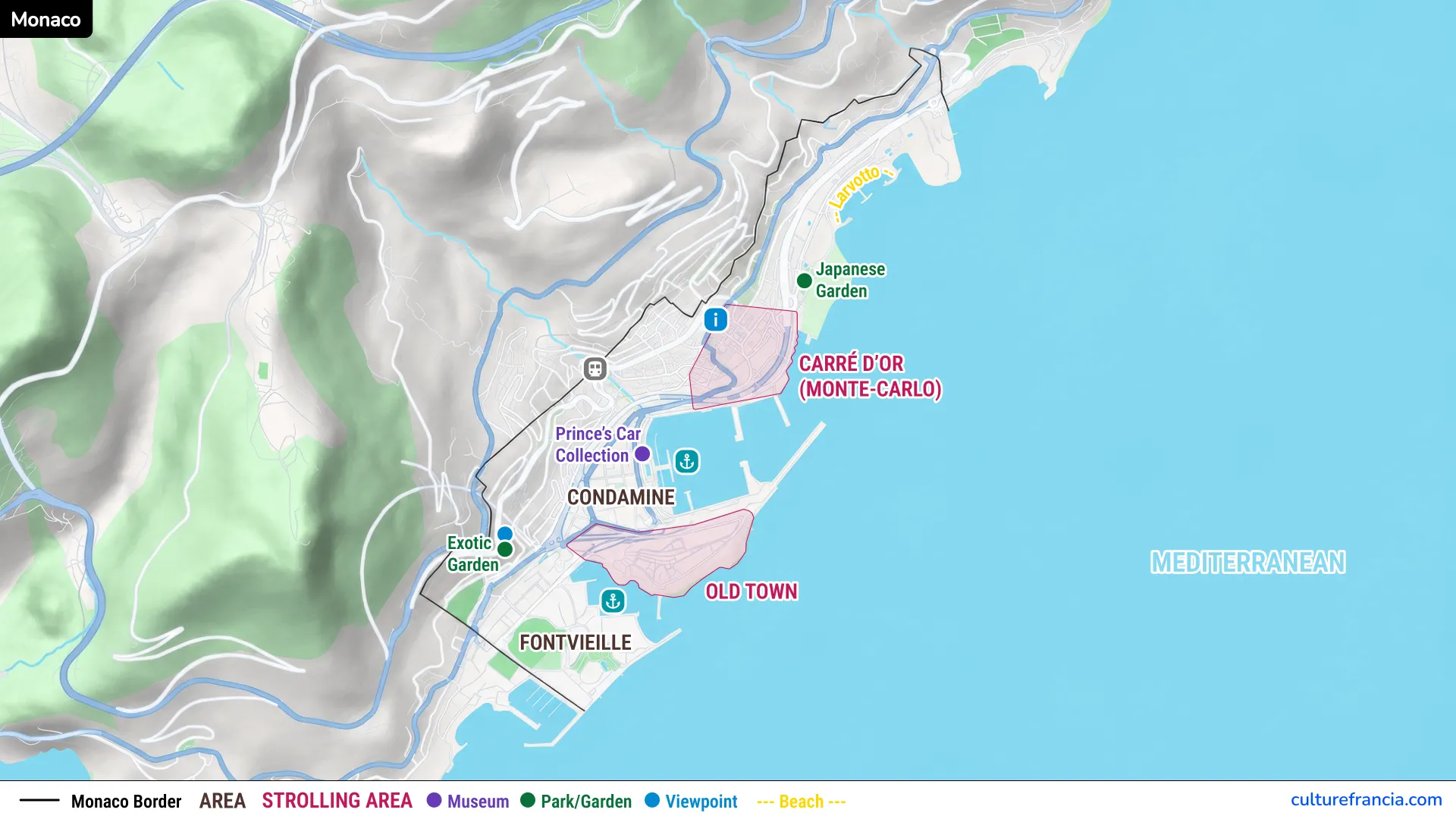
The image version is the quickest way to get your bearings. Use the Monaco tourist map image when you want the whole Principality in one view, from Monaco-Ville on the Rock to Monte Carlo, Larvotto and Fontvieille.
It is especially useful before your visit, when names such as La Condamine, Port Hercule and the Carré d’Or can blur together. Open the image full screen and see how your priorities sit around the harbor and steep slopes.
PDF: Monaco Tourist Map
Open the Monaco Tourist Map PDF
The PDF is the practical version to keep with you. Open the Monaco tourist map PDF if you want a printable or easy-to-save overview of the main sights and districts.
A PDF works well for offline planning or marking the places you do not want to miss. It is designed for orientation rather than turn-by-turn navigation. Monaco has many changes of level, so a short route on paper can still involve stairs, slopes or lifts.
Interactive: Monaco Tourist Map

Click on the icon  in the top-right corner to view the map in full screen.
Show/Hide layers as needed.
After clicking on the image,
click on the icon  in the top-left corner to display the map legend.
Show/Hide layers as needed.
The interactive map is the best choice when you want to move from an overall view to a specific attraction. Use the interactive Monaco map to locate landmarks, gardens, viewpoints, museums and key districts more precisely.
Zoom in around the Prince’s Palace, Port Hercule or Casino Square, then zoom back out to understand the wider route. This is particularly handy in Monaco because the Principality is compact but vertical. Two places can appear almost side by side while sitting on very different levels.
Other Monaco Maps
Monaco City Tourist Map
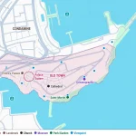
For the historic heart of the Principality, open our Monaco City Tourist Map. It focuses on Monaco-Ville, also known to visitors as Monaco Old Town, Le Rocher or The Rock.
Use this detailed map for the Prince’s Palace, Monaco Cathedral, the Oceanographic Museum, Saint-Martin Gardens and the old streets around the palace. If your visit is mainly about history and the classic views over the Mediterranean, this is the map to open next.
Monte Carlo Tourist Map
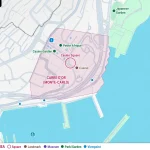
For the famous casino district, use our Monte Carlo Tourist Map. It gives you a closer look at Casino Square, the Casino de Monte-Carlo, the Hôtel de Paris, the Opéra and the streets around the Carré d’Or.
Monte Carlo is only one part of Monaco, not another name for the whole Principality. The dedicated map helps keep that distinction clear while making it easier to plan a walk around its most recognizable landmarks.
Monaco Map with Attractions and Landmarks
Monaco-Ville and the Prince’s Palace
Monaco-Ville occupies the Rock, a dramatic promontory overlooking the sea and Port Hercule. This is the historic center to prioritize if you want palaces, old streets and sweeping views rather than modern Monaco.
The Prince’s Palace stands at the western end of the Rock, with Place du Palais opening toward viewpoints over both sides of the Principality. Nearby, the lanes of the old town lead toward Monaco Cathedral, Saint-Martin Gardens and the Oceanographic Museum.
Monte Carlo and Casino Square
Monte Carlo is Monaco’s best-known glamorous quarter, centered on Place du Casino. Casino Square is the key landmark to find on a Monte Carlo map, because several major sights cluster around it.
The Casino de Monte-Carlo, Hôtel de Paris and Opéra de Monte-Carlo form the architectural heart of the area. Around them, elegant gardens, luxury boutiques and modern developments create a very different atmosphere from the narrow streets of Monaco-Ville.
Port Hercule and La Condamine
Between the Rock and Monte Carlo lies Port Hercule, backed by La Condamine. This harbor area is one of the best geographic reference points in Monaco, because it visually separates the old town from the slopes leading toward Monte Carlo.
La Condamine has a more everyday, lived-in feel than the casino district. Its streets climb above the port, while the market area provides a useful central stop. From the waterfront, the Rock rises dramatically on one side and Monte Carlo occupies the opposite slopes.
Larvotto
Larvotto lies east of central Monte Carlo along the Mediterranean. Look for Larvotto on the map if beaches and the seafront are part of your Monaco visit.
The district provides a contrast to the palace, harbor and casino areas. Here, the focus shifts toward the coast, landscaped public spaces and the beach. It is useful to see Larvotto in relation to Monte Carlo before deciding whether to add it to a short visit.
Fontvieille
Fontvieille occupies the western side of Monaco, below the Rock and close to the French border at Cap-d’Ail. Much of the district was created on land reclaimed from the sea.
Fontvieille is worth locating because it shows how far Monaco extends beyond the classic palace and casino circuit. The area includes a marina, residential buildings, gardens and major sporting facilities, with particularly clear views back toward the southern side of the Rock.
Monaco Districts Map
Main Districts and Neighborhoods of Monaco
A district map makes Monaco much easier to read. The main visitor areas include Monaco-Ville, Monte Carlo, La Condamine, Fontvieille and Larvotto, each with a noticeably different character.
Monaco-Ville is historic, Monte Carlo is associated with Casino Square, La Condamine wraps around the port, Fontvieille spreads west of the Rock, and Larvotto follows the eastern seafront. Understanding these names is more useful than thinking of Monaco as one continuous city center.
Where Monaco City and Monte Carlo Are Located
Monaco City and Monte Carlo are close, but they are not the same place. Monaco City refers here to the historic Monaco-Ville area on the Rock, while Monte Carlo lies across Port Hercule to the northeast.
This distinction matters when planning on foot. Going from the palace area to Casino Square means leaving the Rock, crossing or skirting the harbor zone, then gaining height again toward Monte Carlo. The map makes that relationship immediately easier to understand.
How to Use the Monaco Tourist Map
Getting Around Monaco on Foot
Walking is one of the best ways to experience Monaco, provided you respect the terrain. Distances are short, but Monaco is steep, and that changes how long a route feels.
Use public lifts, escalators and pedestrian connections whenever they fit your route. We recommend planning by area rather than zigzagging repeatedly between the waterfront and upper streets. Visit several sights on the Rock together, then move on to La Condamine or Monte Carlo as a separate section of the day.
Using the Map to Plan Your Visit
Start by marking your priorities, then group them geographically. For a first visit, the easiest plan is usually to combine attractions that sit in the same district before moving to the next one.
The Palace, cathedral, Saint-Martin Gardens and Oceanographic Museum naturally form one Monaco City cluster. Port Hercule and La Condamine form another. Casino Square and its surrounding landmarks make a compact Monte Carlo cluster, while Larvotto and Fontvieille can be added according to your interests and available time.
The map gives you the essential overview. Once your route is clear, use the dedicated Monaco City Tourist Map or Monte Carlo Tourist Map for the areas where you want more detail.