




Nice Tourist Map
Image: Nice Tourist Map
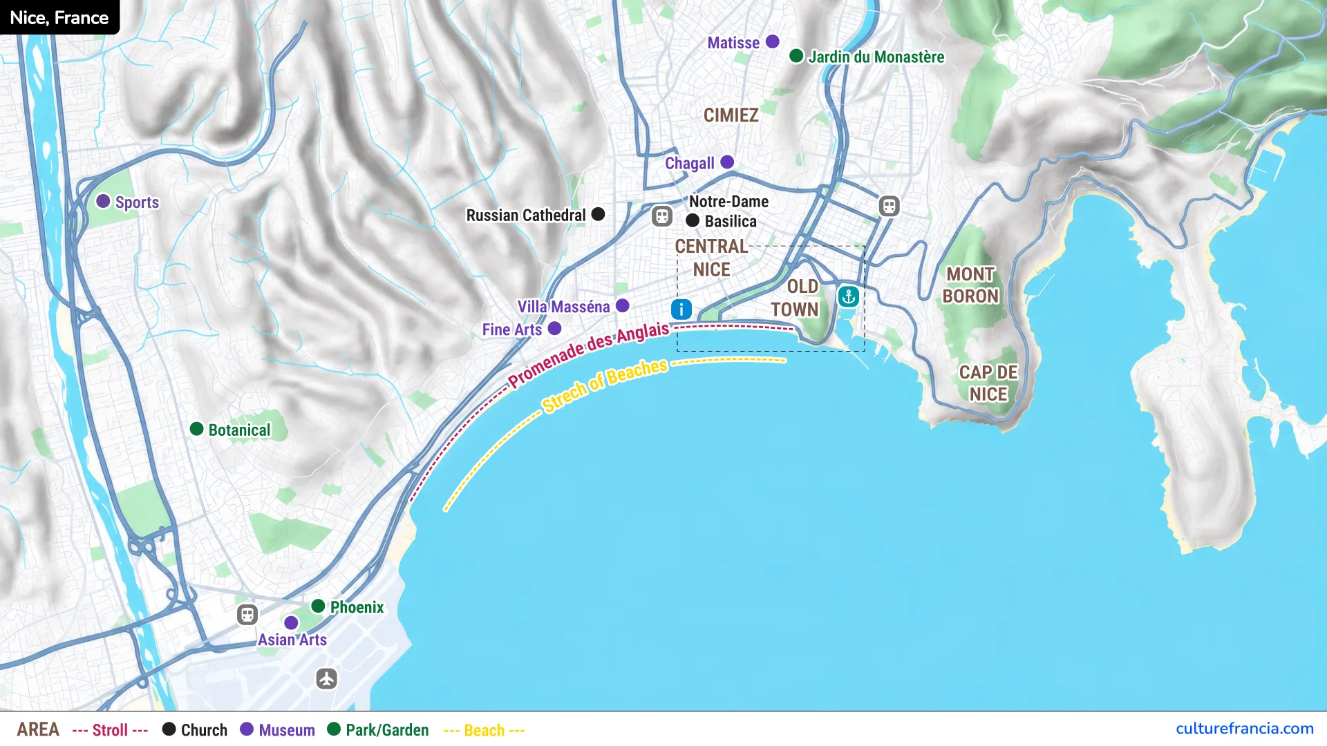
The image version gives you the quickest overview of Nice and its main visitor areas. Use the Nice tourist map image when you want to understand the city’s geography at a glance, from the seafront and Old Town to the port and northern neighborhoods.
It is particularly useful before your trip. You can immediately see which attractions naturally belong together and avoid planning a route that jumps unnecessarily from one side of Nice to another.
PDF: Nice Tourist Map
The PDF version is ideal if you prefer something simple to save, print or keep available offline. Open the Nice tourist map PDF for an easy reference to the main attractions, landmarks and neighborhoods.
A printable Nice map also works well when building a day itinerary. Mark your priorities, group nearby sights and keep the map beside your schedule instead of relying entirely on live navigation.
Interactive: Nice Tourist Map

Click on the icon  in the top-right corner to view the map in full screen.
Show/Hide layers as needed.
After clicking on the image,
click on the icon  in the top-left corner to display the map legend.
Show/Hide layers as needed.
The interactive map lets you move from a citywide view to individual attractions. Use the interactive Nice map when you need more precise locations or want to understand the relationship between different areas.
Zoom into Vieux Nice for its dense street pattern, then out toward Cimiez or along the Promenade des Anglais. For us, this is the most useful format once you have already understood the general layout of the city.
Other Nice Map
Nice Old Town Tourist Map
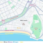
If most of your visit will be spent among the narrow streets of Vieux Nice, use our Nice Old Town Tourist Map for a much closer view.
It focuses on Cours Saleya, Place Rossetti, Nice Cathedral, Palais Lascaris, Place du Palais de Justice and the pedestrian routes leading toward Castle Hill and the seafront.
Use the general Nice map for the whole city and the Nice Old Town map once you enter Vieux Nice. The two maps serve different purposes and are designed to complement each other.
Nice Map with Attractions and Landmarks
Promenade des Anglais
The Promenade des Anglais is Nice’s great Mediterranean reference line, following the curve of the Baie des Anges for several kilometers.
Use the Promenade des Anglais as the southern anchor of your Nice map. From the central section, you are close to Jardin Albert I, Place Masséna and the western edge of Vieux Nice.
The promenade is also useful for orientation because the sea is always on one side. When the maze of city streets becomes confusing, returning toward the waterfront quickly puts Nice back into perspective.
Place Masséna
Place Masséna sits at a strategic meeting point between the city center, the Promenade du Paillon, the shopping streets and Vieux Nice.
Place Masséna is one of the best landmarks for orienting yourself in central Nice. Its red arcaded façades, distinctive paving and open pedestrian space make it difficult to miss.
From here, you can walk south toward the sea, east toward Nice Old Town or north toward Avenue Jean Médecin. For a first visit, it is one of the most useful places to identify on the map.
Nice Old Town
Vieux Nice occupies the historic core between Castle Hill, Boulevard Jean Jaurès and the seafront around Cours Saleya. Its tall façades, green shutters, narrow passages and Baroque churches give the area a noticeably Italian character.
Nice Old Town deserves its own detailed map because its street pattern is much denser than the rest of central Nice. It is an area to explore slowly rather than simply cross from one attraction to another.
Cours Saleya and Place Rossetti make useful reference points when navigating the old quarter.
Castle Hill
Castle Hill rises immediately east of Vieux Nice, separating the Old Town and seafront from Port Lympia.
The name is slightly misleading today, since little remains of the former castle itself. What matters to most visitors is the elevated park and the panorama.
Castle Hill is one of the best places to understand Nice geographically. From above, the sweep of the Baie des Anges, the red roofs of Vieux Nice and Port Lympia suddenly fall into place.
Port Lympia
On the other side of Castle Hill lies Port Lympia, surrounded by colorful façades and dominated at its inner end by the area around Place Île-de-Beauté.
Port Lympia forms a natural eastern extension of a central Nice itinerary, particularly if you walk around Castle Hill or approach from Place Garibaldi.
The port feels calmer than the busiest parts of Vieux Nice and the Promenade des Anglais. Late in the day, the warm light on the façades makes the waterfront especially attractive.
Cimiez
Cimiez sits north of central Nice on higher ground. It feels quite separate from the dense streets of the seafront and Old Town.
Add Cimiez to your map if Roman history, museums and quieter residential Nice are priorities. The district is known for the archaeological remains of ancient Cemenelum, the Roman arena and the Musée Matisse area.
Because Cimiez is uphill and removed from the main central walking circuit, we recommend treating it as a separate section of your itinerary rather than squeezing it between Old Town sights.
Nice Neighborhoods Map
Main Districts and Neighborhoods of Nice
Nice becomes easier to plan once you stop viewing it as a single sightseeing center. The main visitor zones each have their own identity and are best explored in geographic groups.
Vieux Nice is the historic core. The Carré d’Or and central neighborhoods spread west of Place Masséna. Port Lympia lies east of Castle Hill, while Cimiez occupies the hills to the north. The Promenade des Anglais connects much of the central city to the Mediterranean.
A Nice neighborhoods map helps you decide what belongs in the same half-day and what deserves a separate trip.
Where Nice Old Town Is Located
Nice Old Town sits immediately east of Place Masséna and the Promenade du Paillon, with Castle Hill forming its eastern edge and Cours Saleya running close to the sea.
Vieux Nice is very central, but it is not the whole city center. This distinction matters when you are looking for hotels, restaurants or attractions described simply as being “in central Nice.”
Once inside the old quarter, switch to our dedicated Nice Old Town Tourist Map if you want to follow individual streets and landmarks more precisely.
How to Use the Nice Tourist Map
Getting Around Nice on Foot
Nice is an excellent city for walking in its central districts. The Promenade des Anglais, Place Masséna, Vieux Nice and the lower parts of Castle Hill can easily be combined on foot.
The important exception is distance and elevation. Attractions such as Cimiez sit farther from the main sightseeing core, while Castle Hill obviously involves a climb unless you use one of the easier access options.
From our experience planning trips in France, we recommend walking within each neighborhood and using public transport when moving between more distant areas. That gives you more time for the places themselves and less time retracing your steps.
Using the Map to Plan Your Visit
Start by locating the sea, Place Masséna, Vieux Nice and Castle Hill. These four references give you the basic structure of central Nice.
Then group your attractions geographically. A practical first-time route links Place Masséna, Vieux Nice, Castle Hill and the seafront, while Port Lympia can naturally extend the walk to the east.
Keep Cimiez for another block of time if you want to explore its Roman heritage and museums.
The goal of the map is not to turn Nice into a checklist. It is to help you see which places belong together, so you can spend less time navigating and more time enjoying the city. For the narrow streets and monuments of the historic quarter, continue with our Nice Old Town Tourist Map.