Click on the icon ![]() in the top-right corner to view the map in full screen.
in the top-right corner to view the map in full screen.
Show/Hide layers as needed.
After clicking on the image,
click on the icon ![]() in the top-left corner to display the map legend.
in the top-left corner to display the map legend.
Show/Hide layers as needed.
Related Page
Things to Do in Bordeaux
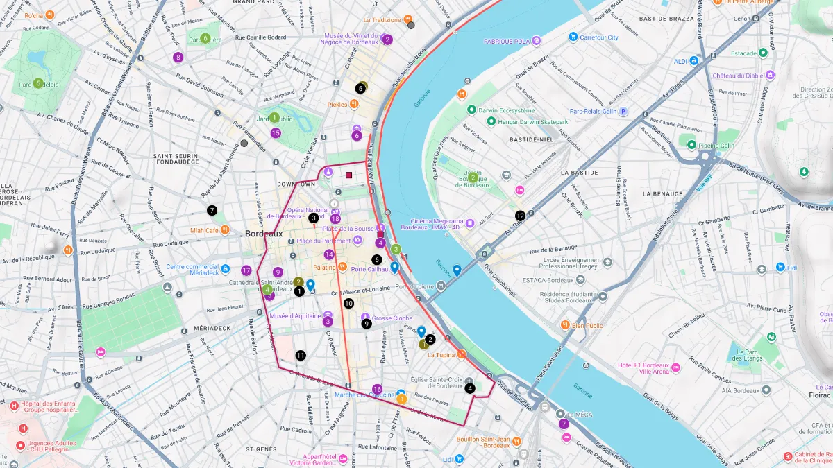
Explore Bordeaux with this interactive tourist map, designed to help you discover the city’s most beautiful places.
Find scenic strolls through the Old Town, the quays, Sainte-Catherine, Place de la Bourse, and the Garonne riverfront, along with top viewpoints such as Pey Berland, Porte Cailhau, Pont de Pierre, and the Cité du Vin.
The map also highlights Bordeaux’s best food markets, flea markets, churches, museums, cultural venues, and parks, making it ideal for planning a city break, walking itinerary, or weekend in Bordeaux.
FRANCE TRAVEL GUIDE 👉 Home Page