


MAP
Corsica
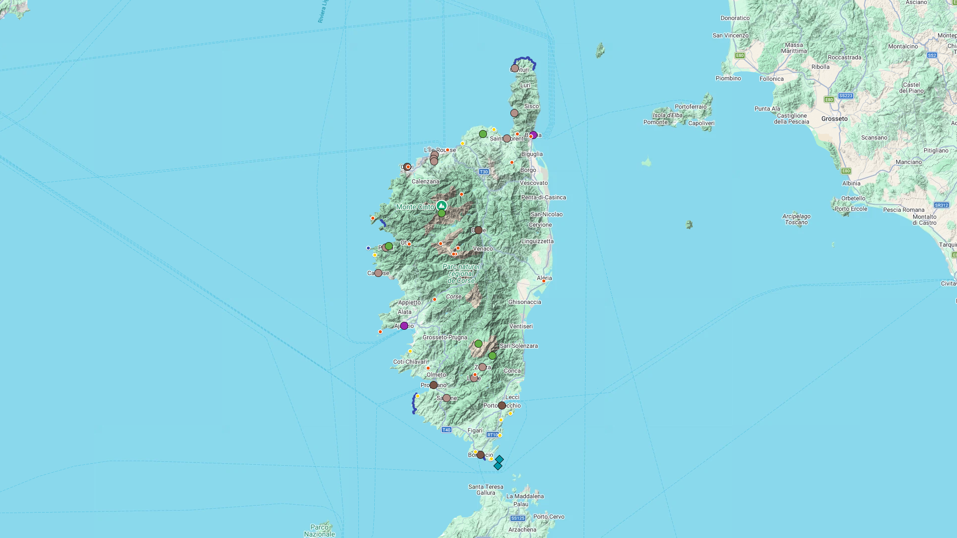
Interactive Map
Corsica
Interactive Map
Click on the icon  in the top-left corner to display the map legend.
Show/Hide layers as needed.
Click on the arrow icons (v) to display the sublayers.
ALL
| Name | Type | Top+ |
|---|---|---|
| Pigna | Village | |
| Sant'Antonino | Village | ✅ |
| Calvi | Small Town | |
| Scandola | Rocky Inlets | ✅ |
| Calanques de Piana | Mountain | ✅ |
| Capo Rosso | Coastal Path | ✅ |
| Corte | Small Town | |
| Aiguilles de Bavella | Mountain | |
| Bonifacio | Small Town | ✅ |
| Île Lavezzu | Island |
Pigna

Type Village
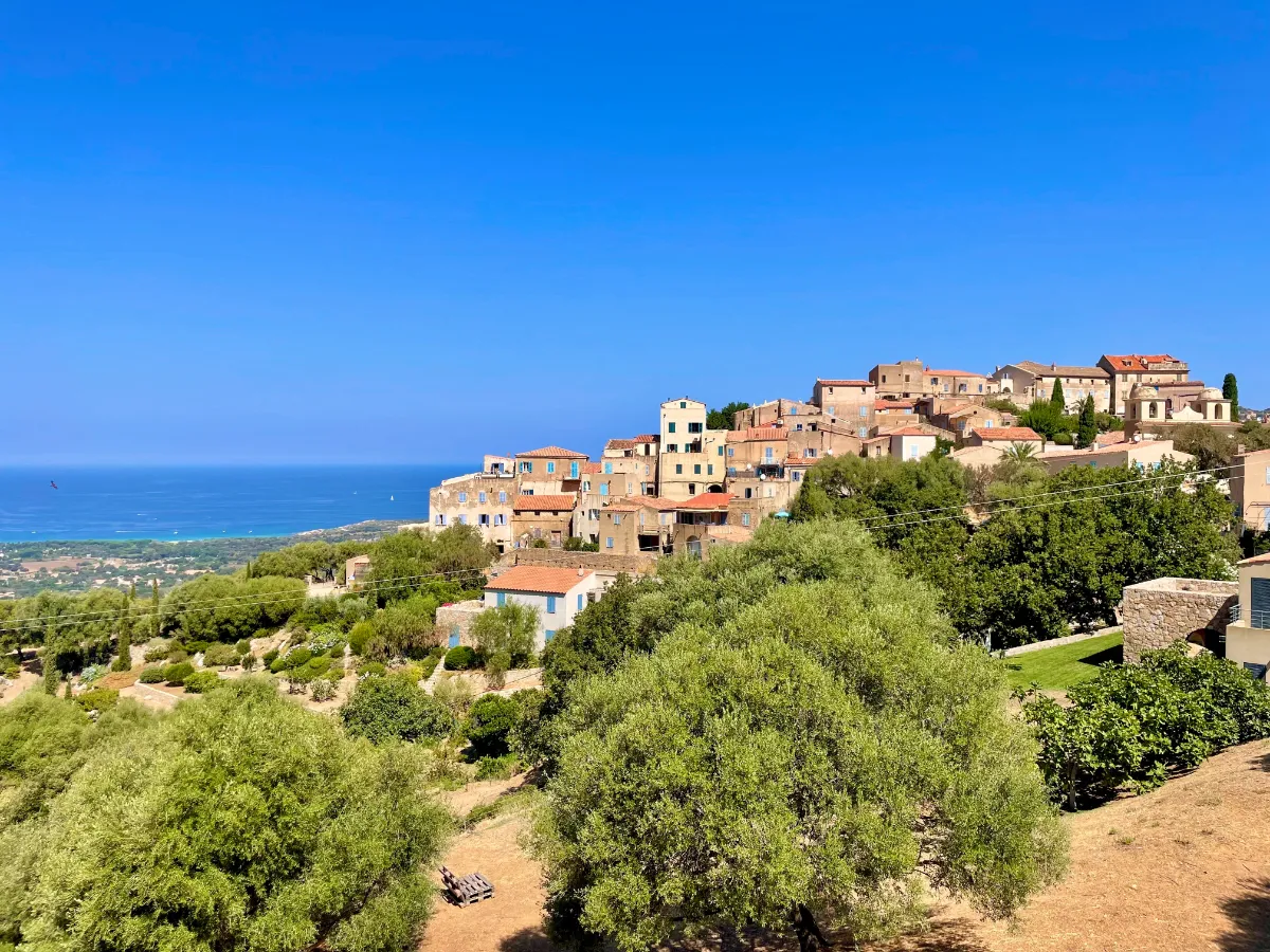
Clinging to a hillside in the Balagne region, Pigna is a lovely little village where pedestrians take priority over cars. Its ochre-colored houses, cobbled streets, and vaulted passageways create a picture-perfect setting. Every turn seems to reveal another beautiful view of the surrounding hills.
Pigna is also known for its vibrant arts and music scene. Traditional Corsican music plays an important role here, especially polyphonic singing. Make your way to the old wheat threshing floor, now an open space, to enjoy sweeping views all the way to the sea.
Sant'Antonino
In Our Top+ ✅
Type Village
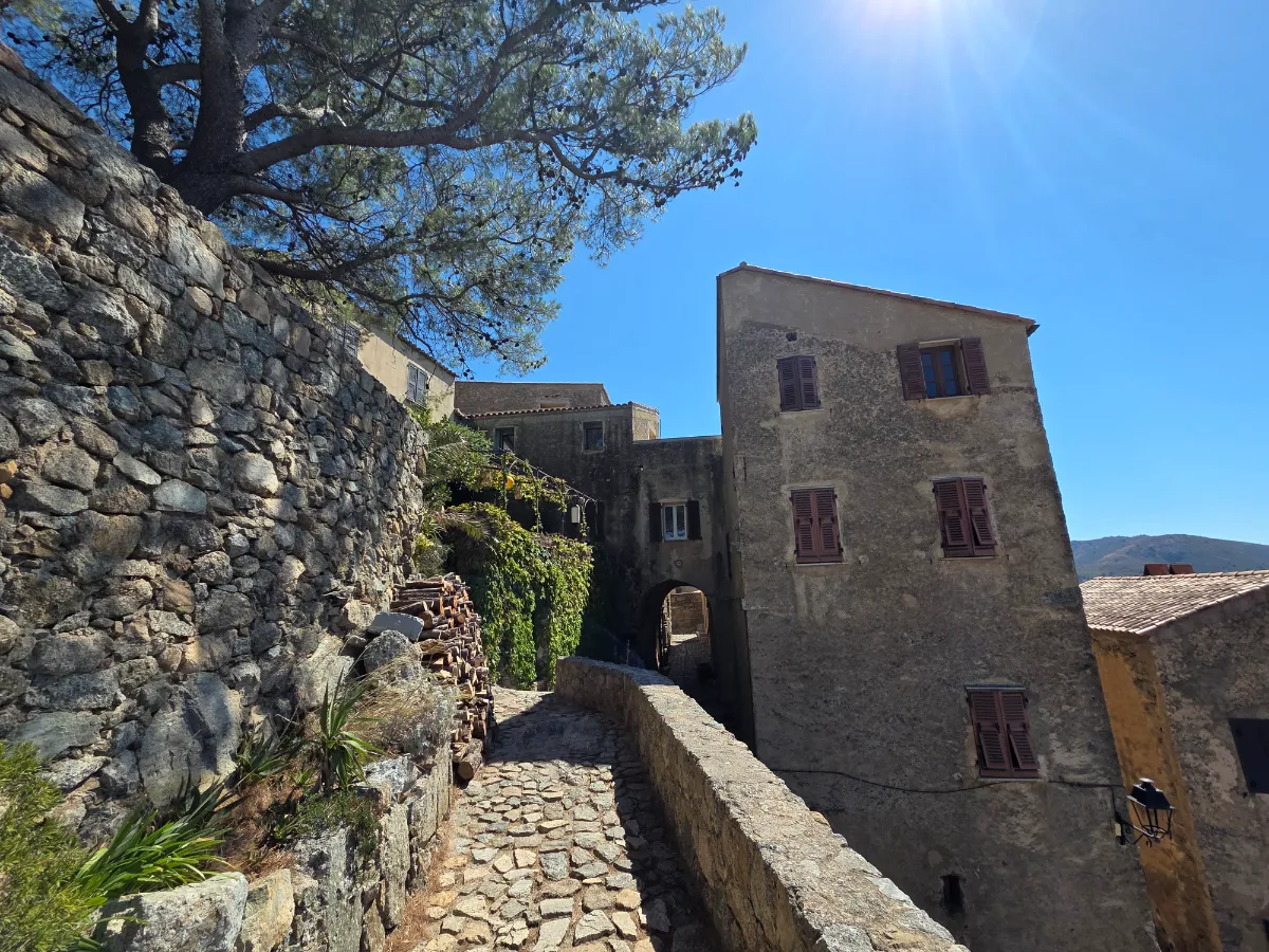
Sant’Antonino looks as though it has grown straight out of its granite hilltop, nearly 500 meters above sea level. One of the oldest villages in Corsica, this medieval settlement is a fascinating jumble of stone houses, tiny streets, and vaulted passageways. Cars have to stay at the entrance.
Exploring the village feels like a little treasure hunt. One staircase leads to a small square, a passageway opens onto a terrace, and suddenly you’re looking down over the surrounding villages and the sea. The views stretch across much of the Balagne region.
Calvi
Type Small Town
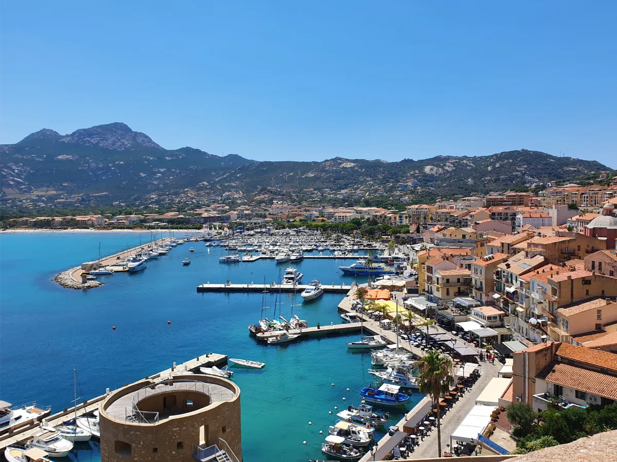
Calvi has one of the most beautiful settings on Corsica’s northwest coast. On one side, there’s a huge bay lined with pale sand and pine forest. On the other, an impressive fortress rises from a rocky headland, its ramparts overlooking the boats and turquoise waters below.
Climb up to the citadel, built and reinforced during the period when Genoa controlled the town. Behind its walls, cobbled streets, historic houses, and the Saint-Jean-Baptiste Cathedral create a wonderfully atmospheric setting.
Scandola
In Our Top+ ✅
Type Rocky Inlets
Full Name
Réserve Naturelle de Scandola
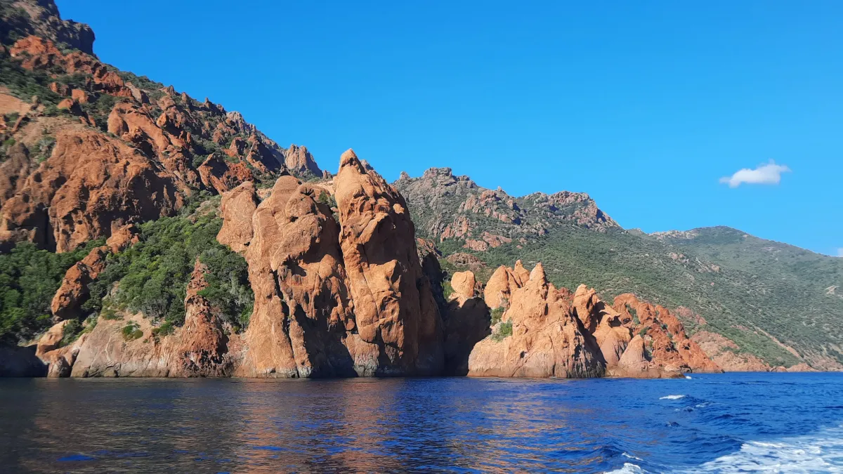
On Corsica’s west coast, the Scandola Nature Reserve protects an extraordinary landscape of red volcanic cliffs, sea caves, and rocks plunging into crystal-clear waters. This exceptional natural area, recognized by UNESCO, is home to remarkable wildlife.
The best way to discover it is by boat, with excursions departing from nearby ports. Tourists aren’t allowed to land anywhere inside the reserve. Strict boating regulations are in place to protect the birds, marine habitats, and many species that find shelter in this fragile environment.
Calanques de Piana
In Our Top+ ✅
Type Mountains
Full Name
Calanques de Piana
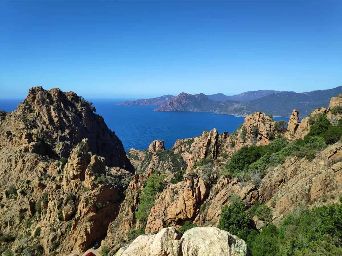
The Calanques de Piana are among Corsica’s most extraordinary landscapes. Picture a jumble of towering red granite rocks rising above the sea, sculpted by erosion into fantastic shapes. Some look like animals, others like figures turned to stone. What you see in them is entirely up to your imagination.
Several trails take you away from the road and into this amazing rocky landscape. The Muleteers’ Trail, once used to travel between neighboring villages, passes through wooded sections before opening onto magnificent viewpoints. The Château Fort Trail leads to a lookout point high above the Gulf of Porto.
More experienced hikers can take on the climb up Capu d’Ortu, a 1,294-meter peak with exceptional views of the coast. The rocks are especially photogenic late in the day, when the sun brings out their warm red and orange tones.
Capo Rosso
In Our Top+ ✅
Type Coastal Path
Full Name
Capo Rosso
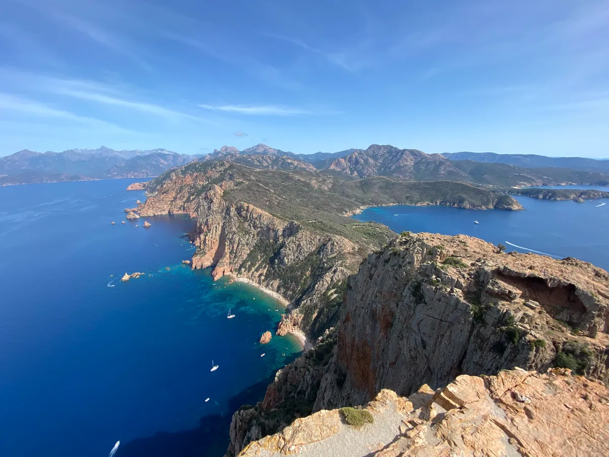
West of Piana, Capo Rosso juts out into the Mediterranean like an enormous fortress of red granite. The trail crosses low, rocky vegetation before climbing toward the Tour de Turghiu, an old watchtower perched 330 meters above the sea.
From the top, you get sweeping views of the Calanques de Piana, the Gulf of Porto, and the Scandola Nature Reserve.
Corte
Type Small Town
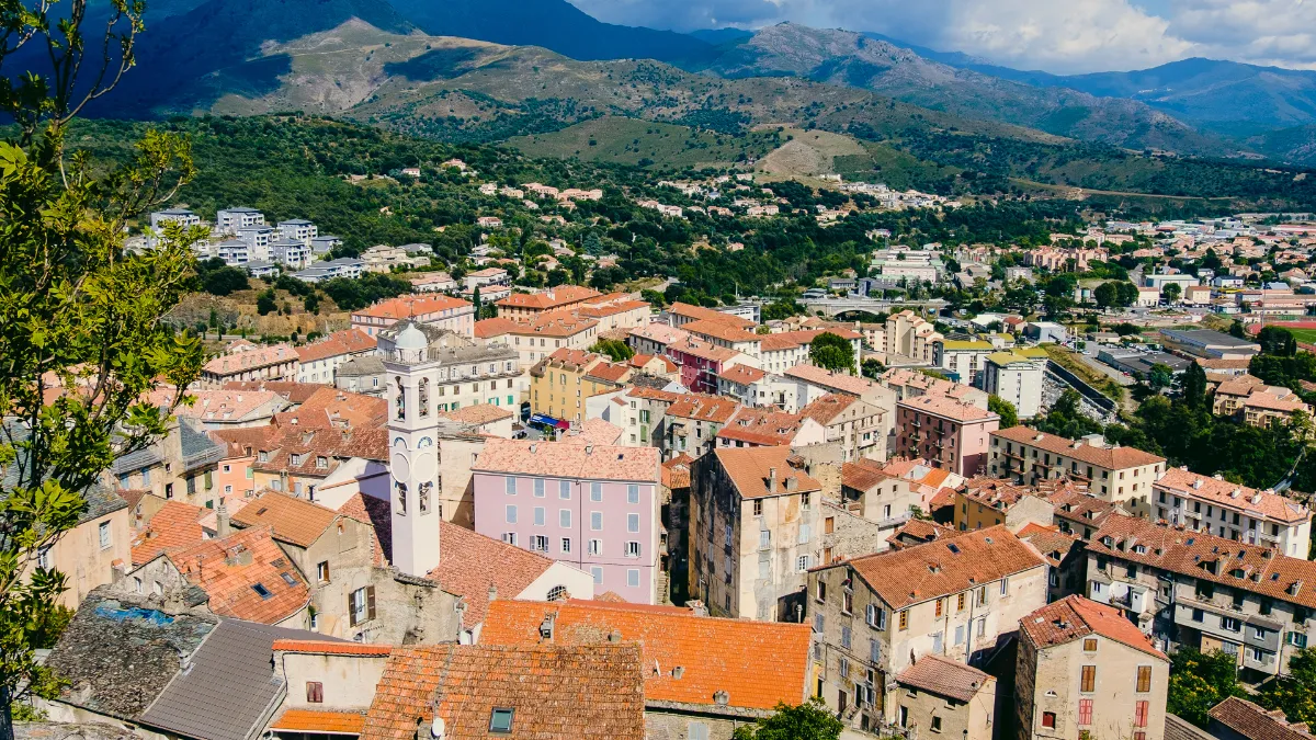
This is a very different side of Corsica from its beaches and seaside resorts. Set deep in the mountains, Corte has a rugged, almost imposing appearance that suits it perfectly. Its tall stone houses seem to be stacked on top of one another beneath a spectacular citadel.
Corte was the capital of independent Corsica from 1755 to 1769, under the leadership of Pasquale Paoli, one of the island’s most important historical figures. This period left a lasting mark on the town. The Museum of Corsica, housed in the citadel, offers a fascinating insight into the island’s identity, traditions, and turbulent history.
Take your time exploring the steep streets of the old town, then head to the viewpoint to admire the surrounding mountains. Corte is also a great starting point for exploring the Restonica and Tavignano valleys, with their clear rivers, forests, and hiking trails.
Aiguilles de Bavella
Type Mountains
Full Name
Aiguilles de Bavella
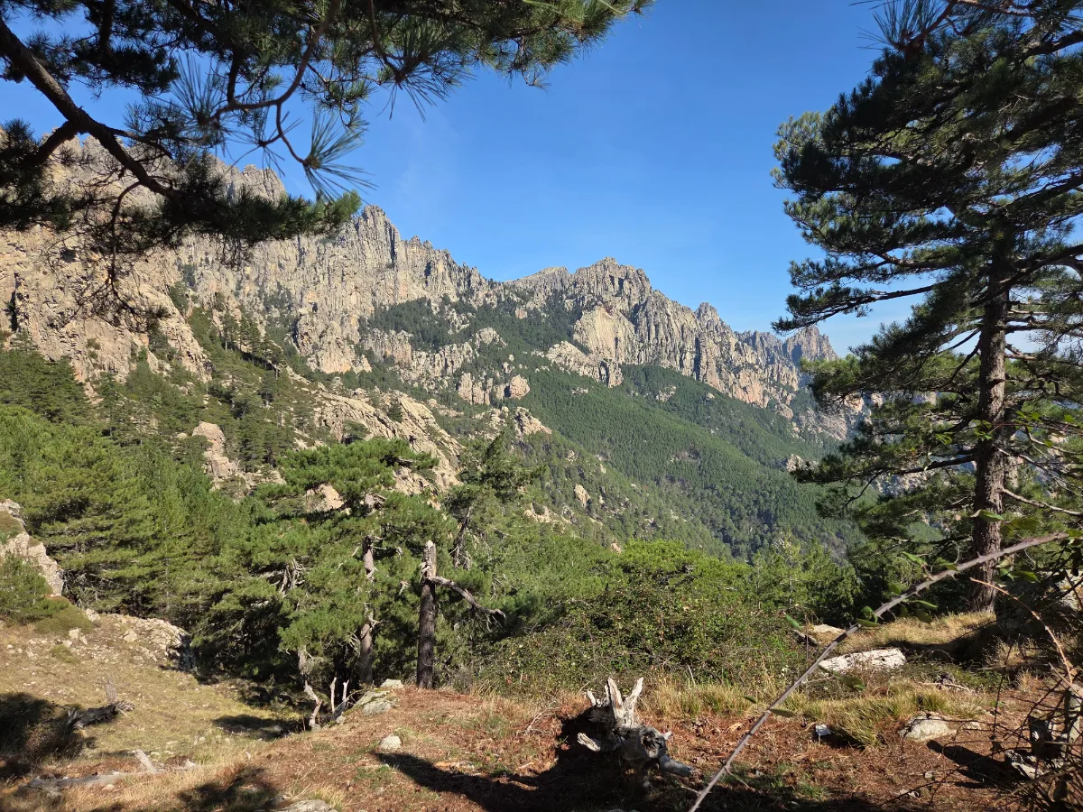
Rising high above the pine forests, the Aiguilles de Bavella are one of Corsica’s most impressive mountain landscapes. These enormous red and gray rocky spires seem to tear through the sky. From the Col de Bavella mountain pass, at 1,218 meters above sea level, the views are already breathtaking.
Bonifacio
In Our Top+ ✅
Type Small Town
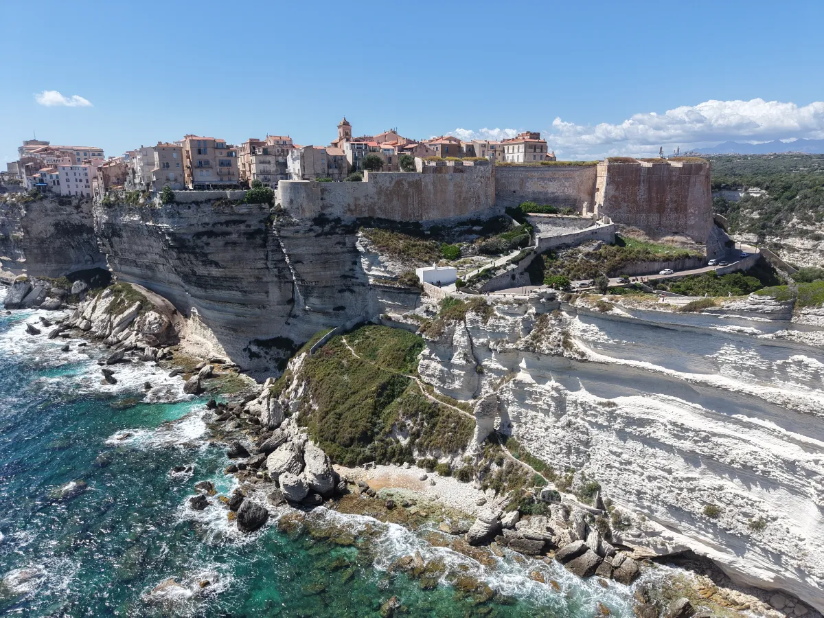
Bonifacio offers one of the most breathtaking sights in the Mediterranean. Picture a small fortified town perched on top of towering white limestone cliffs that drop almost vertically into the deep blue sea. Some houses look as though they’re balancing right on the edge. It’s hard not to be amazed by a setting like this.
The old town, protected by massive fortifications, is a maze of cobbled streets, staircases, and vaulted passageways. Take your time exploring its historic neighborhoods, then discover the impressive King of Aragon’s Staircase, carved into the cliffside and leading down toward the sea.
Below, the harbor sits in a long, narrow natural inlet cut into the rock. A boat trip lets you admire the cliffs from the water, explore sea caves, and fully appreciate the extraordinary location of this town.
Île Lavezzu
Type Island
Size 1 x 1 km (0.6 x 0.6 mi)
Peak Flat
Full Name
Île Lavezzu
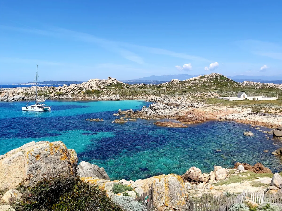
Just off the coast of Bonifacio, Lavezzu Island looks like an extraordinary garden of stones scattered across the Mediterranean. Huge granite boulders, rounded by erosion, surround little sandy beaches and coves filled with crystal-clear water. You can reach the island by boat from Bonifacio.
A few trails let you explore the island’s interior, including the cemeteries linked to the wreck of the Sémillante in 1855. Lavezzu is a protected natural area that’s home to many seabirds.
FERRY
Company
SPMB
Duration (one-way) 30min
Price (round-trip) €37