


PRESENTATION
Between the Mediterranean and the Pyrenees
It’s hard to imagine a region with more contrasting landscapes. From Montpellier to the first mountains of the French Catalonia, you’ll pass through vineyard-covered plains, rocky hills and deep valleys. Just a few kilometres from the sea, you’ll find stone villages, winding roads and a completely different sense of tranquillity. With the coast and mountains so close together, travelling here has a rhythm all its own. Sometimes, the scenery changes completely around a single bend in the road.
Around Montpellier and Béziers, beaches alternate with lagoons separated from the sea by narrow strips of land. Flamingos and small harbours dot these stretches of water, where shellfish farming is still an important activity. Further north, the hills are covered with low-growing oak trees, thyme and rosemary, forming the garrigue, the typical scrubland vegetation of this dry region.
Heading west, vineyards stretch out at the foot of the Corbières, a range of limestone mountains cut through by gorges, with villages tucked away among the hills. The Minervois combines dry plateaus and lush green valleys, bathed in a light that brings out the white of the rocks and the deep green of the vines. Back on the coast, the beaches and lagoons around Narbonne and Leucate offer that unmistakable Mediterranean light, often accompanied by strong winds.
Further south, in the Pyrénées-Orientales, the plain around Perpignan gives way to a rocky coastline. Around Collioure, the mountains plunge straight into the sea, creating little coves and picturesque harbours. Heading inland, orchards gradually give way to the forests and lakes of the Catalan Pyrenees, where peaks rise to nearly 3,000 metres. Pine forests and mountain meadows take over from the Mediterranean scenery.
The seasons also transform the landscape, along with the opportunities for exploring it. Winters are mild along the coast, while snow can cover mountain trails for several months. In between, the sun bathes the villages in golden light, while the tramontane, a sometimes powerful northwesterly wind, sweeps across the plains.
A Rich History Shaped by Roman, Occitan and Catalan Influences
Long before tourism arrived, this region was a crossroads between the Mediterranean, Spain and inland Europe. The Romans built roads and cities here. Narbonne, founded in 118 BC, became a major city of the Roman Empire. Ancient roads and monuments still offer a glimpse of that time, when goods travelled between coastal ports and inland towns.
During the Middle Ages, trading towns and monasteries transformed the landscape. Montpellier flourished thanks to trade and the teaching of medicine, while the abbeys of Saint-Guilhem-le-Désert and Lagrasse reflected the power of the Church. Churches and inner courtyards still tell the story of centuries marked by wealth and rivalry. Pale stone façades, arches and vaulted passageways preserve traces of that era.
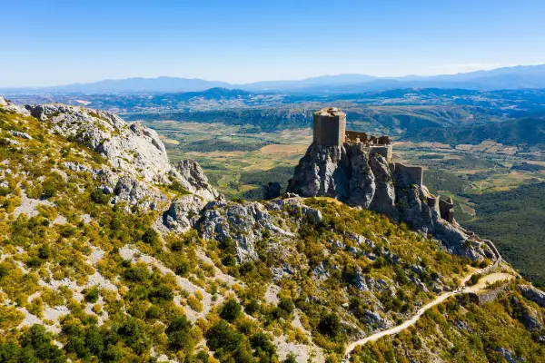
But the region’s history also had a violent side. During the 12th and 13th centuries, Catharism, a Christian religious movement condemned by the Catholic Church, spread across parts of Languedoc. A religious war launched in 1209 led to sieges and massacres, permanently changing local society and the balance of power. The castles of the Corbières are reminders of this troubled past, although many were later reinforced by French kings to defend the border.
Further south, history took a different course. Perpignan was part of the Catalan world and the Kingdom of Majorca before a treaty signed in 1659 brought Roussillon under French rule. Fortifications were built in the mountains to control the routes into Spain, but Catalan language and traditions remained deeply rooted in the region.
The 17th century brought another major transformation with the construction of the Canal du Midi. Designed by Pierre-Paul Riquet and completed in 1681, it connected Toulouse to the Thau Lagoon through a waterway equipped with locks, chambers that allow boats to move between different water levels. The wine trade and the development of ports later reshaped towns and landscapes. Today, you can still follow the canals and discover the remarkable engineering structures originally designed to transport goods.
A Mediterranean Identity with Many Faces
Under the same Mediterranean sun, ways of life can change from one valley to the next. Around Montpellier, Occitan heritage is particularly strong, rooted in the traditional language and culture of southern France. Around Perpignan, Catalan identity is expressed through its own language, festivals and close ties with the other side of the Pyrenees. The two cultures have their own distinct identities, even if they share a love of celebrations.
Vineyards connect these different landscapes. They cover plains and rocky slopes, especially around Banyuls-sur-Mer, where stone walls support the cultivated terraces. Elsewhere, life revolves around the water, from the fishing boats of Sète and the oyster farms of the Thau Lagoon to the busy harbours of the Catalan coast. The history of these activities has even shaped the layout of the villages.
Local festivals also show just how deeply rooted these traditions are. In Sète, water jousting sees competitors face off while standing on platforms at the back of boats. In Catalan communities, the sardana, a traditional group dance performed in a circle, brings people together at local celebrations. Regional accents and place names keep these traditions alive in everyday life, well beyond the tourist season.
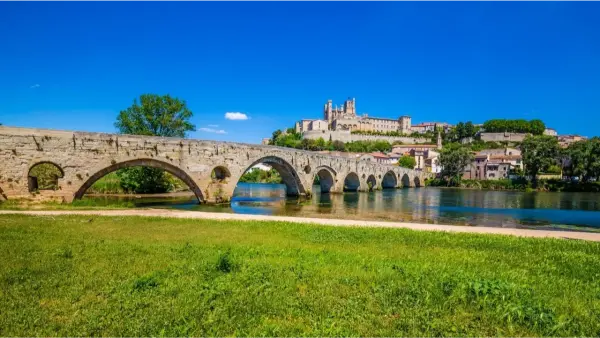
Every town has its own personality. Montpellier is a lively university city that’s always on the move. Béziers has been shaped by winegrowing and a turbulent past. Narbonne takes pride in its Roman origins, while Perpignan’s architecture and traditions reflect its close connections with Catalonia. On the roads further inland, the bustle fades away, giving way to fortified villages, old stone bridges and sun-baked hills filled with the scents of thyme and rosemary.
OVERVIEW
Map
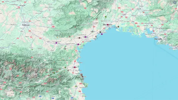
Interactive Map
Interactive Map
Click on the icon  in the top-left corner to display the map legend.
Show/Hide layers as needed.
Click on the arrow icons (v) to display the sublayers.
Top Picks