


INTERACTIVE MAP
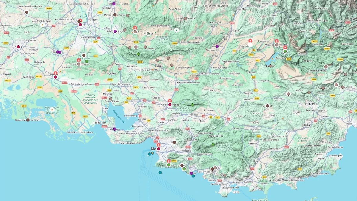
Click on the icon  in the top-right corner to view the map in full screen.
Show/Hide layers as needed.
After clicking on the image,
click on the icon  in the top-left corner to display the map legend.
Show/Hide layers as needed.
ROCKY INLETS
Overview Table
| Name | Top Picks | Exp. Picks |
|---|---|---|
| Calanques | ✅ | ☑️ |
Calanques
In Our Top Picks ✅
Full Names
Parc National des Calanques
Massif des Calanques
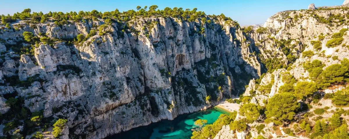
Between Marseille and Cassis, you get one of the most spectacular natural landscapes in Provence, the Calanques. This rugged stretch of coastline, shaped by deep limestone inlets and turquoise water, forms a one of a kind natural setting where white rock drops straight down into the Mediterranean. The high, steep cliffs that define these places sometimes fall vertically into the sea, creating dramatic, untamed views that are among the most striking on the French Mediterranean coast.
These spectacular landscapes also continue below the surface of the sea. Underwater, the cliffs turn into dizzying drop offs, home to especially rich marine life. The seabed in the calanques is considered one of the most beautiful in the French Mediterranean and has played an important role in the history of scuba diving.
Today, the whole area is protected as part of Calanques National Park. You mainly discover this natural territory on foot, through a network of trails winding between cliffs, pine woods, and limestone valleys. The park’s main crossing follows a path of about 28 kilometres linking Marseille to Cassis and giving you spectacular views over the sea and the wild inlets.
Hiking is still the best way to explore this landscape. A lot of the coves are isolated and can only be reached after a sometimes demanding walk, which helps preserve their wild character. As a walker, you can discover remarkable spots, enjoy a swim in crystal clear water, or follow the many marked trails running through the park.
You can also take in the calanques from the sea, thanks to boat trips leaving from Marseille, Cassis, or La Ciotat. These cruises let you admire the vertiginous cliffs, the narrow coves, and the impressive rock formations that make up this exceptional landscape, while still respecting the rules put in place to protect this fragile environment.
⚙️ Visitor Info (Official Website – Fr)
Access to the Sugiton and Pierres Tombées area requires prior reservation during the summer.
COASTALL CLIFF
Overview Table
| Name | Top Picks | Exp. Picks |
|---|---|---|
| Cap Canaille | ☑️ |
Cap Canaille
In Our Expanded Picks ☑️
Full Names
Cap Canaille
Falaises de Cassis
Falaises Soubeyranes
Route des Crêtes
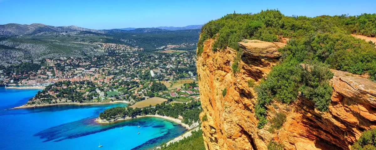
Overlooking the coast between Cassis and La Ciotat, Cap Canaille is one of the most spectacular landscapes on the Provençal shoreline. This rocky headland rises about 360 metres above the sea and gives you an outstanding view over the Mediterranean, the islands off Marseille, and the Calanques National Park.
If you enjoy walking, several trails also let explore the area. Starting from Cassis, a marked route takes you up to the top of the Soubeyranes cliffs and then to the semaphore, before heading down towards La Ciotat after several hours of hiking, with striking views all along the way over the sea and the limestone ridges of the coast.
CANYON
Overview Table
| Name | Top Picks | Exp. Picks |
|---|---|---|
| Verdon | ✅ | ☑️ |
Verdon

In Our Top Picks ✅
Full Names
Gorges du Verdon
Parc Naturel Régional du Verdon
The Verdon Gorge is one of the most spectacular natural landscapes in Provence. It’s considered the most impressive gorge in Europe.
The scenery is breathtaking, with sheer cliffs rising 300 to 600 meters above the river, rocky chaos, wild banks, and dramatic views. This grand setting is a perfect playground for anyone who loves nature and adventure. If you enjoy hiking or climbing, you are in paradise here, and the roads running along the gorge give you incredible views over the canyon.
To protect this exceptional area, a regional natural park was created in 1997. It covers about 180,000 hectares and brings together 45 towns and villages. The park’s mission is to balance environmental protection with local development, while preserving the Verdon’s remarkable landscapes.
The wildlife and plant life are also rich. Reintroduction programs have made it possible for the griffon vulture, which had disappeared from Provence in the 19th century, to return. If you pay close attention, you might also spot golden eagles soaring above the cliffs. Along the discovery trails, signs introduce you to the trees, shrubs, and aromatic plants that make up the local vegetation, helping you understand the canyon’s unique ecosystem.
The Verdon Gorge is also part of the Haute Provence geological reserve, which means minerals and fossils are strictly protected. Even so, the region is ideal for many outdoor activities, including hiking, climbing, wildlife watching, and fishing in the Verdon and its tributaries, where trout, pike, and carp live.
Beyond the natural spectacle, the Verdon is also a lived in land full of history. Hilltop villages, Gallo Roman remains, old churches, and rural heritage all show that people have lived here for a very long time.
MOUNTAIN RANGES
Overview Table
| Name | Top Picks | Exp. Picks |
|---|---|---|
| Dentelles de Montmirail | ||
| Alpilles | ||
| Luberon | ||
| Sainte-Baume |
Dentelles de Montmirail
Full Name
Dentelles de Montmirail
Highest Peak 722m (2,369ft) 📍Crête de Saint-Armand
It’s 8km (5mi) long.
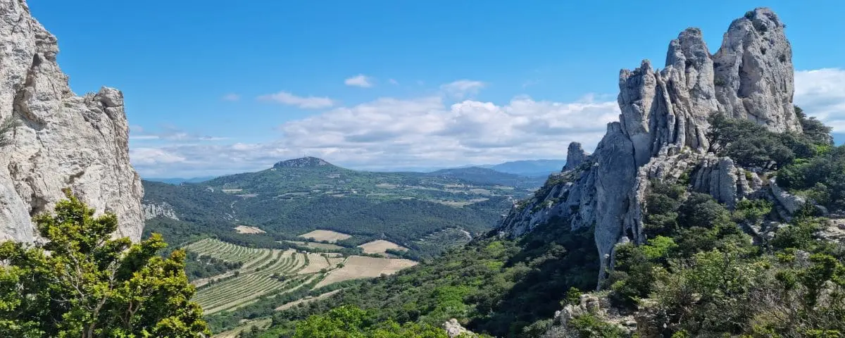
Right in the heart of Vaucluse, not far from Mont Ventoux, the Dentelles de Montmirail are some of the most striking landscapes you’ll see in Provence. What hits you straight away is their dramatic shape, a series of finely carved limestone ridges, almost like they’ve been sculpted by hand, which is exactly how they got their name.
These rock formations give you a view that feels incredibly intense. Their sharply cut edges and steep slopes make the whole place feel almost unreal, both wild and elegant at the same time. It’s the kind of setting that naturally inspires people, and it’s no surprise that painters and writers have been drawn here, especially because of the light and the raw, mineral feel of the landscape.
The Dentelles are also a perfect spot if you like observing nature or just taking it all in. You’ll find botanists as well as people who simply love landscapes, all fascinated by the variety of shapes and terrain. This natural richness is part of the wider Ventoux area, known for its diverse wildlife and plant life, and for offering plenty of hiking opportunities.
Alpilles
Full Names
Massif des Alpilles
Parc Naturel Régional des Alpilles
Highest Peak 496m (1,627ft) 📍Les Opies
It’s 25km long (16mi) and 8km (5mi) wide.
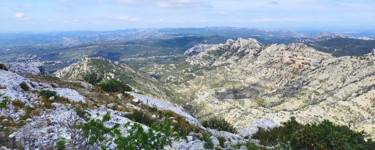
The Alpilles range gives you one of the most iconic images of Provence, with its dazzling white rocks, bright landscapes, and deeply Mediterranean feel. These limestone hills are a full part of the region’s identity, alongside olive groves, old villages, and sun soaked scenery.
Right in the heart of the Bouches du Rhône, this range forms a line of fairly low but very distinctive hills, standing out clearly from the surrounding plains, especially the Crau. The Alpilles give you a rich and varied landscape, where little valleys, plateaus, and rocky ridges follow one another. The Baux valley, in particular, shows this richness perfectly. It has an impressive concentration of olive trees, with hundreds of thousands of them, showing just how important olive growing is in this area.
The range is also a protected natural area, part of a regional nature park. There, you can enjoy plenty of ways to explore it, guided walks, birdwatching, exhibitions, and marked routes that let you discover the Alpilles on foot or by bike. There are also special trails called discovery routes, which make it easier for you to explore the area while highlighting its landscapes and heritage.
At the same time, this preserved natural environment is still fragile. In summer, access to the range is regulated to reduce risks, especially wildfires, which are common in these dry and exposed landscapes.
Around the range, lots of typical villages complete the picture. On the edge of the Alpilles, places like Eygalières give you a glimpse of Provençal charm, mixing old stone buildings, lush vegetation, and wide open views over the hills. Altogether, it creates a harmonious area where nature, history, and farming traditions are closely woven together.
Luberon
Full Names
Massif du Luberon
Parc Naturel Regional du Luberon
Highest Peak 1125m (3,690ft) 📍Mourre Nègre
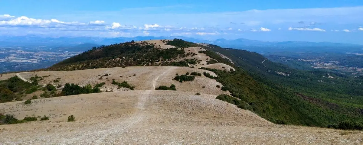
The Luberon Massif gives you that perfect mix of iconic Provence vibes, with soft hills, perched villages, and bright, glowing landscapes. You’ll notice how varied everything feels, the hills rolling between farmland, vineyards, and forests, and every turn in the road opens up a new view of the surrounding mountains.
As you explore, you’ll come across plenty of villages clinging to the hillsides, some of the most typical in the region. These villages, often old historic strongholds, still feel authentic, especially if you go outside peak season, when the streets are quiet again.
You’ll also experience the Luberon through its living landscapes and traditions. Local markets are a big part of it, full of regional produce. It all comes together in a place where nature and agriculture exist side by side in a really natural way.
If you like being active, you’re in the right place. The small, winding roads can be challenging, but they’re perfect for cycling, with marked routes that let you ride all around the Luberon over a few days, through preserved and varied scenery. And if you prefer walking, there are plenty of trails where you can explore the wildlife, plants, and local heritage at your own pace.
Sainte-Baume
Full Names
Massif de la Sainte-Baume
Parc Naturel Régional de la Sainte-Baume
Highest Peak 1148m (3,766ft) 📍Joug de l’Aigle
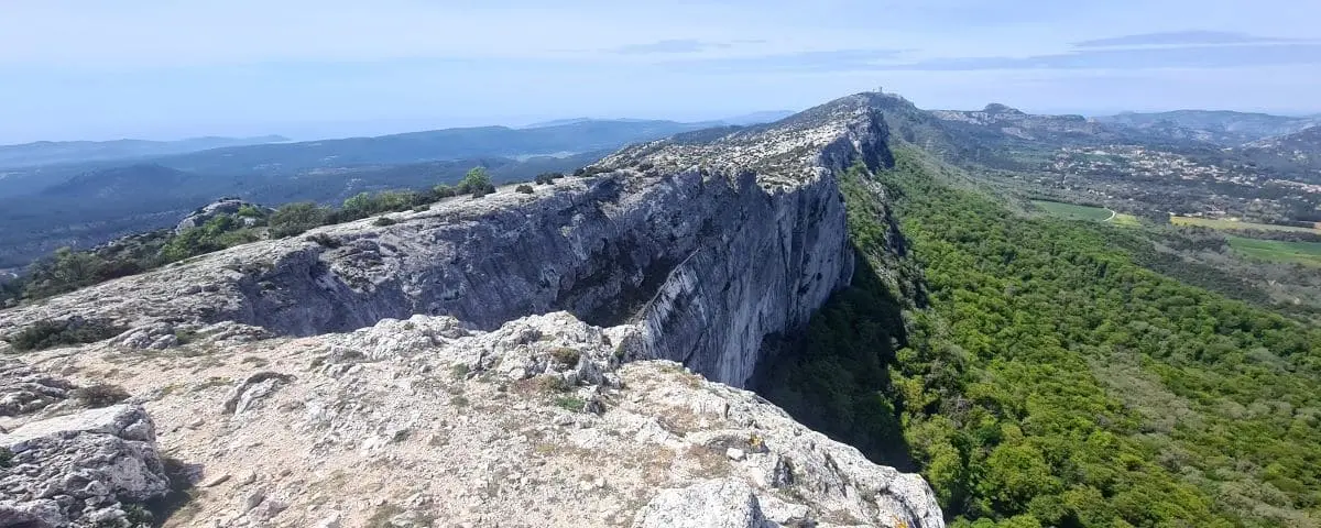
The Sainte-Baume massif rises like a huge rocky wall, topping out at over 1,100 meters. It’s a real cool oasis, home to one of the oldest and best-preserved forests in all of Provence. Deep and shady, it’s packed with white oaks, beeches, yews and maples.
But this place isn’t just a natural gem, it’s also full of spiritual meaning. It’s closely tied to Mary Magdalene, who’s said to have lived as a hermit in a cave tucked into the cliffside, around 950 meters up. Since the Middle Ages, that cave’s been a pilgrimage site. You can only reach it on foot, walking through the ancient forest that shelters you from wind and sun, in this quiet, almost sacred atmosphere. The climb itself feels meditative, with tall trees all around and the soft rustle of leaves underfoot.
Once you get to the top, the view really opens up. From the ridge, you can see all the way to the sea on one side and the Alps on the other. The cliffs stretch out in a long limestone ribbon, perfect for hiking. Up there, it’s totally peaceful, just the sound of the wind or the flap of a bird of prey’s wings.
MOUNTAINS
Overview Table
| Name | Top Picks | Exp. Picks |
|---|---|---|
| Ventoux | ||
| Sainte-Victoire |
Ventoux
Full Name
Mont Ventoux
Peak 1909m (6,263ft)
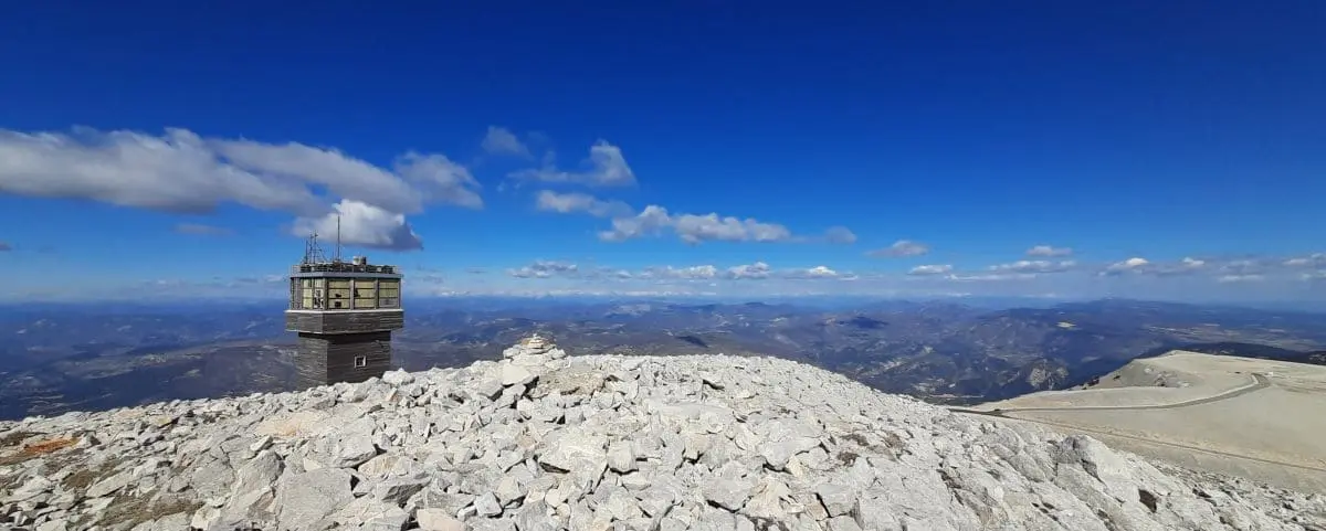
Rising high above all of Provence at 1,911 metres, Mont Ventoux stands out as one of the most iconic landmarks in the Vaucluse landscape. You can spot its unmistakable outline long before you even reach its slopes, appearing behind the cultivated plains and the villages clinging to its sides.
Climbing Ventoux is an experience in itself, because the variety of landscapes is so striking. At first, the road winds through Mediterranean vegetation, with cedars, holm oaks and white oaks, then as you go higher, you move into areas of beech, fir and larch trees. Little by little, the forest fades away and gives way to an almost unreal mineral setting, a vast stretch of pale stones that makes the summit feel almost lunar.
When you reach the top, the view more than matches the effort. On a clear day, the panorama seems endless, stretching from the Alps all the way to the Mediterranean, and giving you a rare sense of sheer vastness. The summit is also a perfect place for unforgettable moments, like a night time climb that lets you watch the sunrise, an experience often described as magical.
But Ventoux is not a mountain you tame easily. Its climate is known for being harsh, the winds can blow heavily, sometimes topping 200 km/h, and snow can make access difficult until spring. That severity is part of what gives it its unique character and explains the fascination it inspires.
Beyond the summit itself, the massif is home to remarkable natural richness. Its wildlife and plant life are varied and adapted to sharply contrasting conditions, which makes it an ideal place for hikers, botanists and nature lovers.
Sainte-Victoire
Full Name
Montagne Sainte-Victoire
Highest Peak 1011 m (3,317ft) 📍Pic des Mouches
It’s 20km long (12mi) and 8km (5mi) wide.
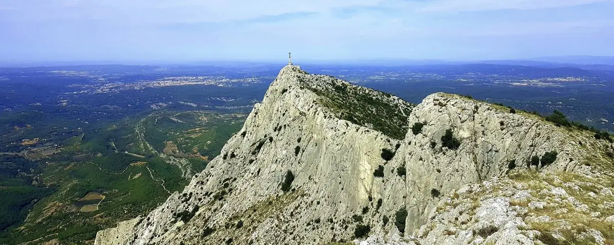
📍Croix de Provence is one of the most notable points of the site, situated on top of the second highest peak of the massif at 946m (3,104ft).
Overlooking the Aix-en-Provence area, Sainte Victoire Mountain is one of the most iconic landmarks in Provence. It forms a natural boundary around the landscape of Aix and stands out on the horizon with its long, bright limestone ridge. It became especially famous through the painter Paul Cézanne, who made it one of his favorite subjects. So when you look at it, you see a mountain watching over a heavily urbanized area around Aix, while still keeping a wild and unspoiled character.
Like other massifs in the region, it has a low population density and forests made up in particular of beeches and oaks. This geological and natural diversity adds to the richness of Provençal scenery and stands in contrast with the agricultural plains farther north or along the Rhône river.
Because this area is both popular and fragile, certain protection rules are in place. During the summer, especially from June to September, access to some parts of the massif may be restricted because of fire risk.
Sainte Victoire Mountain is not just a majestic backdrop to the Aix area, it is also a symbol of the Provençal landscape, a natural place where artistic heritage, outdoor activities, and environmental protection all come together.
OCHRE FORESTS
Overview Table
| Name | Top Picks | Exp. Picks |
|---|---|---|
| Sentiers des Ocres | ||
| Mines de Bruoux | ||
| Colorado Provençal | ☑️ |
Sentiers des Ocres
Full Name
Sentier des Ocres
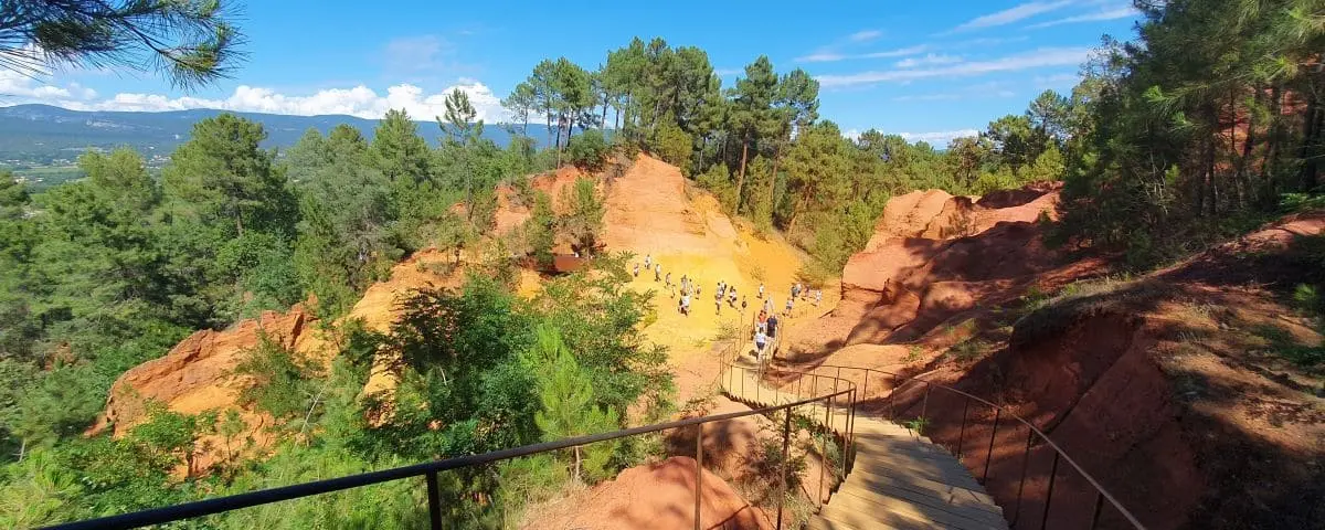
Right next to the village of Roussillon, the Ochre Trail is one of the most iconic and surprising landscapes in Provence. Here, the village and its surroundings feel like one and the same. Even the houses are dressed in the warm shades that come from the ochre quarries worked since the late 18th century, creating a scene where architecture and nature blend together in a blaze of color.
The trail feels like a natural extension of your visit to the village. After wandering through its colorful streets, you only have to walk a few minutes east to reach these spectacular formations.
The path takes you into the heart of a landscape shaped by erosion, where the ochre cliffs show off an incredible range of shades, deep reds, bright oranges, glowing yellows. The Provençal light, especially intense here, makes these colors even more striking and turns the walk into a real visual experience.
The walk is easy and fairly short, letting you explore these sculpted landforms that sometimes look almost unreal. The natural shapes, carved out over time, create a setting that feels both wild and poetic, where every turn reveals a new mix of colors and textures.
There are 2 possible routes:
– Short walk: 0.9km
– Long walk: 1.3km
⚙️ Hours & Prices (Tourist Office Website – Fr)
⚙️ Map (Image)
⚠️ Do not confuse this site with the Colorado Provençal, 20km (12mi) from Roussillon, which also offers a hike through former ochre quarries, larger than those in Roussillon.
Mines de Bruoux
Full Name
Mine d’Ocre de Bruoux
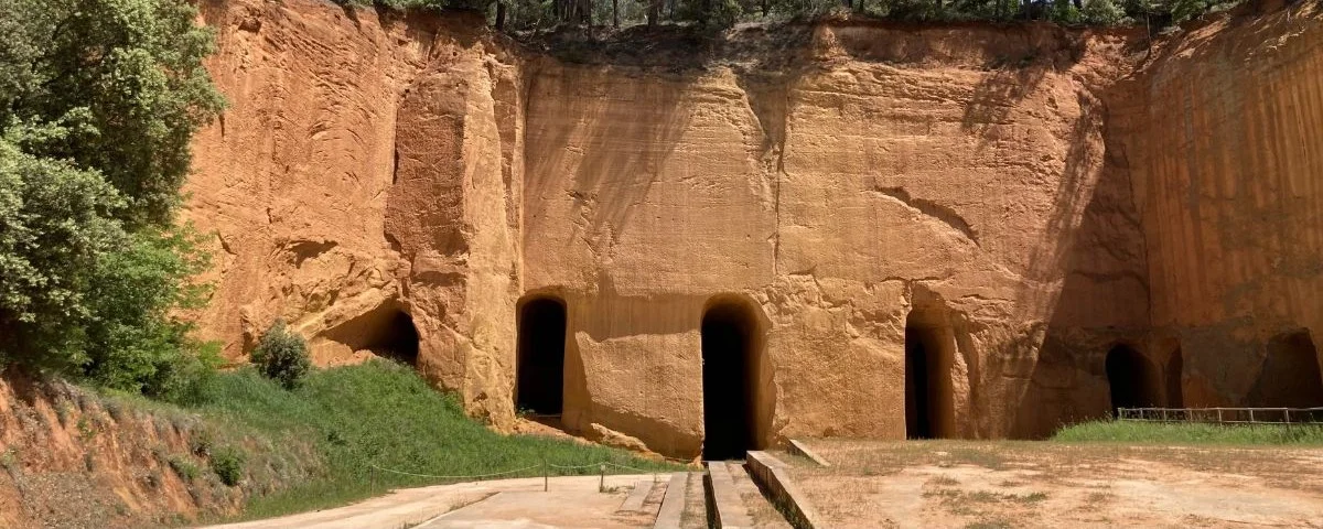
The Bruoux Ochre Mine lets you discover a place that feels both spectacular and mysterious, with towering cliffs, blazing colors, and a huge underground network. These former ochre quarries, worked between 1880 and 1950, stretch across more than 40 km of galleries. Today, you can explore part of them on a 650 meter guided tour, and really feel the site’s almost unreal scale.
The Bruoux Mine is deeply tied to the story of the “ochre rush” that shaped the local region at the end of the 19th century. The ochre quarries multiplied throughout the area at that time, and the Bruoux mines are still one of the most striking reminders of it today. For a long time, this natural resource supported several industrial uses, ochre was used to make colored pigments, but it also had more surprising applications, especially in the rubber seals of preserving jars and in bicycle tires, which used to be orange, where it acted as a thickener.
Colorado Provençal
In Our Expanded Picks ☑️
Full Names
Colorado Provençal
Colorado de Rustrel
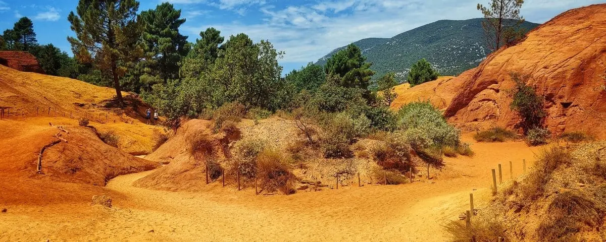
This spectacular natural site is best known for its former ochre quarries, whose colorful formations have created an almost unreal setting.
The landscape you see today comes from both erosion and human activity. The ochre quarries have been worked since the French Revolution, and that activity deeply shaped the terrain. Strange shaped valleys, rugged reliefs, and fairy chimneys create an almost fantastical scenery. The colors are especially striking. Even though the word ochre literally means “yellow earth” in Greek, the site’s palette actually ranges from pale yellow to bright red, with many shades of orange, sometimes crossed by purple veins and dotted with the green of pine trees.
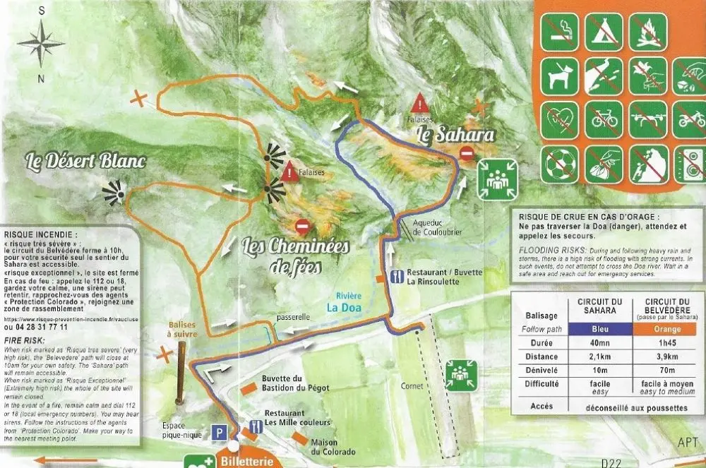
Today, the Colorado Provençal is a private site managed by the Colorado de Rustrel Association. You can explore this unique landscape by following two marked trails. The Sahara trail, which takes about forty five minutes, lets you quickly see the main rock formations and the spectacular shades of ochre. The Belvédère trail is longer, around one hour and forty five minutes. It crosses the old quarries and leads you to several viewpoints overlooking the reliefs, including the famous fairy chimneys.
There are two possible routes. They pass through ochre areas, and the rest is forest.
Check the official website (especially in summer) to see if a reservation is required or if the site is closed due to fire risk.