


MAP
Central Atlantic
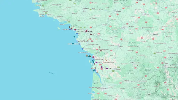
Interactive Map
Central Atlantic
Interactive Map
Click on the icon  in the top-left corner to display the map legend.
Show/Hide layers as needed.
Click on the arrow icons (v) to display the sublayers.
ALL
| Name | Top+ | Top | Ferry (one-way) | Ferry (one-way) | Price (round-trip) | Peak m (ft) | Size km (mi) |
|---|---|---|---|---|---|---|---|
| Noirmoutier | ✅ | Bridge | - | - | 23 (75) | 24 × 12 (14.9 × 7.5) | |
| Île d'Yeu | ✅ | Ferry | 35min | €48.40 | 32 (105) | 9.9 × 3.75 (6.2 × 2.3) | |
| Île de Ré | ✅ | Bridge | - | - | 19 (62) | 25.75 × 5 (16.0 × 3.1) | |
| Oléron | ✅ | Bridge | - | - | 35 (115) | 32 × 8 (19.9 × 5.0) | |
| Île-d'Aix | Ferry | 25min | €25 | 15 (49) | 3 × 0.7 (1.9 × 0.4) | ||
| Île Madame | Causeway | - | - | 18 (59) | 1 × 0.7 (0.62 × 0.4) |
Noirmoutier
In Our Top+ ✅
Size 24 × 12 km (14.9 × 7.5 mi)
Peak 23m (75ft)
Full Name
Île de Noirmoutier
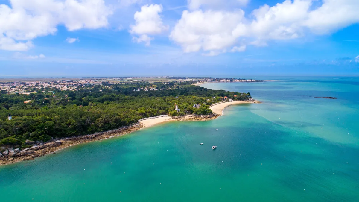
Noirmoutier has a way of making you forget the mainland almost as soon as you arrive. Sandy beaches, pine forests, villages with low houses and salt pans give the island a wonderfully relaxed feel. You don’t have to travel far to enjoy a change of scenery here. Often, a short bike ride is enough to take you from dunes to marshes.
The Passage du Gois is one of the island’s most extraordinary sights. This road, more than 4 km long, connects the island to the mainland but disappears beneath the sea at high tide. You can only cross it during a limited window around low tide, and it’s essential to check the tide times and conditions before setting off.
If you’d rather reach Noirmoutier without worrying about the tides, there’s also a bridge that’s open all year round. Even so, the Gois is well worth seeing for its unusual spectacle: the road emerging from the water, birds gathering on the sandbanks and people collecting shellfish as the sea retreats.
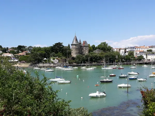
In the north, the town of Noirmoutier-en-l’Île has kept its old castle and lively streets. White houses cluster around the harbour, where the island’s maritime traditions are still very much present. Further on, the Bois de la Chaise is home to evergreen oaks, mimosa trees, beautiful old villas and little beaches lined with white bathing huts.
On the western side, the island takes on a wilder character, with dunes, beaches open to the Atlantic and forests offering shelter from the wind. The little villages are dotted with gardens, low stone walls and old windmills, reminders of a time when local life revolved around farming and the sea.
Salt marshes cover a large part of the island’s interior. Their shallow pools form a checkerboard of mirrors reflecting the clouds overhead. In summer, salt workers collect the crystals left behind as seawater evaporates, using techniques passed down through generations.
FERRY
Company 1
L’Évasion III
Duration (one-way) 1h
Price (round-trip) €35
📍 From Pornic
⚙️ Schedules & Prices (Official Website – Fr)
Company 2
Compagnie Vendéenne
Duration (one-way) 45min
Price (round-trip) €46.60
📍 From Île d’Yeu Island
⚙️ Schedules (Official Website – Fr)
⚙️ Prices (Official Website – Fr)
Île d'Yeu
In Our Top+ ✅
Size 9.9 × 3.75 km (6.2 × 2.3 mi)
Peak 32m (105ft)
Full Name
Île de d’Yeu
Getting to the Île d’Yeu takes a little effort, but that’s part of its appeal. After the boat crossing, you arrive at Port-Joinville, with its pale houses, fishing boats and busy maritime life. Far from the mainland’s large ports, the island has kept an independent spirit shaped by the ocean and generations of sailors.
One of its greatest attractions is the surprising variety of its landscapes. Along the northeastern coast, sandy beaches and small dunes create a gentle, open scenery. On the southwestern side, everything changes. Rocky cliffs plunge into the Atlantic, coves become narrower and waves crash against granite boulders.
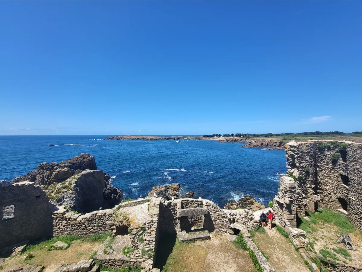
The Vieux Château, an isolated medieval fortress perched on a rock, overlooks one of the most spectacular stretches of this rugged coast. Its ruined walls almost seem to merge with the natural stone. Nearby, narrow paths follow the headlands and reveal breathtaking views over the sea, especially on windy days.
Cycling is one of the best ways to explore the island, although the occasional uphill stretch reminds you that it’s not quite as flat as you might expect. Between stretches of coastline, the roads pass through heathland, walled gardens and small woods. Houses with colourful shutters hide behind hedges and flowers.
Continue across the island and you’ll reach Saint-Sauveur, once its main village, with quiet streets and a church whose tower is visible from afar. The road then leads back towards the rugged coast, where the tiny harbour of La Meule nestles between two cliffs. The boats look almost miniature, sheltered in this narrow opening in the rock.
The sea hasn’t just shaped the island’s scenery. For centuries, it also provided a living for its inhabitants. Fishing, particularly tuna fishing, played a central role in local life. As you explore, lighthouses, small harbours and former maritime buildings tell the story of this past. Along the coastal paths, gorse bushes, low grasses and seabirds accompany the steady sound of the waves.
FERRY
Company 1
Yeu Continent
Duration (one-way) 70min
Price (round-trip) €40
High-Speed Boat Duration (one-way) 35min
High-Speed Boat Price (round-trip) €43.60 Low Season – €48.40 High Season
📍 From Fromentine
⚙️ Schedules (Official Website – Fr)
⚙️ Prices (Official Website – Fr)
Company 2
Compagnie Vendéenne
Duration (one-way) 45min (from Fromentine)
Price (round-trip) €46.60
📍 From Fromentine
📍 From Île de Noirmoutier Island
📍 From Saint-Gilles-Croix-de-Vie
⚙️ Schedules (Official Website – Fr)
⚙️ Prices (Official Website – Fr)
Île de Ré
In Our Top+ ✅
Size 25.75 × 5 km (16.0 × 3.1 mi)
Peak 19m (62ft)
Full Name
Île de Ré
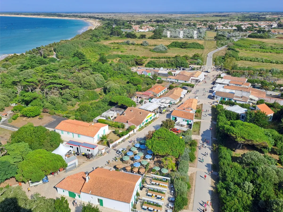
The Île de Ré wins you over with its wonderfully gentle atmosphere. Connected to the mainland by a long bridge, the island offers a succession of whitewashed villages, beaches, dunes and salt marshes. Its almost completely flat terrain and extensive network of cycle paths make it ideal for exploring without a car.
Low houses with green shutters, narrow streets filled with hollyhocks and pretty little harbours create a landscape that’s instantly recognisable. La Flotte and Saint-Martin-de-Ré reflect the island’s maritime trading past, with their handsome pale stone houses and harbours filled with gently bobbing boats.
In Saint-Martin, powerful fortifications built in the 17th century still surround the town. They were designed to withstand attacks from the sea and provide a refuge for local people. The ramparts, listed as a UNESCO World Heritage Site, can be explored on foot, with views over the moats and old defensive structures.
Further west, the landscape opens up. Salt marshes form a vast patchwork of shallow pools, crossed by narrow paths and home to numerous birds. The little villages have kept their churches, small squares and quiet streets, while salt producers continue a traditional craft that depends on sunshine and wind.
At the far end of the island, the Phare des Baleines lighthouse rises high above the ocean. Nearby beaches are more exposed to the waves, while other parts of the coast offer calmer waters and long stretches of sand at low tide.
The sea is everywhere, even when it’s hidden behind the dunes. Along the coast, oyster beds form dark lines in the shallow water. In the wetlands, herons, egrets and migratory birds find refuge in protected areas, far from the busy summer beaches.
FERRY
Company
Compagnie Interîles
Duration (one-way) 1h10min
Price (round-trip) €27.50 (from La Rochelle)
📍 From La Rochelle
⚙️ Schedules & Prices (Official Website – Fr)
📍 From La Tranche-sur-Mer
⚙️ Schedules & Prices (Official Website – Fr)
Oléron
In Our Top+ ✅
Size 32 × 8 km (19.9 × 5.0 mi)
Peak 35m (115ft)
Full Name
Île d’Oléron
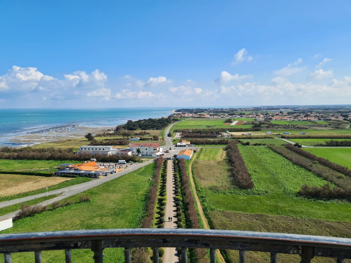
Oléron is the Atlantic on a grand scale. Larger than its neighbour, the Île de Ré, it offers kilometres of beaches, vast forests, fishing villages and marshes crisscrossed by canals. Connected to the mainland by a bridge, the island is easy to explore, but it’s worth taking the time to venture away from the main roads.
The western coast faces the open ocean. Waves roll onto long sandy beaches, sometimes backed by dunes and pine trees. On the eastern side, the more sheltered waters have encouraged oyster farming. Colourful huts, shallow pools and little harbours create landscapes entirely shaped by the rhythm of the tides.
In the south, the Saint-Trojan forest stretches behind the dunes. You can walk through the shade of its pine trees before emerging onto wide beaches where wind and sand constantly reshape the scenery. Other trails cross former salt marshes, now divided between natural areas and maritime activities.
Le Château-d’Oléron has an imposing 17th-century citadel, built to guard the approaches to the Charente estuary. Its ramparts offer lovely views over the sea and the surrounding pools. Further north, La Cotinière is a reminder that Oléron is also a working fishing island, with a harbour that’s still very active.
At the northern tip, the Phare de Chassiron, with its distinctive black and white stripes, stands watch over a rocky coastline swept by strong currents. From the top of the lighthouse, when it’s open to visitors, you can enjoy sweeping views of the ocean, villages and low-lying landscapes of the island.
Off the eastern coast, the unmistakable outline of Fort Boyard rises from the water. This enormous fortress was built in the 19th century to defend the coastline. You can’t simply land there, but its unusual shape is easy to spot on boat trips around the island.
BY ROAD BRIDGE
FERRY
Company 1
Liaison Maritime La Rochelle – Île d’Oléron
—>📍 To Boyardville
Duration (one-way) 50min
Price (round-trip) €27.50
📍 From La Rochelle
⚙️ Schedules (Official Website – Fr)
⚙️ Prices (Official Website – Fr)
Company 2
Compagnie Interîles
Duration (one-way) 50min
Price (round-trip) €27.50
📍 From La Rochelle
⚙️ Schedules & Prices (Official Website – Fr)
Duration (one-way) 1h
Price (round-trip) €27.50
📍 From La Rochelle
⚙️ Schedules & Prices (Official Website – Fr)
Company 3
Saint-Denis & Oléron Croisières
Duration (one-way) 1h
Price (round-trip) €27.50
📍 From La Rochelle
⚙️ Schedules (Official Website – Fr)
⚙️ Prices (Official Website – Fr)
Île-d'Aix
Size 3 × 0.7 km (1.9 × 0.4 mi)
Peak 15m (49ft)
Full Name
Île d’Aix
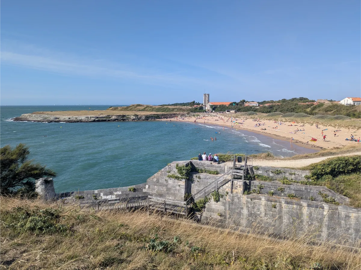
You reach the Île d’Aix by boat, and the change of pace begins as soon as you set off. There’s no ordinary car traffic here, so the island’s little roads are best explored on foot or by bike, passing low houses, woods and beaches. The fortified village still bears traces of its military past, when the island helped protect the entrance to the Charente River.
Napoleon spent his final days on French soil here in 1815, before leaving for exile. Further along, the coastal paths reveal coves, old defensive walls and beautiful views of Fort Boyard, the isolated fortress rising from the water. It’s the perfect island for a peaceful day out.
FERRY
Company
La Maritime d’Aix
Duration (one-way) 25min
Price (round-trip) €11 to €25
📍 From Fouras
⚙️ Schedules (Official Website – Fr)
⚙️ Prices (Official Website – Fr)
Île Madame
Size 1 × 0.7 km (0.62 × 0.4 mi)
Peak 18m (59ft)
Full Name
Île Madame
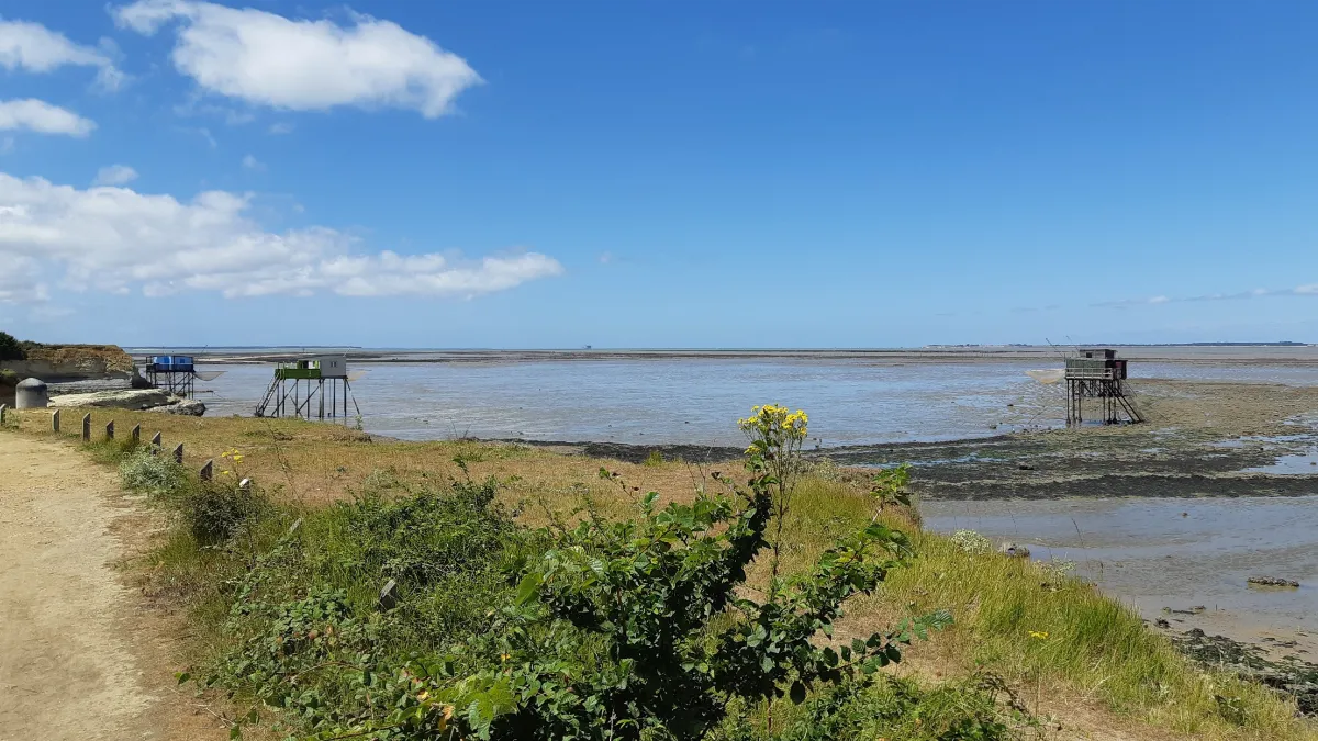
The Île Madame is tiny and feels almost like a secret. To reach it, you have to cross the Passe aux Bœufs at low tide, a sandy and pebbly causeway that’s regularly covered by the sea. It’s essential to check the tide times before setting off, because here, the ocean decides when you can return.
Once on the island, a handful of paths lead through meadows, rocky areas and the surroundings of an old fort. A cross made of pebbles commemorates priests who died in the region during the French Revolution. All around, birds search for food on the exposed shore, in a vast and wonderfully quiet landscape.
BY ROAD
Tidal Causeway
📍 From Port-des-Barques
⚙️ Info (Tourist Office Website)
Carriage
La Calèche de Madame