


MAP
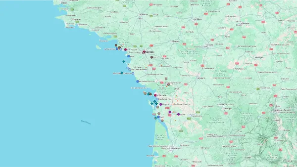
Central Atlantic
Interactive Map
Central Atlantic
Interactive Map
Click on the icon  in the top-left corner to display the map legend.
Show/Hide layers as needed.
Click on the arrow icons (v) to display the sublayers.
ALL
| Name | Type | Top+ |
|---|---|---|
| Guérande | Small Town | |
| Marais Salants de Guérande | Salt Marsh | ✅ |
| Saint-Nazaire | City | |
| Noirmoutier | Island | ✅ |
| Île d'Yeu | Island | ✅ |
| Puy du Fou | Historical Theme Park | ✅ |
| Sables-d'Olonne | Coastal Town | |
| Marais Poitevin | Wetland | ✅ |
| La Rochelle | City | ✅ |
| Île de Ré | Island | ✅ |
| Oléron | Island | ✅ |
| Brouage | Village | |
| Château Roche Courbon | Castle & Garden | |
| Talmont-sur-Gironde | Village | |
| Phare de Cordouan | Lighthouse |
Guérande
Type Small Town
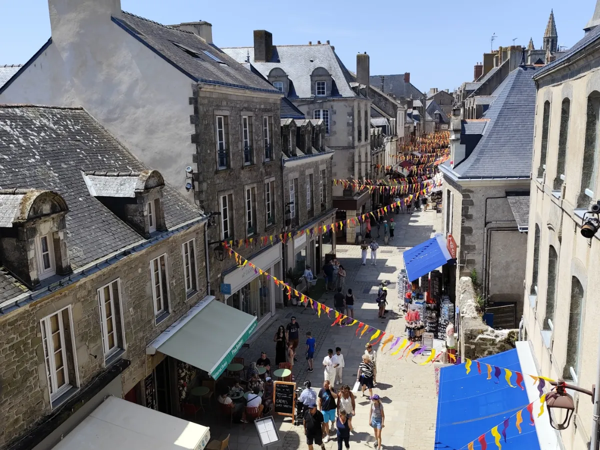
In Guérande, you step through the gates of a genuine medieval walled town. The ramparts still surround the old streets, stone houses and imposing Church of Saint-Aubin. Take time to admire the carved windows and wander through the narrow passageways, away from the main gates.
Just a few kilometres away, the landscape changes completely. The salt marshes form an enormous patchwork of shallow pools. Salt has been harvested here for centuries using nothing more than sunshine and wind. Towards the end of the day, the water reflects the sky, shifting from silvery grey to pink as the light changes.
Marais Salants de Guérande
In Our Top+ ✅
Type Salt Marsh
Full Name
Marais Salants de Guérande
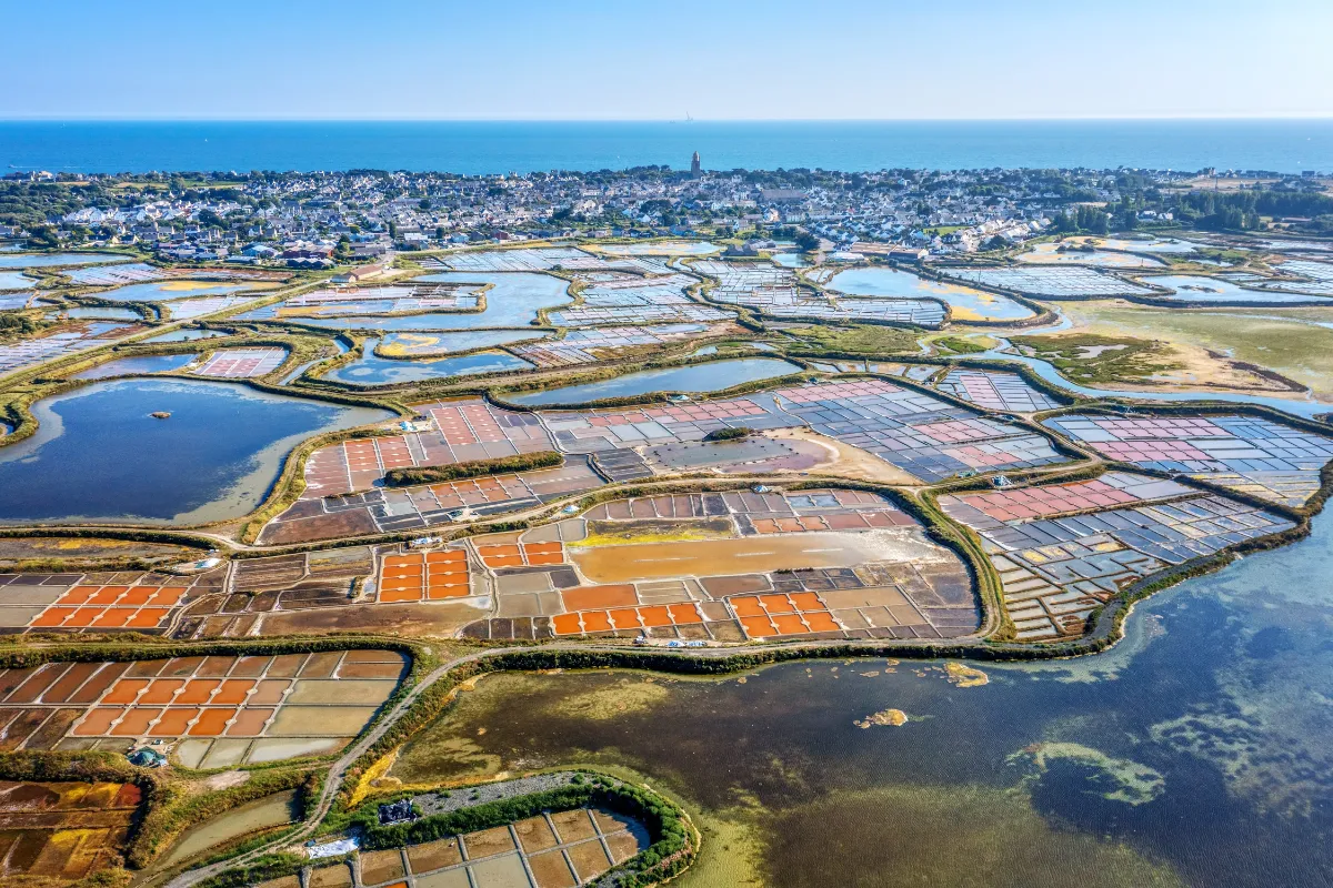
At first glance, the Guérande salt marshes look like a gigantic puzzle spread out between land and sea. Thousands of small pools, separated by narrow earthen banks, create a geometric landscape that constantly changes with the light. At sunrise, the water reflects shades of grey, pink and silver.
For nearly two thousand years, local people have shaped these low-lying lands to harvest salt. Seawater enters the marshes at high tide, then slowly moves from one pool to another. Under the effects of sunshine and wind, it gradually evaporates until salt crystals begin to form.
Coarse sea salt forms at the bottom of the pools. Fleur de sel, a finer and more delicate salt, sometimes appears on the surface of the water and is carefully collected. Salt workers still use long traditional tools, preserving the essential harvesting techniques without mechanising the process.
The marshes are also home to remarkable wildlife. Stilts, egrets and other birds take advantage of the shallow water to find food. By sticking to authorised paths or joining a guided tour, you can discover the salt pans without damaging this fragile environment.
Saint-Nazaire
Type City
Population 75 000
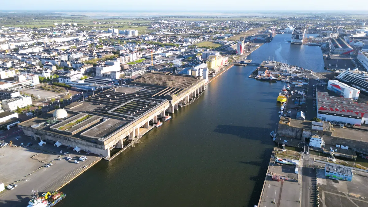
Saint-Nazaire is nothing like the typical holiday towns along the Atlantic coast. First and foremost, it’s a working port, with enormous cranes, docks and shipyards where some of the world’s largest cruise ships are built. Located at the mouth of the Loire, the city has had close ties with long-distance ocean travel since the 19th century.
This was once the departure and arrival point for great transatlantic crossings between Europe and America. The golden age of ocean liners comes back to life at Escal’Atlantic, an attraction housed inside a former military base. Cabins, lounges and technical areas recreate the world of these magnificent ships, which captured the imagination of generations of travellers before modern aviation took over.
It’s impossible to miss the enormous submarine base built by the German military during the Second World War. Its concrete walls, several metres thick, withstood the bombing raids that destroyed much of Saint-Nazaire. Today, you can explore parts of the complex and climb up to its terraces for views over the harbour.
Nearby, the Espadon submarine gives you an idea of what everyday life was like for sailors living in such cramped conditions. At the shipyards, everything is on a completely different scale. Hulls under construction, towering gantry cranes and vast docks showcase an industrial tradition that’s still very much alive.
Saint-Nazaire also has a gentler side. A seafront promenade runs past beaches, villas and viewpoints overlooking the estuary. Small coves alternate with long stretches of sand, far removed from the activity of the industrial port.
Noirmoutier
In Our Top+ ✅
Type Island
Size 24 × 12 km (14.9 × 7.5 mi)
Peak 23m (75ft)
Full Name
Île de Noirmoutier
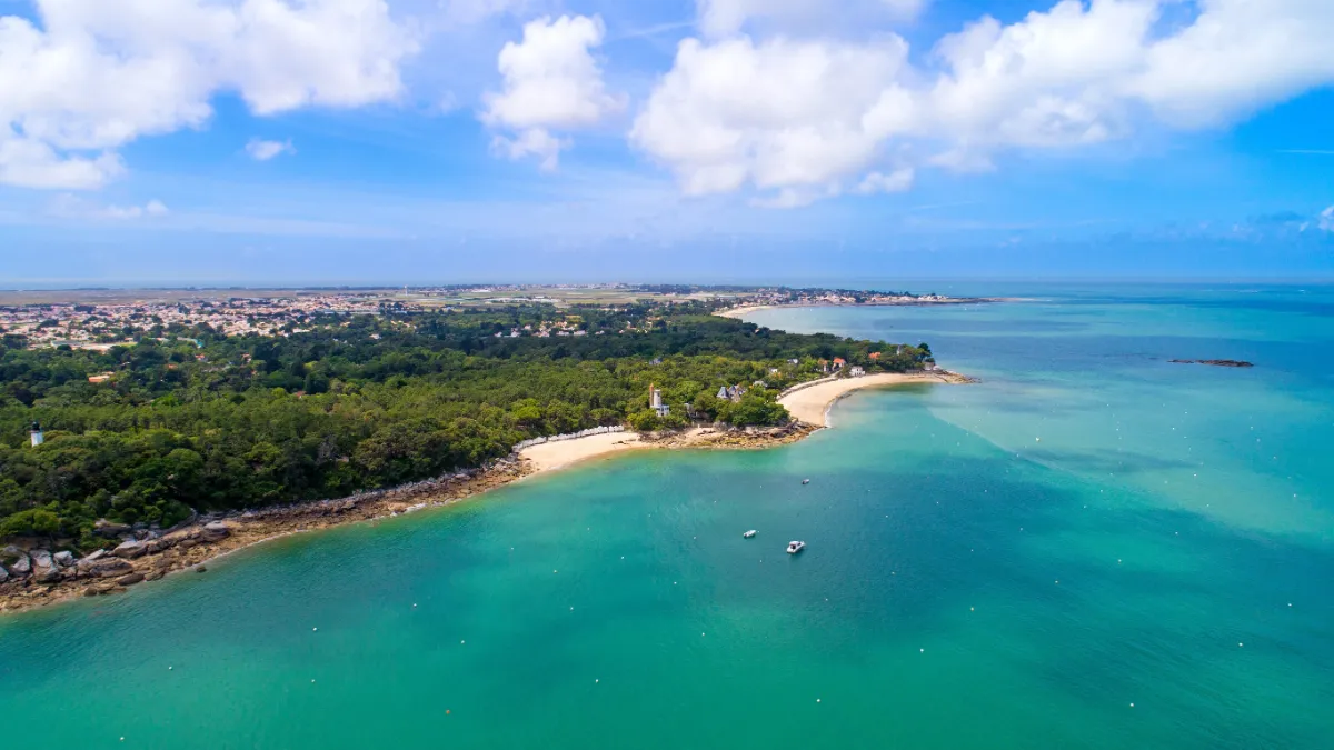
Noirmoutier has a way of making you forget the mainland almost as soon as you arrive. Sandy beaches, pine forests, villages with low houses and salt pans give the island a wonderfully relaxed feel. You don’t have to travel far to enjoy a change of scenery here. Often, a short bike ride is enough to take you from dunes to marshes.
The Passage du Gois is one of the island’s most extraordinary sights. This road, more than 4 km long, connects the island to the mainland but disappears beneath the sea at high tide. You can only cross it during a limited window around low tide, and it’s essential to check the tide times and conditions before setting off.
If you’d rather reach Noirmoutier without worrying about the tides, there’s also a bridge that’s open all year round. Even so, the Gois is well worth seeing for its unusual spectacle: the road emerging from the water, birds gathering on the sandbanks and people collecting shellfish as the sea retreats.
In the north, the town of Noirmoutier-en-l’Île has kept its old castle and lively streets. White houses cluster around the harbour, where the island’s maritime traditions are still very much present. Further on, the Bois de la Chaise is home to evergreen oaks, mimosa trees, beautiful old villas and little beaches lined with white bathing huts.
On the western side, the island takes on a wilder character, with dunes, beaches open to the Atlantic and forests offering shelter from the wind. The little villages are dotted with gardens, low stone walls and old windmills, reminders of a time when local life revolved around farming and the sea.
Salt marshes cover a large part of the island’s interior. Their shallow pools form a checkerboard of mirrors reflecting the clouds overhead. In summer, salt workers collect the crystals left behind as seawater evaporates, using techniques passed down through generations.
FERRY
Company 1
L’Évasion III
Duration (one-way) 1h
Price (round-trip) €35
📍 From Pornic
⚙️ Schedules & Prices (Official Website – Fr)
Company 2
Compagnie Vendéenne
Duration (one-way) 45min
Price (round-trip) €46.60
📍 From Île d’Yeu Island
⚙️ Schedules (Official Website – Fr)
⚙️ Prices (Official Website – Fr)
Île d'Yeu
In Our Top+ ✅
Type Island
Size 9.9 × 3.75 km (6.2 × 2.3 mi)
Peak 32m (105ft)
Full Name
Île de d’Yeu
Getting to the Île d’Yeu takes a little effort, but that’s part of its appeal. After the boat crossing, you arrive at Port-Joinville, with its pale houses, fishing boats and busy maritime life. Far from the mainland’s large ports, the island has kept an independent spirit shaped by the ocean and generations of sailors.
One of its greatest attractions is the surprising variety of its landscapes. Along the northeastern coast, sandy beaches and small dunes create a gentle, open scenery. On the southwestern side, everything changes. Rocky cliffs plunge into the Atlantic, coves become narrower and waves crash against granite boulders.
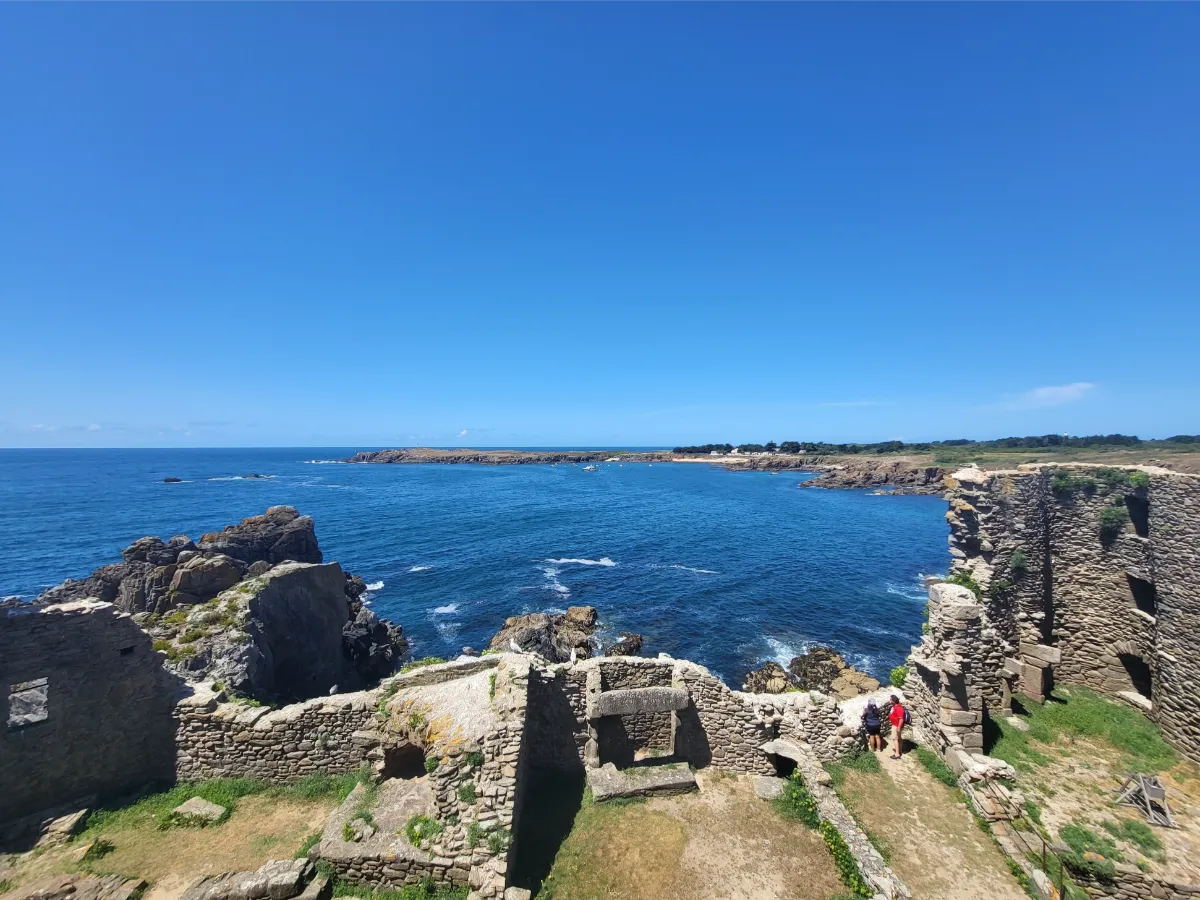
The Vieux Château, an isolated medieval fortress perched on a rock, overlooks one of the most spectacular stretches of this rugged coast. Its ruined walls almost seem to merge with the natural stone. Nearby, narrow paths follow the headlands and reveal breathtaking views over the sea, especially on windy days.
Cycling is one of the best ways to explore the island, although the occasional uphill stretch reminds you that it’s not quite as flat as you might expect. Between stretches of coastline, the roads pass through heathland, walled gardens and small woods. Houses with colourful shutters hide behind hedges and flowers.
Continue across the island and you’ll reach Saint-Sauveur, once its main village, with quiet streets and a church whose tower is visible from afar. The road then leads back towards the rugged coast, where the tiny harbour of La Meule nestles between two cliffs. The boats look almost miniature, sheltered in this narrow opening in the rock.
The sea hasn’t just shaped the island’s scenery. For centuries, it also provided a living for its inhabitants. Fishing, particularly tuna fishing, played a central role in local life. As you explore, lighthouses, small harbours and former maritime buildings tell the story of this past. Along the coastal paths, gorse bushes, low grasses and seabirds accompany the steady sound of the waves.
FERRY
Company 1
Yeu Continent
Duration (one-way) 70min
Price (round-trip) €40
High-Speed Boat Duration (one-way) 35min
High-Speed Boat Price (round-trip) €43.60 Low Season – €48.40 High Season
📍 From Fromentine
⚙️ Schedules (Official Website – Fr)
⚙️ Prices (Official Website – Fr)
Company 2
Compagnie Vendéenne
Duration (one-way) 45min (from Fromentine)
Price (round-trip) €46.60
📍 From Fromentine
📍 From Île de Noirmoutier Island
📍 From Saint-Gilles-Croix-de-Vie
⚙️ Schedules (Official Website – Fr)
⚙️ Prices (Official Website – Fr)
Sables-d'Olonne
Type Coastal Town
Les Sables-d’Olonne has everything you’d expect from a classic Atlantic seaside resort: a huge crescent-shaped beach, a long seafront promenade and buildings overlooking the waves. As soon as the weather warms up, walkers and swimmers flock to this lively waterfront, which has been a favourite holiday destination since the 19th century.
For a glimpse of the town’s older character, head to the La Chaume district on the other side of the harbour channel. This former fishing village has kept its narrow lanes, low houses and traditional maritime atmosphere. The Tour d’Arundel recalls the days when approaching ships had to be watched carefully.
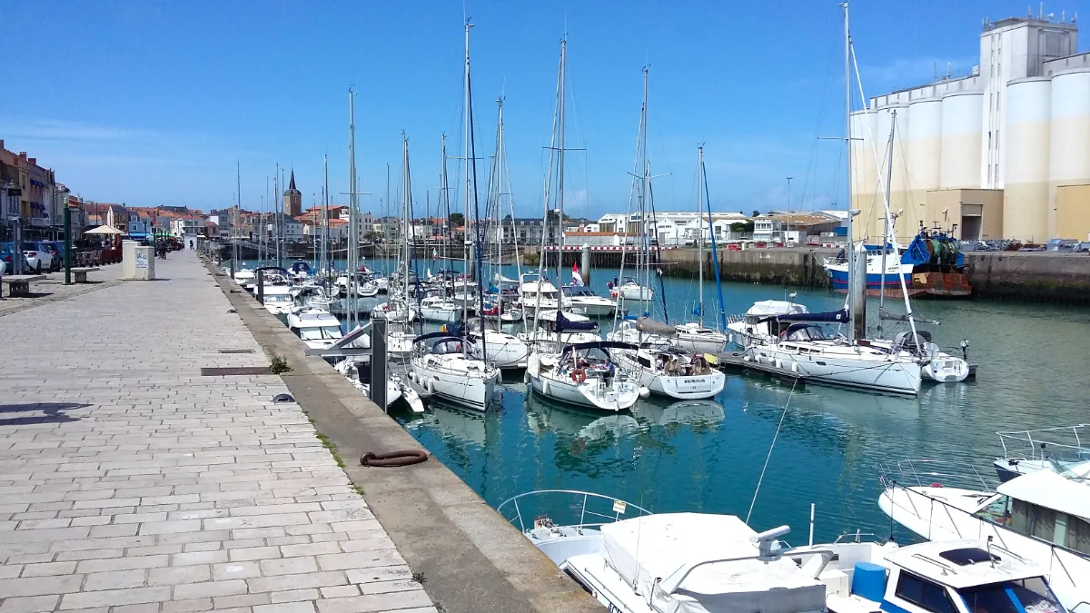
The town is best known internationally for sailing. Every four years, the Vendée Globe starts here, sending solo sailors around the world without stopping or receiving assistance. Even when the race isn’t taking place, the docks, large sailing boats and harbour facilities reflect the town’s passion for the open sea.
Away from the main beach, the landscape becomes wilder. Dunes, rocky shores, forests and marshes provide a home for many birds. At low tide, the rocks emerge from the water, while waves continue to break along this windswept stretch of coast.
Marais Poitevin
In Our Top+ ✅
Type Wetland
Full Names
Marais Poitevin
Parc Naturel Régional du Marais Poitevin
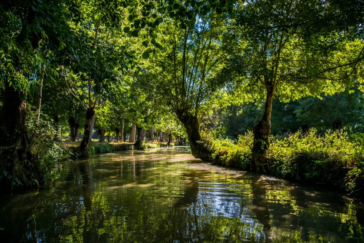
The Marais Poitevin feels like a world of its own, where paths sometimes turn into canals and trees seem to grow straight out of the water. In its greenest area, nicknamed the “Green Venice”, the branches of ash and poplar trees form leafy tunnels above narrow, peaceful waterways.
A traditional flat-bottomed boat is one of the loveliest ways to explore this maze. Around every bend, the reflections change, leaves brush the surface and a heron might suddenly take flight above the reeds. Walking or cycling along the canal-side paths offers another wonderful way to experience the landscape.
Despite appearances, this isn’t an entirely wild natural environment. As far back as the Middle Ages, religious communities began digging canals and building dykes to control the water and make the land suitable for farming. This enormous undertaking created several very different landscapes.
Inland, the wetlands are covered with trees and crossed by waterways. Closer to the ocean, the land becomes wide and open, with fields, meadows and sweeping horizons. The former abbeys of Maillezais and Nieul-sur-l’Autise bear witness to this history, when religious communities played a major role in shaping the marshes.
La Rochelle
In Our Top+ ✅
Type City
Population 80 000
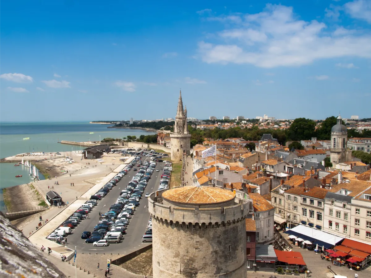
La Rochelle makes an impression the moment you arrive at the Vieux-Port. Two imposing stone towers have guarded the entrance to the harbour since the Middle Ages, standing proudly above the sailing boats. A third, the Tour de la Lanterne, rises a little further along. These old fortifications recall a time when the city controlled a significant share of Atlantic maritime trade.
The quays around the harbour are perfect for wandering without any particular plan. Look up at the pale façades, decorative windows and the masts of the boats. Then head into the old town, where long covered arcades let you stroll from street to street, sheltered from both sunshine and rain.
Behind this relaxed atmosphere lies a rather turbulent history. La Rochelle was once a major centre of French Protestantism, a branch of Christianity that rejected the authority of the Catholic Church. In 1627 and 1628, the forces of King Louis XIII laid siege to the city, cutting off supplies until its inhabitants were forced to surrender.
Yet La Rochelle has never lost its independent spirit. Its town hall, which looks rather like a small fortified palace, along with its historic mansions and cobbled streets, reflects the wealth of its merchants and the importance its people placed on their freedoms. The harbour towers, once used to defend the city or hold prisoners, can still be visited today.
And the sea is never far away. Beyond the historic centre, you’ll find marinas, coastal walks and beaches that are particularly inviting in warmer weather. The Aquarium de La Rochelle offers a fascinating look at life beneath the waves, while attractions devoted to seafaring highlight the continuing importance of the city’s maritime heritage.
Île de Ré
In Our Top+ ✅
Type Island
Size 25.75 × 5 km (16.0 × 3.1 mi)
Peak 19m (62ft)
Full Name
Île de Ré
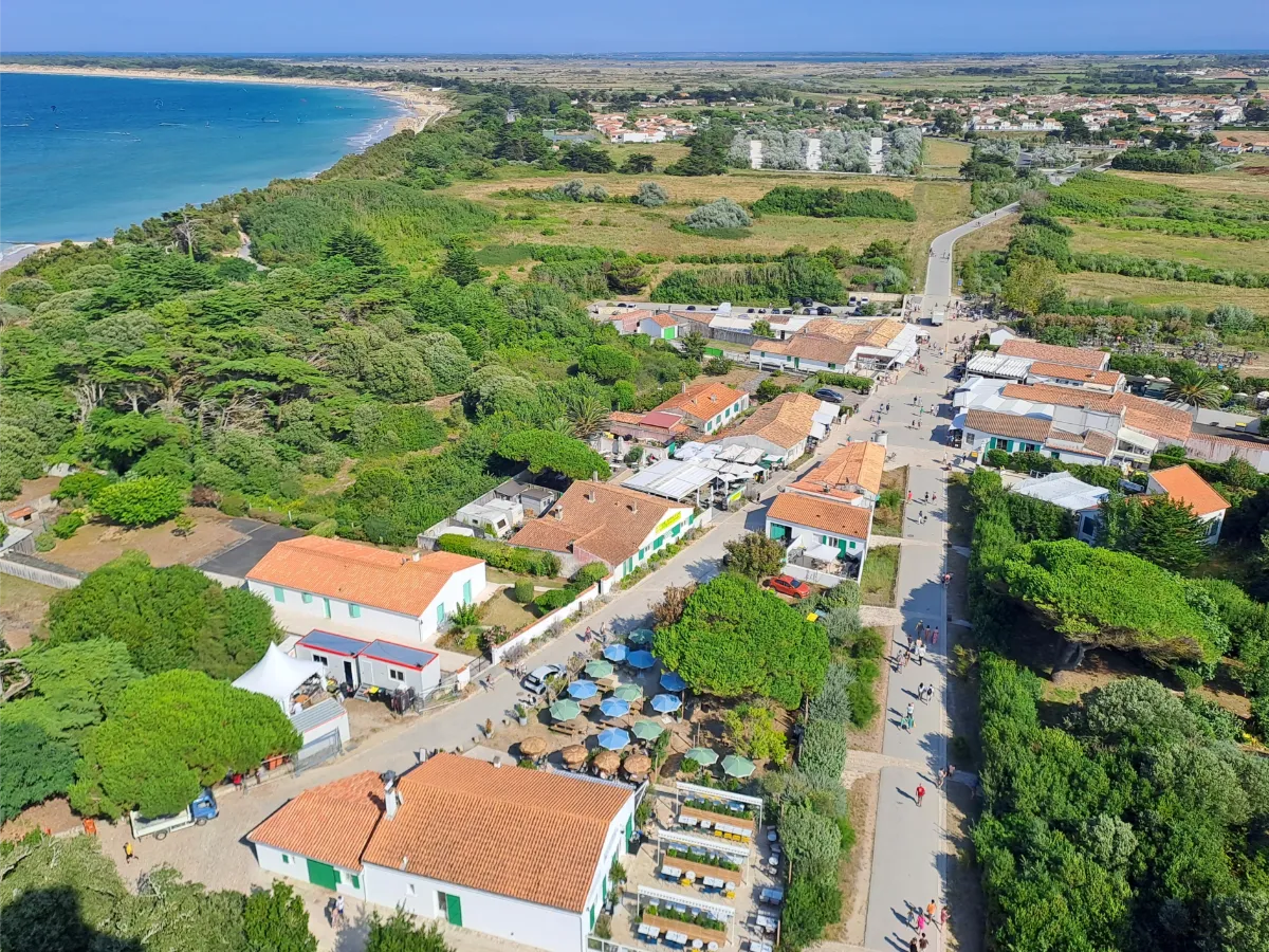
The Île de Ré wins you over with its wonderfully gentle atmosphere. Connected to the mainland by a long bridge, the island offers a succession of whitewashed villages, beaches, dunes and salt marshes. Its almost completely flat terrain and extensive network of cycle paths make it ideal for exploring without a car.
Low houses with green shutters, narrow streets filled with hollyhocks and pretty little harbours create a landscape that’s instantly recognisable. La Flotte and Saint-Martin-de-Ré reflect the island’s maritime trading past, with their handsome pale stone houses and harbours filled with gently bobbing boats.
In Saint-Martin, powerful fortifications built in the 17th century still surround the town. They were designed to withstand attacks from the sea and provide a refuge for local people. The ramparts, listed as a UNESCO World Heritage Site, can be explored on foot, with views over the moats and old defensive structures.
Further west, the landscape opens up. Salt marshes form a vast patchwork of shallow pools, crossed by narrow paths and home to numerous birds. The little villages have kept their churches, small squares and quiet streets, while salt producers continue a traditional craft that depends on sunshine and wind.
At the far end of the island, the Phare des Baleines lighthouse rises high above the ocean. Nearby beaches are more exposed to the waves, while other parts of the coast offer calmer waters and long stretches of sand at low tide.
The sea is everywhere, even when it’s hidden behind the dunes. Along the coast, oyster beds form dark lines in the shallow water. In the wetlands, herons, egrets and migratory birds find refuge in protected areas, far from the busy summer beaches.
FERRY
Company
Compagnie Interîles
Duration (one-way) 1h10min
Price (round-trip) €27.50 (from La Rochelle)
📍 From La Rochelle
⚙️ Schedules & Prices (Official Website – Fr)
📍 From La Tranche-sur-Mer
⚙️ Schedules & Prices (Official Website – Fr)
Oléron
In Our Top+ ✅
Type Island
Size 32 × 8 km (19.9 × 5.0 mi)
Peak 35m (115ft)
Full Name
Île d’Oléron
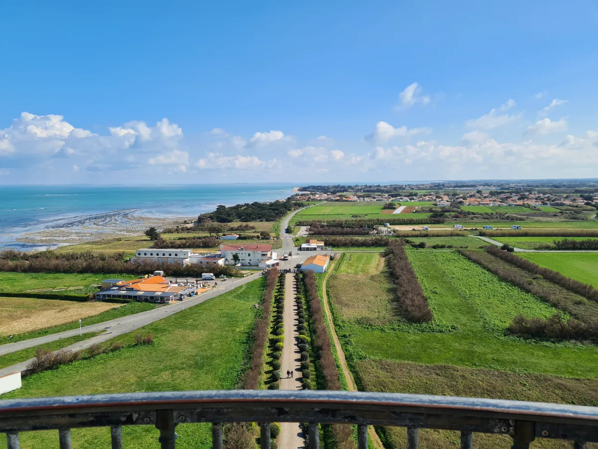
Oléron is the Atlantic on a grand scale. Larger than its neighbour, the Île de Ré, it offers kilometres of beaches, vast forests, fishing villages and marshes crisscrossed by canals. Connected to the mainland by a bridge, the island is easy to explore, but it’s worth taking the time to venture away from the main roads.
The western coast faces the open ocean. Waves roll onto long sandy beaches, sometimes backed by dunes and pine trees. On the eastern side, the more sheltered waters have encouraged oyster farming. Colourful huts, shallow pools and little harbours create landscapes entirely shaped by the rhythm of the tides.
In the south, the Saint-Trojan forest stretches behind the dunes. You can walk through the shade of its pine trees before emerging onto wide beaches where wind and sand constantly reshape the scenery. Other trails cross former salt marshes, now divided between natural areas and maritime activities.
Le Château-d’Oléron has an imposing 17th-century citadel, built to guard the approaches to the Charente estuary. Its ramparts offer lovely views over the sea and the surrounding pools. Further north, La Cotinière is a reminder that Oléron is also a working fishing island, with a harbour that’s still very active.
At the northern tip, the Phare de Chassiron, with its distinctive black and white stripes, stands watch over a rocky coastline swept by strong currents. From the top of the lighthouse, when it’s open to visitors, you can enjoy sweeping views of the ocean, villages and low-lying landscapes of the island.
Off the eastern coast, the unmistakable outline of Fort Boyard rises from the water. This enormous fortress was built in the 19th century to defend the coastline. You can’t simply land there, but its unusual shape is easy to spot on boat trips around the island.
BY ROAD BRIDGE
FERRY
Company 1
Liaison Maritime La Rochelle – Île d’Oléron
—>📍 To Boyardville
Duration (one-way) 50min
Price (round-trip) €27.50
📍 From La Rochelle
⚙️ Schedules (Official Website – Fr)
⚙️ Prices (Official Website – Fr)
Company 2
Compagnie Interîles
Duration (one-way) 50min
Price (round-trip) €27.50
📍 From La Rochelle
⚙️ Schedules & Prices (Official Website – Fr)
Duration (one-way) 1h
Price (round-trip) €27.50
📍 From La Rochelle
⚙️ Schedules & Prices (Official Website – Fr)
Company 3
Saint-Denis & Oléron Croisières
Duration (one-way) 1h
Price (round-trip) €27.50
📍 From La Rochelle
⚙️ Schedules (Official Website – Fr)
⚙️ Prices (Official Website – Fr)
Brouage
Type Village
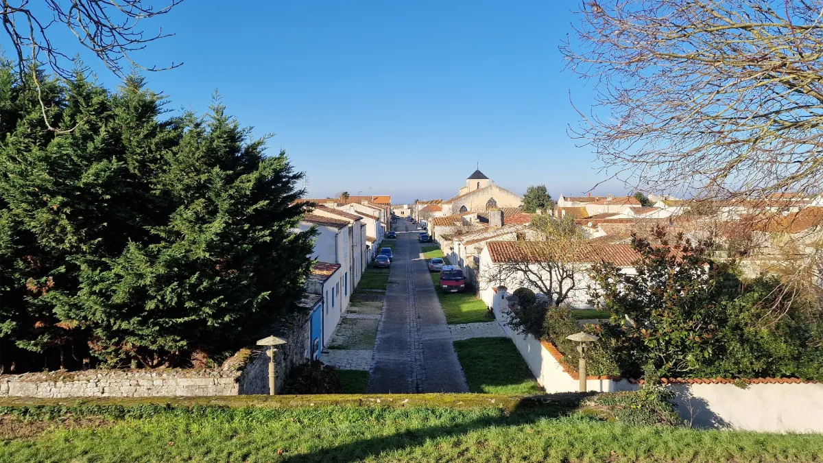
It’s hard to believe today, but Brouage was once a seaport open to the sea. Ships came here to load salt, before the coastline gradually retreated as land and marshes spread across the area. The town now stands surrounded by vast wetlands, enclosed within powerful stone walls.
In the 17th century, Brouage became a fortified military stronghold. Walking along its straight streets, you’ll come across historic buildings and massive gateways. Climb onto the ramparts and you’ll be rewarded with sweeping views over canals, meadows and birdlife. It’s a fortress that has become a surprisingly peaceful place.
Château Roche Courbon
Type Castle & Garden
Price €12 (Gardens)
Price €16 (Gardens & Castle – Guided Visit only)
Full Name
Château de la Roche Courbon
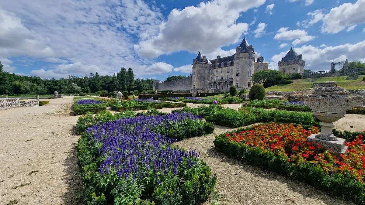
Hidden deep in a vast forest, the Château de la Roche-Courbon looks like something straight out of a fairytale. Its medieval towers, elegant 17th-century façades and large reflecting pool create a wonderfully romantic setting. The perfectly symmetrical gardens are reflected in the water at the foot of the château.
The estate has a surprising feature: part of the gardens rests on wooden structures driven deep into the marshy ground. Without this support, the paths and flowerbeds would risk sinking. Maintaining them requires constant work, despite the peaceful appearance of the surroundings.
Abandoned for many years, the estate came close to disappearing altogether. In the early 20th century, the writer Pierre Loti, who loved the place, launched an appeal to save the château and its forest. Restoration work later helped bring the property back to its former splendour.
Talmont-sur-Gironde
Type Village
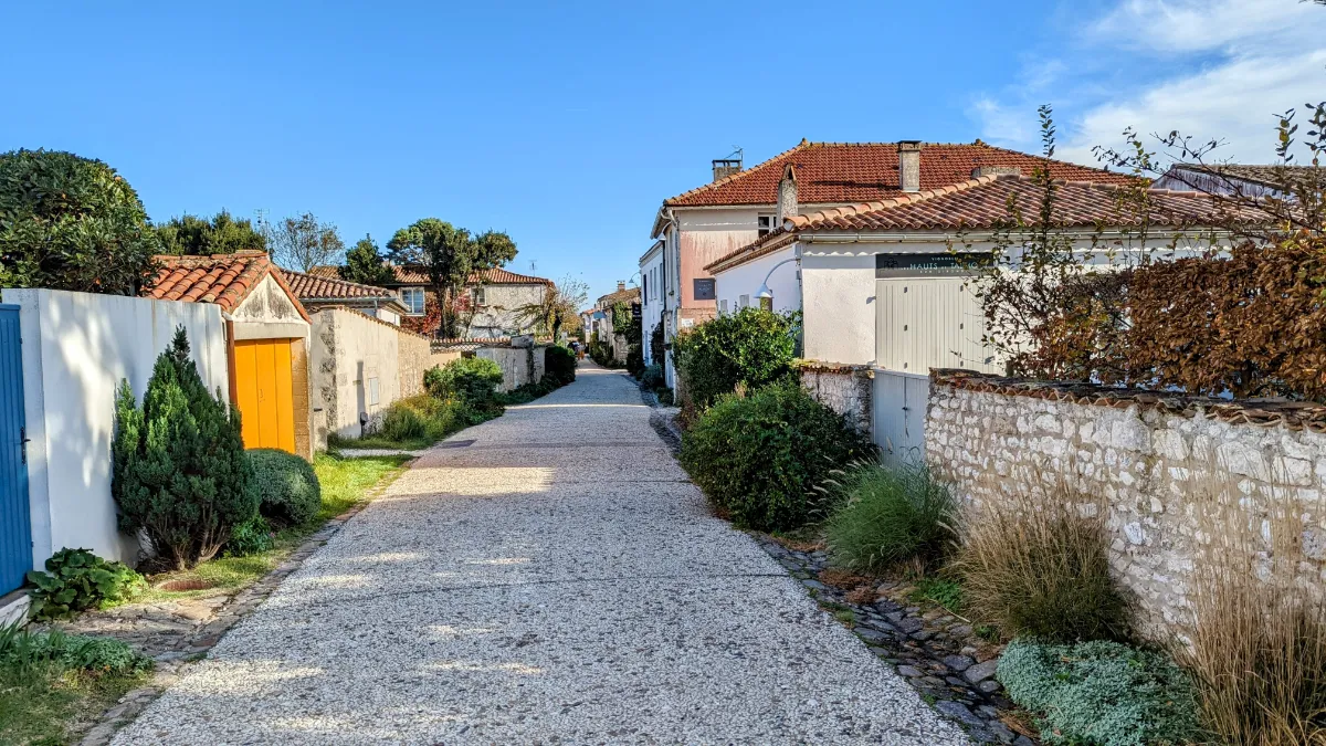
Talmont-sur-Gironde stands on a small headland overlooking a vast estuary, where the river waters gradually meet the Atlantic. Low houses, flower-filled lanes and pale stone walls make up a tiny village bathed in constantly changing light. You can easily explore the whole place on foot.
Its greatest treasure is the Church of Sainte-Radegonde, built in the Middle Ages right beside the water. Around it, hollyhocks add splashes of colour to the old stonework. Down below, fishing huts on stilts stretch their large square nets over the water, creating a particularly beautiful scene at sunset.