


NORTH
| Name | Type | Top+ |
|---|---|---|
| Dinan | Town | ✅ |
| Saint-Suliac | Village | |
| Saint-Malo | Town | ✅ |
| Île-de-Bréhat | Island | ✅ |
| Ploumanac'h | Coastal Path | ✅ |
| Roscoff | Small Town | |
| Île de Batz | Island |
Dinan
In Our Top+ ✅
Type Town
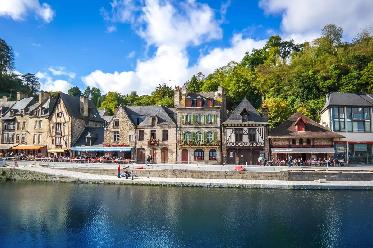
Dinan feels as though it has held on to much of its medieval character. Behind the ramparts, cobbled streets climb, descend and narrow between countless houses with their timber frames still visible. The town has an exceptional concentration of them for Brittany.
Its fortifications stretch for around 3 km, with towers and imposing gateways that tell the story of several centuries of defence. They are among the most impressive fortifications in Brittany.
The landscape itself adds a lot to the town’s charm. The old town sits high above the river, while the port lies much further down, beside a river connected to the sea. The slope between the two is pretty serious, so be ready to give your legs a workout.
This difference in height is also a reminder of Dinan’s former role as a trading town. Towards the end of the day, the streets become quieter, and the timber façades, stonework and fortified gateways seem to stand out even more.
Saint-Suliac
Type Village
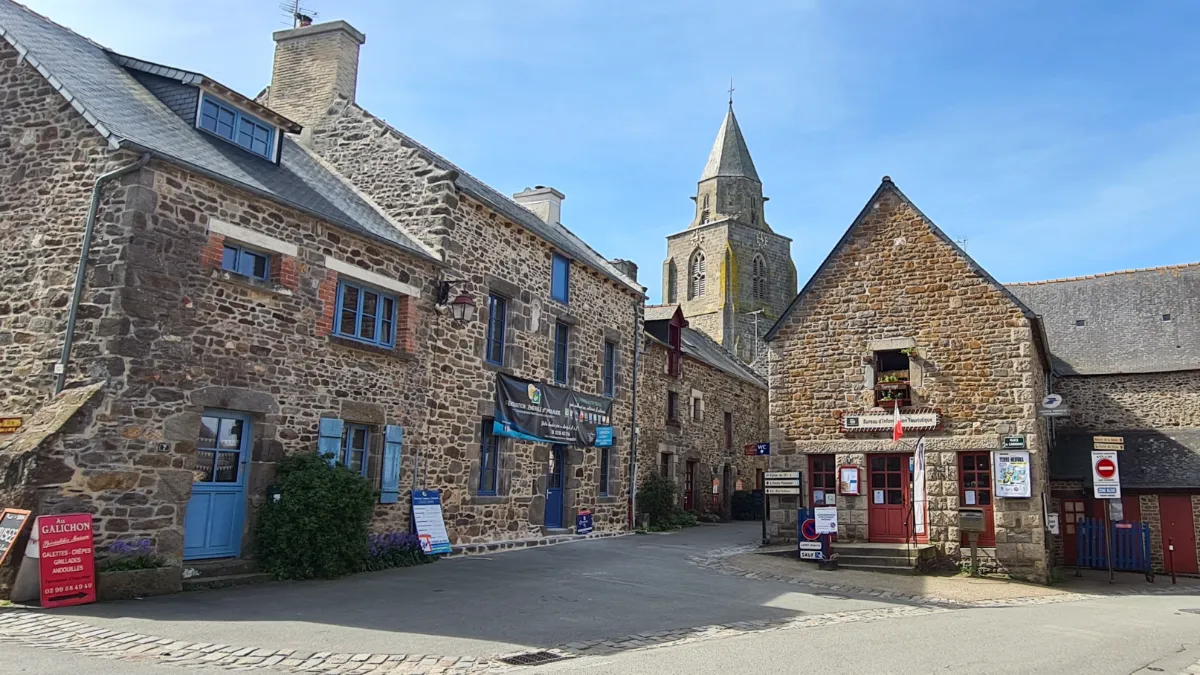
About ten kilometres from Saint-Malo, Saint-Suliac is clustered around a small harbour on the banks of the Rance. Granite houses, narrow passageways and gardens sloping down towards the water give the village an almost timeless feel.
For a long time, life here depended on the sea. Some men would spend several months fishing for cod off the coast of Canada, while others worked in the calmer waters of the Rance.
The small traditional boats you can still see today are a reminder of those tough times. Some were used for fishing locally, while others accompanied the larger ships on their long voyages to Newfoundland.
Saint-Suliac’s church, built mainly in the 13th century, remains one of the village’s main landmarks. Inside, model ships and pictures of sailors are reminders of this centuries-old connection with the ocean, while fishing nets still hanging on some of the houses keep the village’s maritime heritage alive.
Saint-Malo
In Our Top+ ✅
Type Town
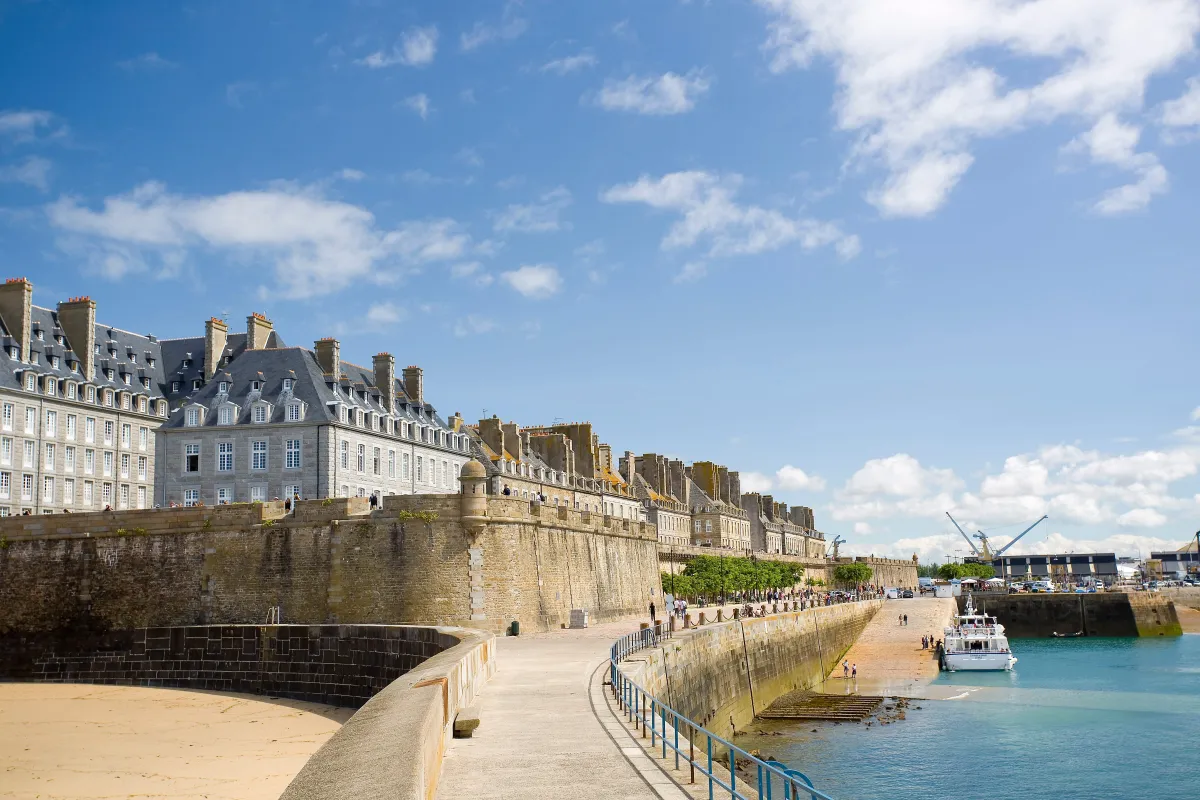
Saint-Malo reaches out towards the sea behind a powerful belt of granite. Its ramparts, around 1.8 km long, immediately set the tone. Navigation, overseas trade and defence shaped the city for centuries.
Its history is inseparable from the corsairs, sailors authorised by the King of France to attack enemy ships during wartime. Wealthy shipowners left behind tall granite houses that are particularly characteristic of the old town.
The fighting in 1944 destroyed a very large part of the historic centre. The city was later rebuilt with the aim of recreating its former appearance, which explains the remarkable architectural unity you see today.
Walk all the way around the ramparts. At high tide, the sea seems to crash directly against the walls. Just a few hours later, it retreats and reveals huge stretches of sand.
Bréhat
In Our Top+ ✅
Type Island
Full Name
Île de Bréhat
Size 3.5 x 1.5 km (2.2 x 0.9 mi)
Peak 35m (115ft)
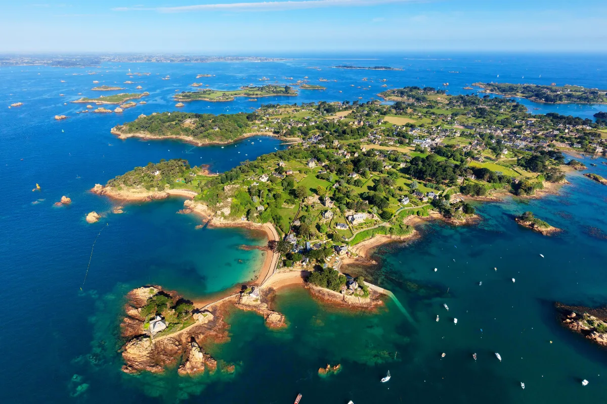
Bréhat has long been known as the “island of flowers”, and it’s more than just a pretty nickname. Its particularly mild maritime climate allows hydrangeas, agapanthus, mimosa, eucalyptus, fig trees and even palm trees to grow between stone houses and granite walls.
The island is actually made up of two main sections, joined for centuries by a stone causeway. Over just a few kilometres, the scenery changes noticeably, with sheltered landscapes and gardens in the south, and barer terrain, more exposed rocks and stronger winds towards the north.
Bréhat was also a pioneer when it came to protecting landscapes. In 1907, it became the first major natural site in France to receive official protection for its beauty. That early concern for conservation partly explains the harmony that still exists between the vegetation, traditional buildings and rocky coastline.
And yet the sea is always part of the picture. Sailors’ houses, former fishing activities and the constant presence of small offshore islands are reminders that behind all the flowers lies a genuinely maritime place, where pink granite rises between clusters of agapanthus.
FERRY
Company 1
Vedettes de Bréhat / BreizhGo
Duration (one-way) 11min
Price (round-trip) €11.90
📍 From l’Arcouest
⚙️ Schedules & Prices (Official Website)
Company 2
Sur Mer Bréhat
Duration (one-way) 10min
Price (round-trip) €11
📍 From l’Arcouest
⚙️ Schedules & Prices (Official Website – Fr)
Ploumanac'h
In Our Top+ ✅
Type Coastal Path
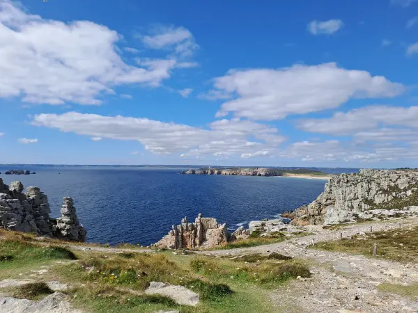
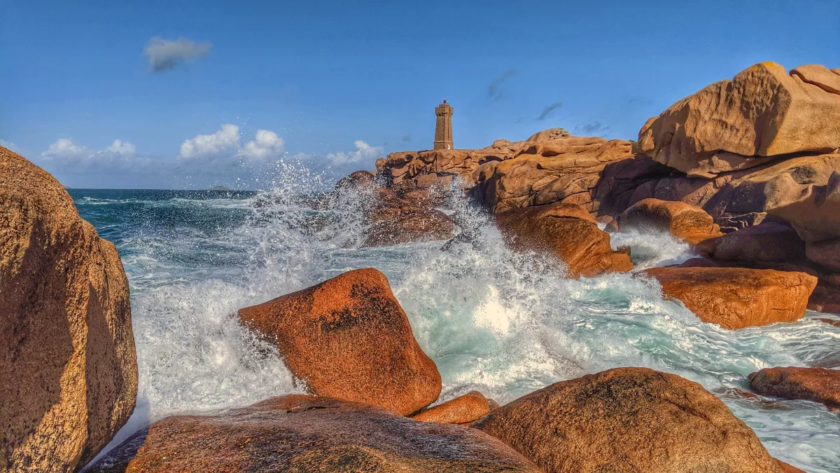
Ploumanac’h sometimes looks like a landscape created by a slightly playful giant. The coastal path winds between enormous blocks of pink granite stacked in unlikely positions, shaped and smoothed over millions of years by water, wind and changes in temperature.
The walk is easy to follow, but it would be a shame to rush it. Around every corner, new shapes appear, a mushroom, a turtle, a face or an upside down bottle, depending on your imagination. The granite changes colour too, shifting from pinkish grey to copper as the sun goes down.
The Mean Ruz lighthouse is the main landmark along the walk. Built from pink granite, it rises among the rocks and creates one of the most recognisable views anywhere on the Breton coast.
Further along, the view opens out towards the sea and Costaérès Castle, standing on its tiny island. On calm days, the blue water makes the strange, rocky landscape look even more striking.
Roscoff
Type Small Town
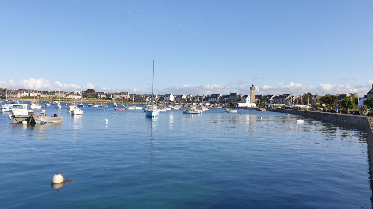
Roscoff is built from solid granite, with its heart firmly turned towards the English Channel. From the 16th century onwards, its port played a major role in a thriving maritime trade with England and northern Europe. Merchants, sailors and later corsairs, who were authorised to attack enemy ships during wartime, brought wealth to the town.
They left behind tall stone houses, some decorated with carved windows and small towers. Here, the sea is never just part of the scenery. The tides reveal the rocks, the Île de Batz seems almost close enough to touch, and the old harbour is a reminder of several centuries of trade and travel.
In the 19th century, local onion farmers also began crossing the sea to sell their produce in Britain. It was an extraordinary adventure that became an inseparable part of Roscoff’s identity. The mild climate, seaweed and salty air also helped make the town a pioneer in treatments using seawater, which began developing here in the late 19th century.
Batz
Type Island
Full Name
Île de Batz
Size 3.5 x 1.5 km (2.2 x 0.9 mi)
Peak 33m (108ft)
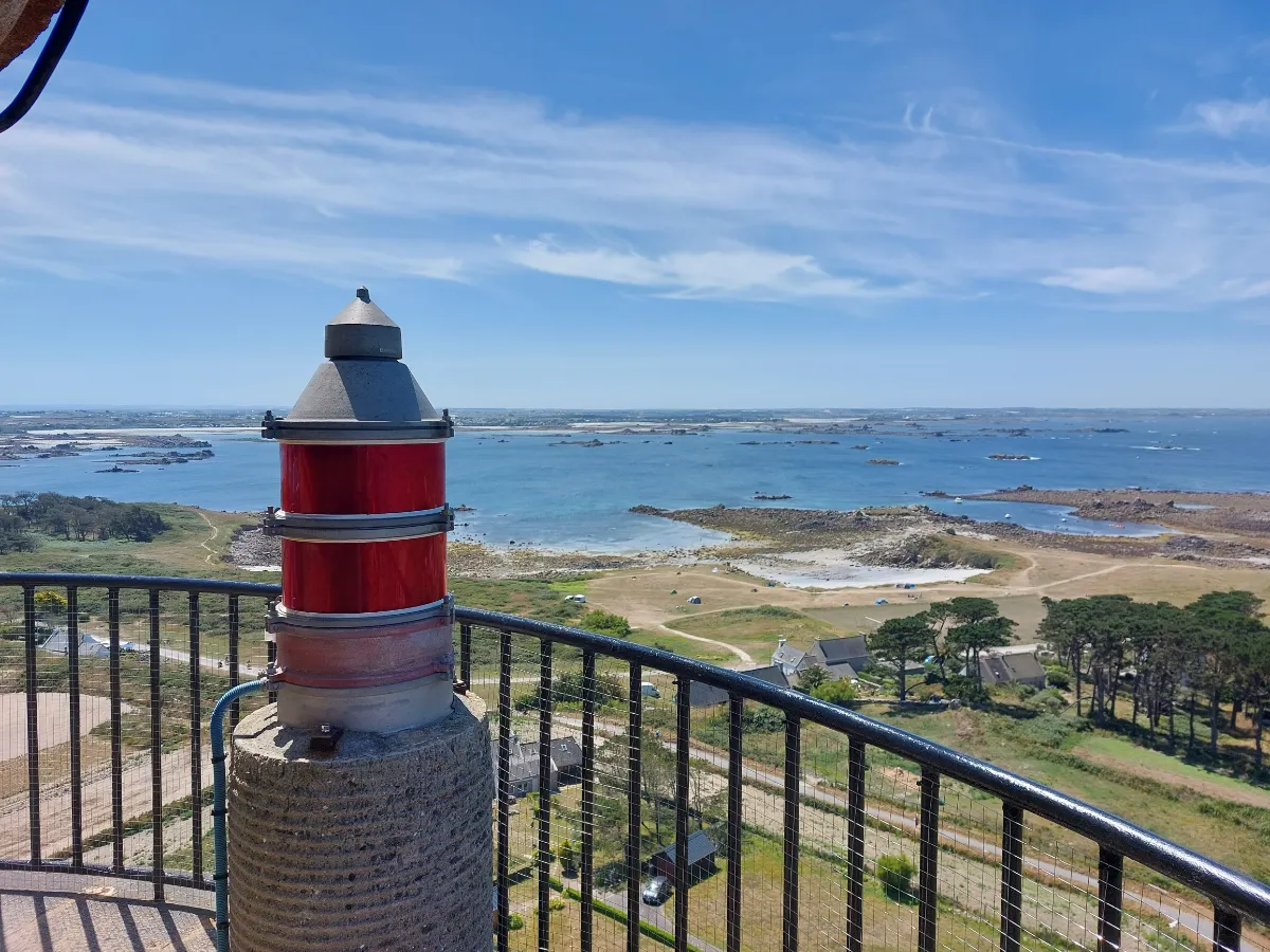
Batz feels like a garden floating on the sea. Only a few kilometres long, relatively flat and blessed with a surprisingly mild climate, the island supports both vegetable farming and plants you would normally expect to find much farther south. Northern Brittany can sometimes play tricks with the climate.
You can go from carefully tended fields to pale sandy beaches, then on to granite rocks sculpted by the sea. Fishing, seaweed harvesting and vegetable growing shaped the island’s rhythm for generations, and Batz has kept a much more agricultural character than many of its neighbours.
An old local legend also tells of a saint who came to convert the island and defeated a dragon. More peacefully, the exotic vegetation that has become one of Batz’s trademarks has benefited from this unusually favourable climate for more than a century. Palm trees, plants from the Southern Hemisphere and species from other continents all thrive here in surprisingly good conditions.
Between the stone houses, you still catch glimpses of vegetable gardens, meadows and patches of ocean, with no clear boundary between the village, farmland and shore.
FERRY
Company
Vedettes de l’Île de Batz
Duration (one-way) 15min
Price (round-trip) €11
WEST
| Name | Type | Top+ |
|---|---|---|
| Aber Wrac'h | Coastal Path | ✅ |
| Aber-Benoît | Coastal Path | |
| Ouessant | Island | ✅ |
| Crozon | Coastal Path | ✅ |
| Locronan | Village | ✅ |
| Pointe du Raz | Coastal Path | ✅ |
Aber Wrac'h
In Our Top+ ✅
Type Coastal Path
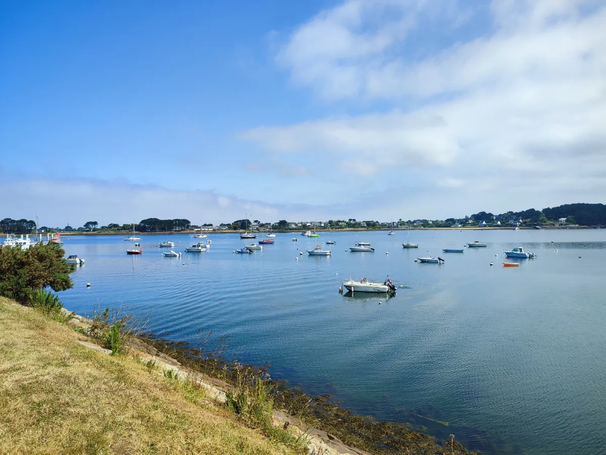
Aber Wrac’h offers a very different kind of walk from Brittany’s exposed ocean coastline. An “aber” is an ancient river valley that has been flooded by the sea. Here, the water reaches deep inland, creating a long sea inlet dotted with small islands and reefs.
The coastal path alternates between wide open views and more sheltered sections. As you get closer to the mouth of the inlet, the scenery becomes much more maritime, with sailing boats, navigation markers, rocks and lighthouses reminding you just how much care is needed to navigate these waters.
Several islands can be seen offshore, along with the spectacular Île Vierge lighthouse. The colours can be amazing when the sun comes out after a shower, pale sand, patches of turquoise water and intensely green vegetation.
The tide completely transforms the walk. At low tide, huge areas around the islands are exposed. A few hours later, the water fills the channels again and visually brings the two shores much closer together.
Aber-Benoît
Type Coastal Path
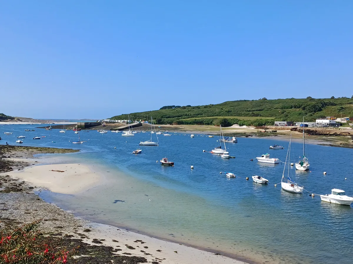
Quieter than its neighbour Aber Wrac’h, Aber-Benoît has a gentle, almost secret atmosphere. This ancient valley flooded by the sea winds between meadows, small woods and low banks before gradually widening as it approaches the ocean.
The walk follows a landscape controlled by the tides. When the water retreats, sandbanks and mudflats appear. When it returns, the landscape once again becomes a broad arm of the sea. This constant transformation is a big part of what makes the walk so interesting.
Near the mouth of the inlet, the scenery changes again, with long beaches and vast protected dunes. The area attracts plenty of birds, including egrets and several species of ducks and seabirds.
The terrain is generally gentler than on the great rocky headlands of Finistère. Here, you walk mainly for the changing light, the silence and that unusual meeting point between countryside and ocean, with seawater reaching deep into the inland landscape.
Ouessant (Ushant)
In Our Top+ ✅
Type Island
Full Name
Île d’Ouessant
Size 8.0 x 4.0 km (5.0 x 2.5 mi)
Peak 61m (200ft)
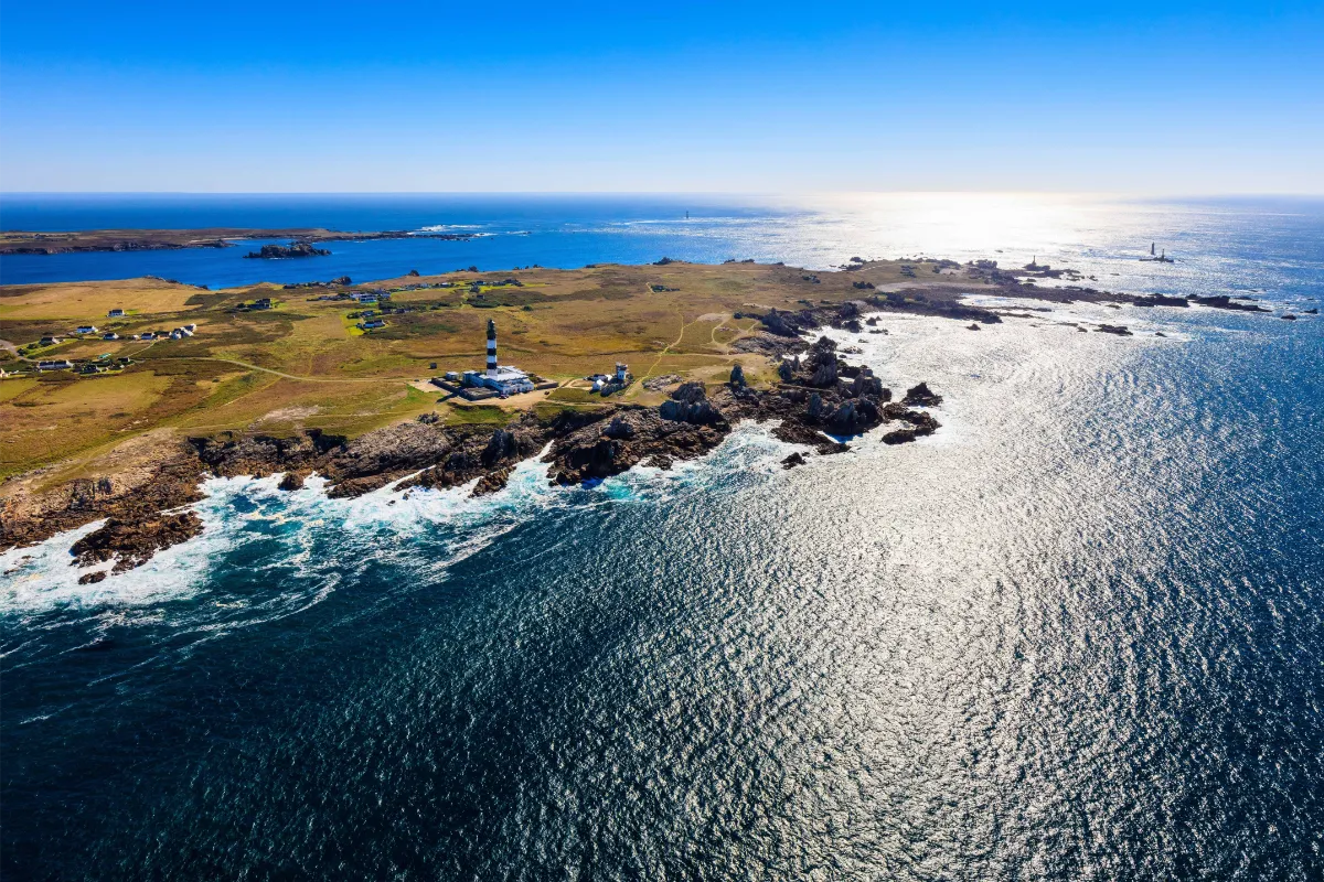
Ouessant feels like Brittany pushed to its absolute limit. Eight kilometres long and four wide, it’s a land worn down by erosion, with a deeply indented coastline and very little standing between you and the Atlantic wind. Storms, fog and powerful currents have shaped its reputation for centuries.
And yet the island never lived from the sea alone. For generations, its inhabitants were farmers as much as sailors, working countless small plots protected by low stone walls. The men sometimes left for months at a time, while the women kept the farms, households and much of everyday island life running.
The vegetation stays low, shaped by salt and wind. Heathland, short grasses and hardy flowers cover the interior, while migratory birds use this piece of land jutting into the ocean as a natural stopover. Ouessant is now part of a UNESCO-recognised biosphere reserve.
The lighthouses are obviously part of the legend. Créac’h Lighthouse, with its black and white stripes, has become one of Brittany’s most recognisable landmarks. Around it, reefs, headlands and white waves make it easy to understand why so many lights were needed to make this shipping route safer.
Even in calm weather, the light changes quickly. A sudden break in the clouds can turn a dark coastline into a dazzling cliff face, before the grey rolls back across the Atlantic.
FERRY
Company 1
BreizhGo Penn Ar Bed
Duration (one-way) 1.5h (from Le Conquet)
Price (round-trip) €33.50 Low Season – €39.80 High Season
📍 From Le Conquet
📍 From Brest
📍 From Camaret
📍 From Molène Island
⚙️ Schedules & Prices (Official Website – Fr)
Company 2
Finist’Mer
Duration (one-way) 50min (from Le Conquet or Lanildut)
Price (round-trip) €32 Low Season – €38 High Season
📍 From Le Conquet
📍 From Lanildut
📍 From Camaret
⚙️ Schedules & Prices (Official Website – Fr)
Crozon
In Our Top+ ✅
Type Coastal Path
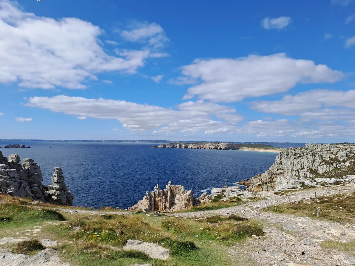
Crozon is an incredible place for walking, sitting between two large bays. The peninsula combines cliffs, long beaches, coves and rocky headlands, with a much wilder coastline on its western side. Hiking here can quickly become quite physical, there’s plenty of climbing and descending, and the edge of the cliffs is rarely far away.
Cap de la Chèvre offers one of the most spectacular routes. A loop of around 13 to 17 kilometres follows high cliffs covered in low vegetation before passing through old fishing villages. Some sections require good walking shoes and a steady footing.
Further north, Pointe de Pen-Hir is just as iconic. Its sandstone cliffs face the Tas de Pois, a series of huge rocks extending out into the ocean.
The geology adds another fascinating dimension to the walk. The cliffs contain rocks that are hundreds of millions of years old and are now protected for their exceptional scientific value.
Locronan
In Our Top+ ✅
Type Village
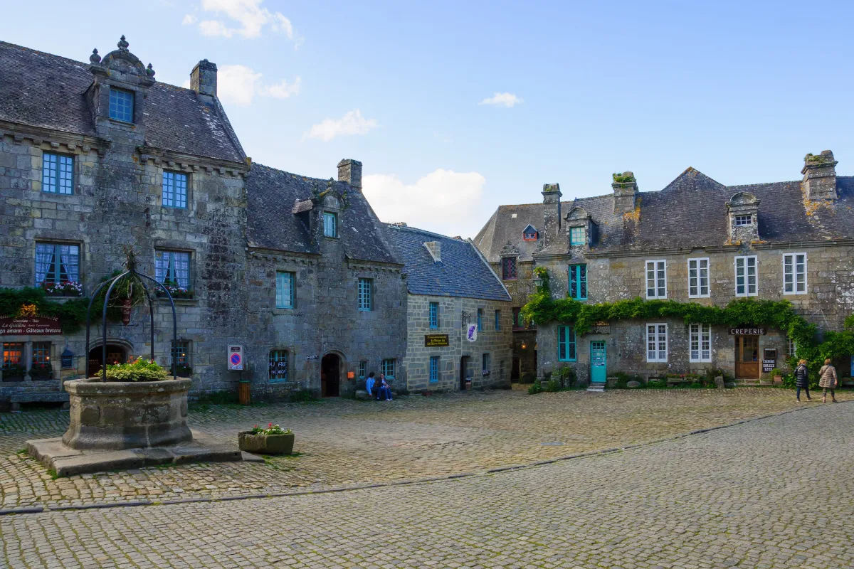
Locronan looks as though it was built to be a film set, and that’s not entirely a coincidence, as several films have been shot here. Its cobbled streets, solid granite houses and large central square have preserved a rare architectural harmony.
The village made its fortune mainly through textiles. From the 15th century onwards, highly durable hemp cloth was produced here for the sails of Europe’s great ships, an industry that brought considerable wealth to local merchants and manufacturers.
The grand houses around the main square mostly date from this prosperous period. By the 17th century, several hundred weavers were working here. The industry later declined with the arrival of modern ships and mechanised production.
Saint-Ronan Church is a reminder of an even older history, linked to a holy man who came from Ireland. His name is still associated with a major religious procession whose origins blend Christian traditions with beliefs that go back much further.
Pointe du Raz
In Our Top+ ✅
Type Coastal Path
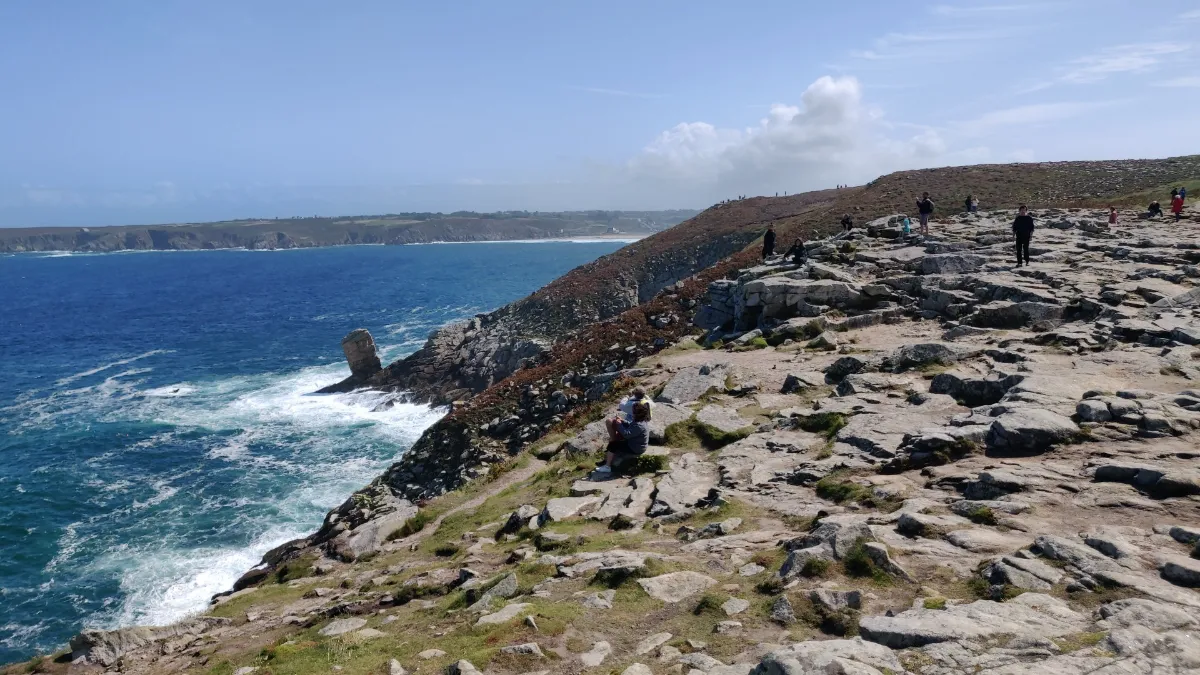
Pointe du Raz fully deserves its reputation as the end of the world. The path runs through low vegetation towards a rocky headland stretching out into the Atlantic, facing the Île de Sein. Between the two, powerful currents mean the sea is rarely calm.
To really enjoy the site on foot, take the coastal path rather than heading straight to the point. A loop of around 4 kilometres is enough to explore the cliffs and several different viewpoints without turning the outing into a long hike.
More ambitious walkers can continue to Pointe du Van. It’s around 5.5 kilometres each way, passing through the Baie des Trépassés. The route climbs and descends along the cliffs and requires a bit more stamina.
On clear days, you can see several lighthouses out at sea. But the point can be just as impressive beneath a grey sky, when the wind sends sea spray over the rocks and long white lines of foam stretch across the ocean.
SOUTH
| Name | Type | Top+ |
|---|---|---|
| St-Nicolas des Glénan | Island | |
| Pont-Aven | Village | |
| Groix | Island | |
| Belle Île | Island | ✅ |
| Vannes | Town | |
| Rochefort-en-Terre | Village | |
| La Gacilly | Small Town |
Saint-Nicolas des Glénan
Type Island
Full Name
Île Saint-Nicolas des Glénan
Size 0.7 x 0.3 km (0.43 x 0.19 mi)
Peak Flat
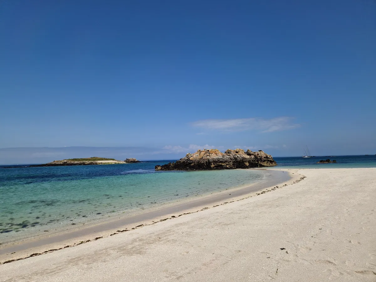
Almost white sand, crystal-clear turquoise water and tiny islands scattered across the horizon, at first sight, Saint-Nicolas can feel like an atoll. But this is still the Breton Atlantic, with cold water, shifting winds and an extremely fragile ecosystem.
The main island of the Glénan archipelago is particularly famous for one small white flower, the Glénan narcissus. It grows naturally nowhere else in the world. Once threatened with extinction, it has been protected since 1974 within a tiny 1.53-hectare nature reserve.
The unusual colour of the water comes largely from shell-rich sand and the pale seabed. Beneath the surface are also beds of maerl, a calcareous algae that grows incredibly slowly.
Saint-Nicolas brings together everything that makes the Glénan so unusual, scenery that looks almost tropical above the water, extremely vulnerable biodiversity below it, and a few weeks each spring when tiny narcissus flowers dot the grass with white.
FERRY
Company
Vedettes de l’Odet
Duration (one-way) 1h (from Bénodet)
Price (round-trip) €39
📍 From Bénodet
📍 From Concarneau
📍 From Loctudy
📍 From Beg Meil
📍 From La Forêt-Fouesnant
⚙️ Schedules & Prices (Official Website)
Pont-Aven
Type Village
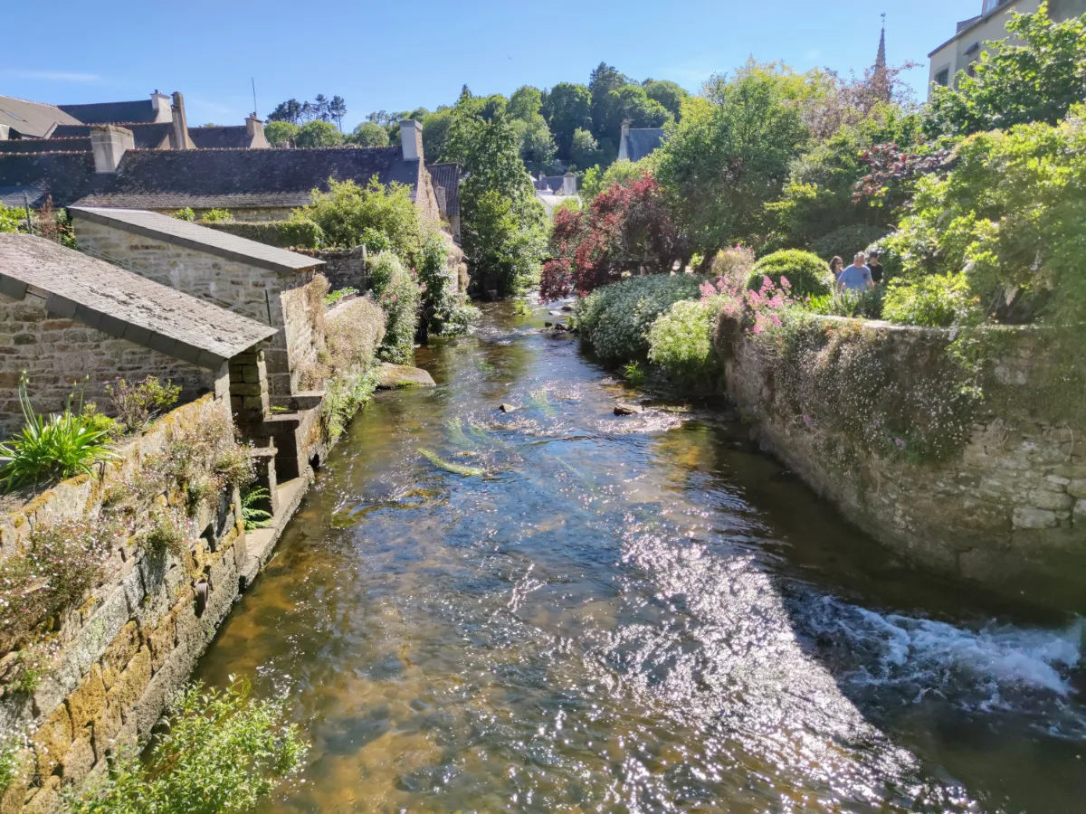
Pont-Aven owes much of its fame to a rather unlikely encounter between a small Breton port and painters from around the world. From the 1860s onwards, American and later European artists began arriving here, drawn by the light, the river and the mills.
Paul Gauguin first stayed here in 1886. Around him, Émile Bernard, Paul Sérusier and other artists soon began experimenting with a new style of painting, far removed from the traditional rules taught in Paris.
Simplified shapes, bold outlines and large areas of vivid colour, these experiments gave rise to the Pont-Aven School, which would play an important role in the development of modern European art.
The River Aven remains the real thread running through the village. It flows between the houses, passes beneath small bridges and eventually reaches the sea. The old mills are a reminder that long before the painters arrived, Pont-Aven was already shaped by water, trade and the constant movement of boats.
Groix
Type Island
Full Name
Île de Groix
Size 8.0 x 3.0 km (5.0 x 1.9 mi)
Peak 48m (157ft)
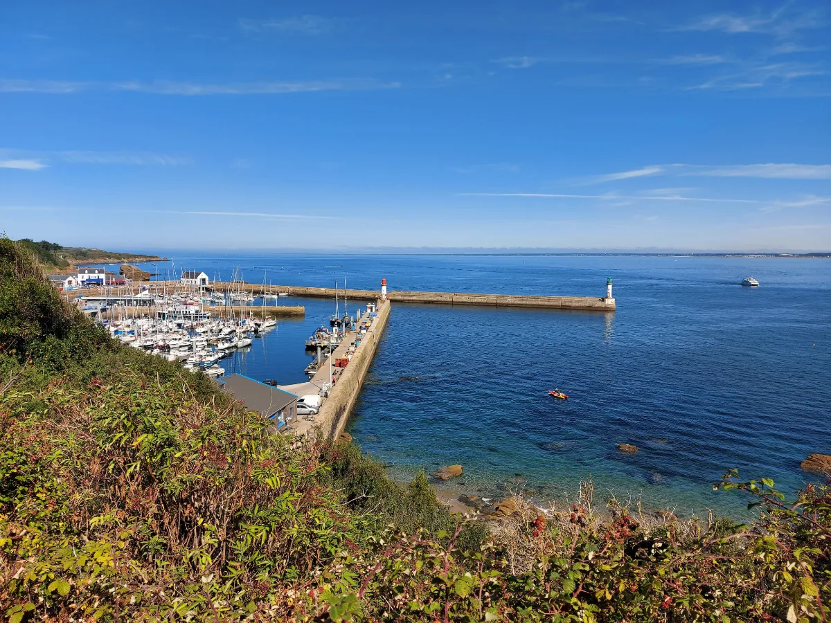
Groix begins with a geological surprise. Unlike much of Brittany, the island is not mainly made of granite. Its metamorphic rocks contain an extraordinary range of minerals, including blue glaucophane and garnet, which is why Groix is sometimes known as “the island of garnets”.
You can see that geological diversity directly in the landscape. The west is more rugged, with cliffs, heathland and powerful seas, while the east is gentler, with beaches and more vegetation. On some shores, tiny garnets even give the sand a reddish tint.
Groix was also once a major tuna-fishing island. During the 19th and early 20th centuries, its boats sailed across the Atlantic, giving the island an exceptionally strong maritime culture. Low houses, old maritime structures and family memories still carry traces of that past.
Grands Sables beach adds another rare curiosity. Its shoreline is convex, curving out towards the sea, and its sand gradually shifts under the influence of the currents. It’s one of Groix’s most iconic landscapes.
Elsewhere, heather, gorse and small valleys quickly bring you back to a much more rural Brittany, until a gap between two houses suddenly reveals the ocean again.
FERRY
Company 1
BreizhGo Océane
Duration (one-way) 45min
Price (round-trip) €37.80 Low Season – €41 High Season
📍 From Lorient
⚙️ Schedules & Prices (Official Website)
Company 2
Escal’Ouest
Duration (one-way) 45min
Price (round-trip) €30
📍 From Lorient
📍 From Port Louis
⚙️ Schedules & Prices (Official Website)
Company 3
Laïta Croisières
Duration (one-way) 20min
Price (round-trip) €29
Belle-Île
In Our Top+ ✅
Type Island
Full Name
Belle-Île-en-Mer
Size 20.0 x 9.0 km (12.4 x 5.6 mi)
Peak 71m (233ft)
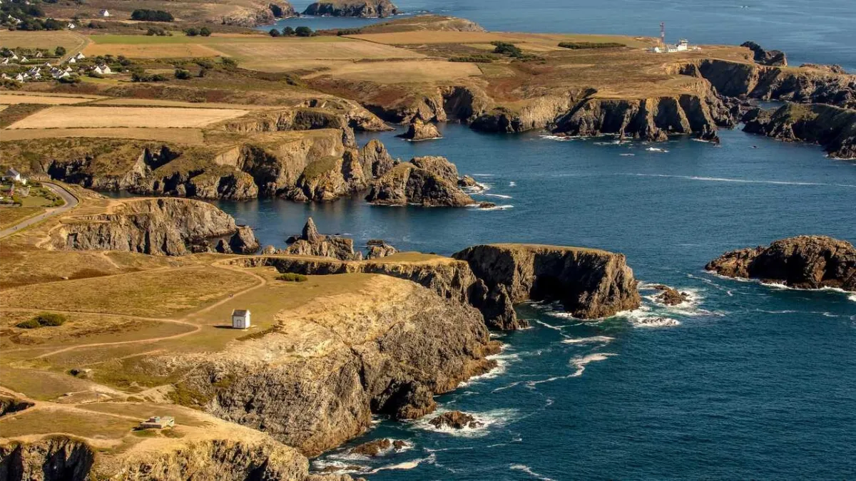
Belle-Île certainly lives up to its name, but its scenery is anything but uniform. Brittany’s largest island has two very different faces, a sheltered coast that is softer and greener, and a western side exposed to the Atlantic, with cliffs, caves, dark rocks and sea spray.
Inland, the landscape becomes surprisingly pastoral, with fields, valleys, hedges and small villages of low houses. You can almost forget you’re on an island, until a road suddenly drops towards a cove or a patch of ocean appears between two hills.
Its history has been eventful. Fortified for centuries because of its strategic position, the island was occupied by the British from 1761 to 1763. Soon afterwards, Acadian families expelled from North America settled here, adding an unexpected chapter to the island’s history.
Belle-Île was especially loved by artists. Claude Monet stayed for more than two months in 1886, painting the wild coastline over and over again, particularly the Aiguilles de Port-Coton, where rocks and waves become almost abstract under his brush.
A few years later, Sarah Bernhardt fell in love with the Pointe des Poulains. She bought an old fort there in 1894 and returned almost every summer until 1922, surrounded by artists, friends and much of the Parisian cultural scene of the time.
FERRY
Company 1
BreizhGo Océane
Duration (one-way) 50min
Price (round-trip) €38 Low Season – €41 High Season
📍 From Quiberon
⚙️ Schedules & Prices (Official Website)
Duration (one-way) 30min
Price (round-trip) €37.80 Low Season – €41 High Season
📍 From Quiberon
⚙️ Schedules & Prices (Official Website)
Company 2
Navix
Duration (one-way) 1h (from Port Navalo)
Price (round-trip) €36.60
📍 From Port Navalo
📍 From Locmariaquer
📍 From Vannes
📍 From La Trinité-sur-Mer
📍 From La Turballe
📍 From Le Croisic
⚙️ Schedules & Prices (Official Website – Fr)
Company 3
Compagnie du Golfe
Duration (one-way) 1h
Price (round-trip) €35.90
📍 From Port Navalo
📍 From Vannes
⚙️ Schedules & Prices (Official Website – Fr)
Vannes
Type Town
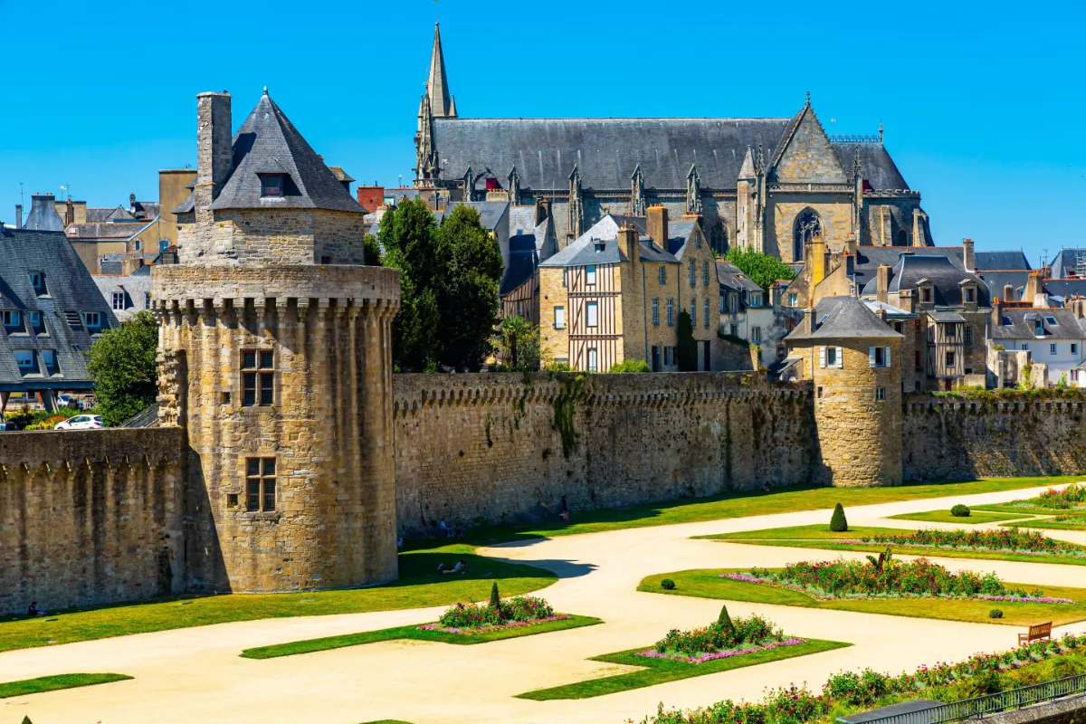
Vannes combines a remarkably well preserved historic centre with a real sense of being close to the sea. Once you pass through the fortified gates, you enter a network of narrow streets lined with old houses, many of them with colourful timber frames still clearly visible.
The ramparts are the city’s other great landmark. Towers, walls, gardens and old gateways still form a large part of the defensive system that once protected Vannes. The city’s history stretches back more than 2,000 years.
Despite all this history, Vannes never feels frozen in time. As you head down towards the harbour, the streets become wider, the light opens up, and the boats hint at the coastal landscapes waiting just beyond the city.
Everything is easy to explore on foot. Within just a few minutes, you can go from narrow streets squeezed between timber framed façades to open quays, then on to gardens laid out at the foot of the old walls.
Rochefort-en-Terre
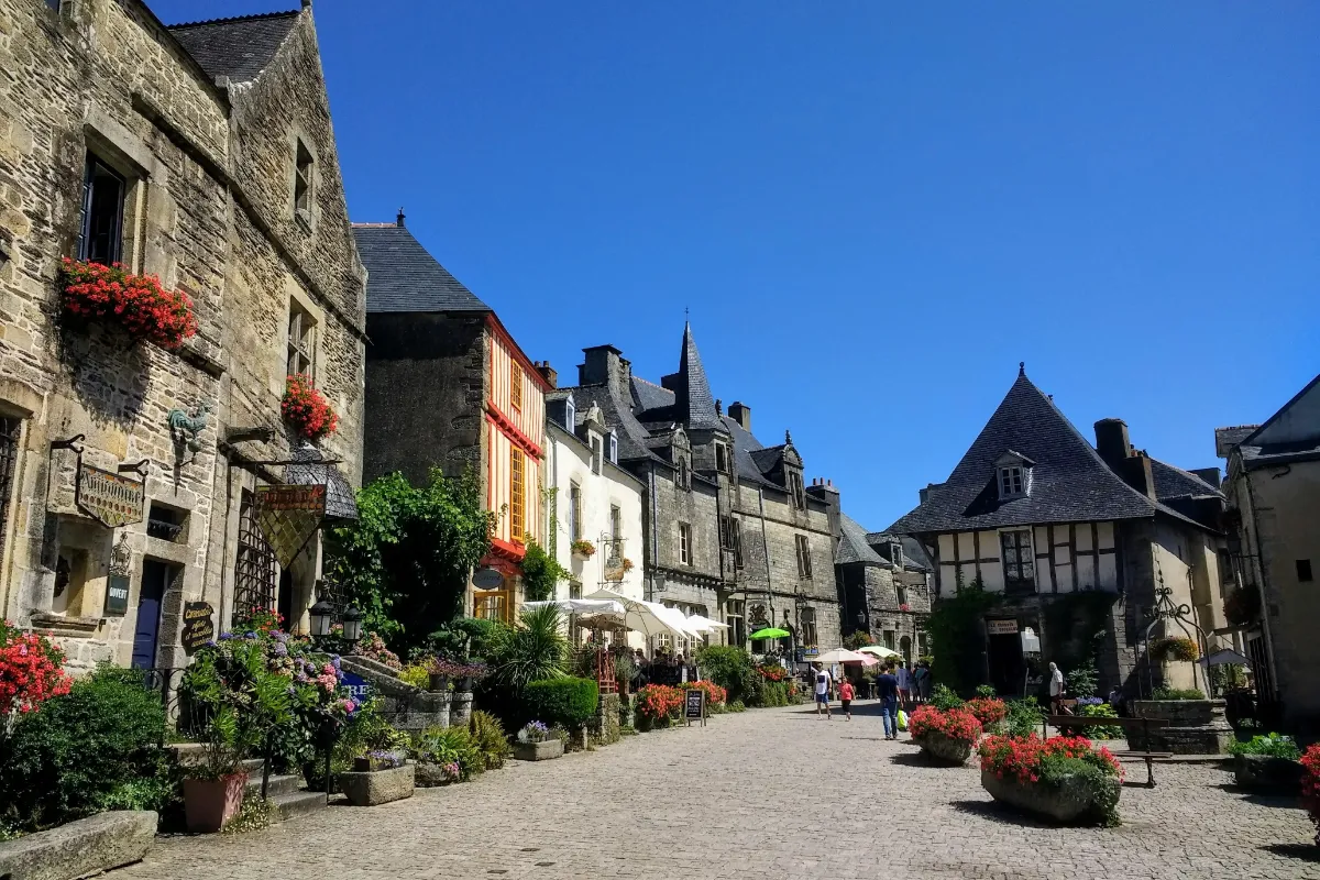
Type Village
Rochefort-en-Terre certainly lives up to its name, the small town clings to a rocky ridge overlooking a lush green valley. Cobbled streets, granite façades and historic houses form a remarkably well-preserved setting, almost swallowed up by the surrounding greenery.
A castle was first established here in the 12th century. Destroyed, rebuilt and damaged again over the course of various wars, it survived several turbulent centuries before taking on an entirely new life at the beginning of the 20th century.
In 1903, American painter Alfred Klots discovered Rochefort-en-Terre. He later bought the castle ruins, turned part of the site into a home and invited other artists to come and work in the village.
In 1911, Klots also launched a competition encouraging residents to decorate their windows with flowers. The idea left a lasting mark on the village. Even today, plants and flowers spill over the façades, creating a striking contrast with the dark stone and old walls.
La Gacilly
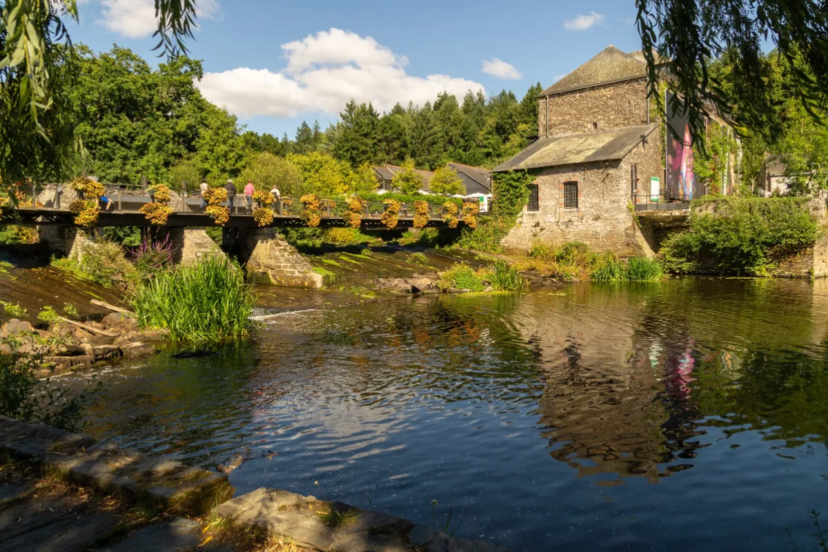
Type Small Town
La Gacilly is more about flowers than grand monuments. Set in a green valley crossed by the Aff River, the village is a mix of sloping streets, old houses and little passageways where plants seem determined to cover every wall. The atmosphere is peaceful and creative, with a slightly bohemian feel that gives the place plenty of charm.
Much of this personality comes from the artists and craftspeople who have settled here over the past few decades, but also from the story of Yves Rocher, who was born in La Gacilly. His interest in plants had a profound influence on the village and helped shape an identity centred around botany, nature and environmental protection.
During the warmer months, the village takes on a whole new look. The La Gacilly Photo Festival transforms its streets, façades and gardens into one huge open air exhibition. Hundreds of large scale photographs explore themes including the relationship between people and the environment. You simply wander from one photograph to the next through the narrow streets, sometimes barely noticing where the village ends and the exhibition begins.