


NORTH
| Name | Top+ | Top | Ferry (one-way) | Price (round-trip) | Peak m (ft) | Size km (mi) |
|---|---|---|---|---|---|---|
| Cézembre | 20m | €17.80 | 38 (125) | 0.6 x 0.25 (0.37 x 0.16) | ||
| Ébihens | Foot / 30m | 0 / €38 | 17 (56) | 1.0 x 0.3 (0.62 x 0.19) | ||
| Bréhat | ✅ | 11m | €11.90 | 35 (115) | 3.5 x 1.5 (2.2 x 0.9) | |
| Moines | Cruise only | €24.50 | 33 (108) | 0.47 x 0.25 (0.29 x 0.16) | ||
| Batz | ☑️ | 15m | €11 | 33 (108) | 3.5 x 1.5 (2.2 x 0.9) |
Cézembre
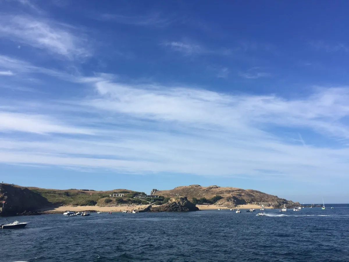
Full Name
Île de Cézambre
Size 0.6 x 0.25 km (0.37 x 0.16 mi)
Peak 38m (125ft)
A small rocky outcrop just off Saint-Malo, Cézembre has a completely different personality from Brittany’s lush, garden-like islands. Here, granite, wind and sea set the scene, but the history of the 20th century is still visible everywhere beneath the low vegetation.
In August and September 1944, the island, which had been turned into a German military stronghold, came under exceptionally heavy Allied bombardment. Aircraft, naval artillery and land-based guns pounded it for several weeks. Craters and the remains of fortifications still scar the landscape, which remained dangerous for decades because of unexploded ordnance.
That history gives Cézembre an almost unreal atmosphere. Among the shattered concrete remains, nature has reclaimed the land, with short grasses, salt-resistant plants and seabirds thriving on ground that the war had almost turned over stone by stone. Along the coast, cliffs and rocks plunge straight into water whose colour can change in a matter of minutes.
FERRY
Company 1
Compagnie Corsaire
Duration (one-way) 20min
Price (round-trip) €17.80
📍 From Saint-Malo
📍 From Dinard
⚙️ Schedules & Prices (Official Website)
Company 2
Bateaux Rouges
Duration (one-way) 20min
Price (round-trip) €18.30
📍 From Saint-Malo
📍 From Dinard
⚙️ Schedules & Prices (Official Website – Fr)
Ébihens
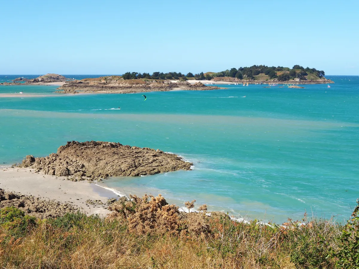
Full Name
Archipel des Ébihens
Size 1.0 x 0.3 km (0.62 x 0.19 mi)
Peak 17m (56ft)
The Ébihens are a tiny world of sand, granite and vegetation, set in a sea that constantly reshapes the landscape. The main island is privately owned and barely developed, with just a few houses hidden among the trees, while the pale beaches can sometimes make the scenery feel surprisingly Mediterranean.
Its main historic landmark is the Garangeau Tower, built between 1694 and 1697 to designs inspired by Vauban, to keep watch over this stretch of coastline. The island also passed into the hands of the family of the famous privateer Robert Surcouf, a reminder of a time when these waters were as much a strategic route as a holiday destination.
Around it, small rocks and islets are home to remarkable marine life and seabird colonies. The whole place has an understated elegance, with white sand, pine trees, windswept grasses and old military stonework standing against the horizon.
ON FOOT, only at low tide
Duration (one-way) 30min
FERRY
Company
Bateaux Rouges
Duration (one-way) 30min
Price (round-trip) €38
📍 From Saint-Malo
📍 From Dinard
⚙️ Schedules & Prices (Official Website – Fr)
Bréhat
In Our Top+ ✅
Full Name
Île de Bréhat
Size 3.5 x 1.5 km (2.2 x 0.9 mi)
Peak 35m (115ft)
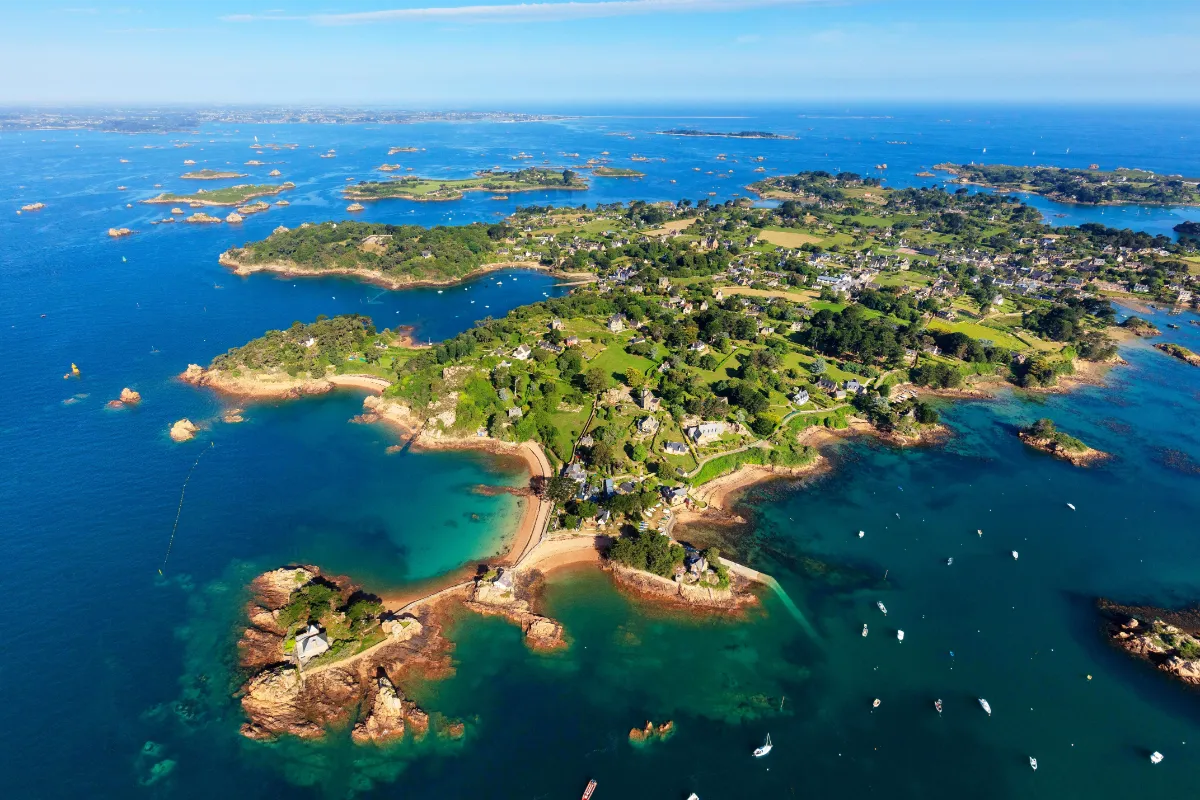
Bréhat has long been known as the “island of flowers”, and it’s more than just a pretty nickname. Its particularly mild maritime climate allows hydrangeas, agapanthus, mimosa, eucalyptus, fig trees and even palm trees to grow between stone houses and granite walls.
The island is actually made up of two main sections, joined for centuries by a stone causeway. Over just a few kilometres, the scenery changes noticeably, with sheltered landscapes and gardens in the south, and barer terrain, more exposed rocks and stronger winds towards the north.
Bréhat was also a pioneer when it came to protecting landscapes. In 1907, it became the first major natural site in France to receive official protection for its beauty. That early concern for conservation partly explains the harmony that still exists between the vegetation, traditional buildings and rocky coastline.
And yet the sea is always part of the picture. Sailors’ houses, former fishing activities and the constant presence of small offshore islands are reminders that behind all the flowers lies a genuinely maritime place, where pink granite rises between clusters of agapanthus.
FERRY
Company 1
Vedettes de Bréhat / BreizhGo
Duration (one-way) 11min
Price (round-trip) €11.90
📍 From l’Arcouest
⚙️ Schedules & Prices (Official Website)
Company 2
Sur Mer Bréhat
Duration (one-way) 10min
Price (round-trip) €11
📍 From l’Arcouest
⚙️ Schedules & Prices (Official Website – Fr)
Moines
Full Name
Île aux Moines
Size 0.47 x 0.25 km (0.29 x 0.16 mi)
Peak 33m (108ft)
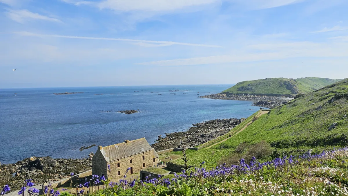
Don’t confuse it with its much larger namesake in southern Brittany. This Île aux Moines is part of the Sept-Îles archipelago, a vast seabird sanctuary off the Pink Granite Coast. The landscape is raw, rocky and exposed to the wind, surrounded by a sea that can be spectacular.
It’s also the island where most of the archipelago’s human history is concentrated. Religious communities lived here in isolation during the Middle Ages, and later came a fort, military quarters and a lighthouse, built in the 19th century and rebuilt after being destroyed in 1944.
All around you lies one of France’s great marine wildlife areas, with seabird colonies, rocks occupied by grey seals and, on the nearby island of Rouzic, the famous colony of northern gannets. Stone, heathland and a handful of isolated buildings are all it takes to create the scenery here.
CRUISE
Company
Armor Navigation
Access is only available as part of a 2.5-hour cruise, including a 40-minute stop on the island.
Price (round-trip) €24.50
📍 From Perros-Guirec
⚙️ Schedules & Prices (Official Website – Fr)
Batz
In Our Top ☑️
Full Name
Île de Batz
Size 3.5 x 1.5 km (2.2 x 0.9 mi)
Peak 33m (108ft)
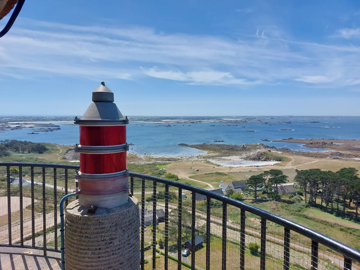
Batz feels like a garden floating on the sea. Only a few kilometres long, relatively flat and blessed with a surprisingly mild climate, the island supports both vegetable farming and plants you would normally expect to find much farther south. Northern Brittany can sometimes play tricks with the climate.
You can go from carefully tended fields to pale sandy beaches, then on to granite rocks sculpted by the sea. Fishing, seaweed harvesting and vegetable growing shaped the island’s rhythm for generations, and Batz has kept a much more agricultural character than many of its neighbours.
An old local legend also tells of a saint who came to convert the island and defeated a dragon. More peacefully, the exotic vegetation that has become one of Batz’s trademarks has benefited from this unusually favourable climate for more than a century. Palm trees, plants from the Southern Hemisphere and species from other continents all thrive here in surprisingly good conditions.
Between the stone houses, you still catch glimpses of vegetable gardens, meadows and patches of ocean, with no clear boundary between the village, farmland and shore.
FERRY
Company
Vedettes de l’Île de Batz
Duration (one-way) 15min
Price (round-trip) €11
WEST
| Name | Top+ | Top | Ferry (one-way) | Price (round-trip) | Peak m (ft) | Size km (mi) |
|---|---|---|---|---|---|---|
| Vierge | 5m | €15 | Flat | 0.4 x 0.2 (0.25 x 0.12) | ||
| Molène | 45m | €39.80 | 26 (85) | 1.2 x 0.8 (0.7 x 0.5) | ||
| Ouessant | ✅ | 1.5h | €39.80 | 61 (200) | 8.0 x 4.0 (5.0 x 2.5) | |
| Sein | 1h | €39.80 | Flat | 1.8 x 0.5 (1.1 x 0.3) |
Vierge
Full Name
Île Vierge
Size 0.4 x 0.2 km (0.25 x 0.12 mi)
Peak Flat
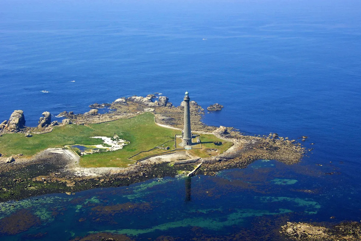
On Île Vierge, one monument dominates almost the entire landscape, its great granite lighthouse. Standing 82.5 metres tall and first lit in 1902, it is the tallest lighthouse in Europe and one of the tallest stone lighthouses in the world. Next to it, its 19th-century predecessor suddenly looks tiny.
The outside is impressive for its sheer height, but the interior is even more surprising. The stairwell is lined with thousands of white and pale blue opaline tiles, giving this otherwise austere tower an unexpectedly refined elegance.
All around it, the island remains an exposed piece of rock, battered by wind and sea spray. The contrast is striking, architecture of almost mathematical precision rising from a harsh, unforgiving landscape, facing waters that sailors feared for centuries along this stretch of the Breton coast.
FERRY
Company
Vedettes des Abers
Duration (one-way) 5min
Price (round-trip) 15€
📍 From Pointe du Castel Ac’h
⚙️ Schedules & Prices (Official Website – Fr)
Molène
Full Name
Île de Molène
Size 1.2 x 0.8 km (0.7 x 0.5 mi)
Peak 26m (85ft)
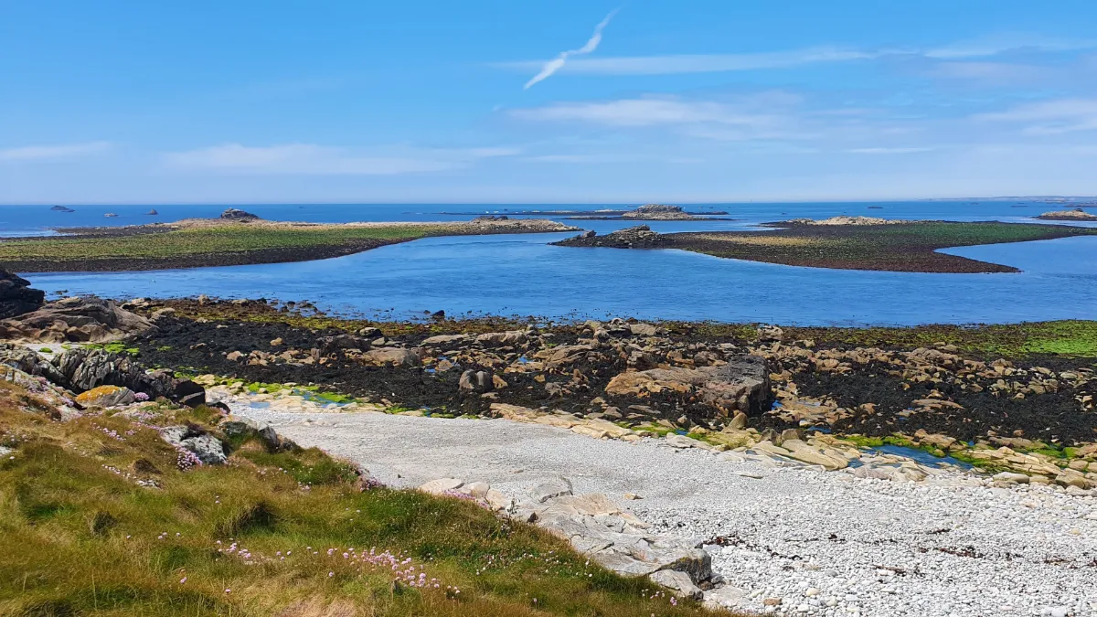
Molène doesn’t try to impress you with height. It’s low and almost completely horizontal, with a small village clustered around the church and the old maritime lookout station. At low tide, the landscape suddenly seems to expand, revealing rocks, islets and vast areas covered in seaweed.
You’re right in the heart of an archipelago whose waters contain one of Europe’s largest seaweed fields. Grey seals, dolphins, birds and an impressive variety of fish thrive in this mosaic of rocky seabeds, sand and underwater vegetation.
For generations, life here revolved around fishing, seaweed and an economy based on limited resources. You can see that in the architecture, tightly grouped houses, stone walls and almost nothing unnecessary when you’re living in a place this exposed to the wind.
Molène’s tiny size makes the sea feel even more present. Wherever you look, the horizon appears behind a rooftop, a patch of grass or a line of black rocks shining with sea spray.
FERRY
Company 1
BreizhGo Penn Ar Bed
Duration (one-way) 45min (from Le Conquet)
Price (round-trip) €33.50 Low Season – €39.80 High Season
📍 From Le Conquet
📍 From Brest
📍 From Camaret
📍 From Ouessant Island
⚙️ Schedules & Prices (Official Website – Fr)
Company 2
Finist’Mer
Duration (one-way) 45min (from Le Conquet)
Price (round-trip) €30 Low Season – €32 High Season
📍 From Le Conquet
📍 From Lanildut
⚙️ Schedules & Prices (Official Website – Fr)
Ouessant (Ushant)
In Our Top+ ✅
Full Name
Île d’Ouessant
Size 8.0 x 4.0 km (5.0 x 2.5 mi)
Peak 61m (200ft)
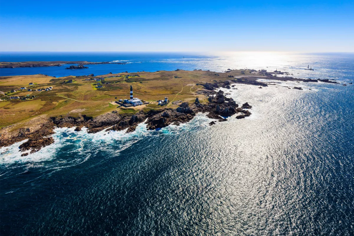
Ouessant feels like Brittany pushed to its absolute limit. Eight kilometres long and four wide, it’s a land worn down by erosion, with a deeply indented coastline and very little standing between you and the Atlantic wind. Storms, fog and powerful currents have shaped its reputation for centuries.
And yet the island never lived from the sea alone. For generations, its inhabitants were farmers as much as sailors, working countless small plots protected by low stone walls. The men sometimes left for months at a time, while the women kept the farms, households and much of everyday island life running.
The vegetation stays low, shaped by salt and wind. Heathland, short grasses and hardy flowers cover the interior, while migratory birds use this piece of land jutting into the ocean as a natural stopover. Ouessant is now part of a UNESCO-recognised biosphere reserve.
The lighthouses are obviously part of the legend. Créac’h Lighthouse, with its black and white stripes, has become one of Brittany’s most recognisable landmarks. Around it, reefs, headlands and white waves make it easy to understand why so many lights were needed to make this shipping route safer.
Even in calm weather, the light changes quickly. A sudden break in the clouds can turn a dark coastline into a dazzling cliff face, before the grey rolls back across the Atlantic.
FERRY
Company 1
BreizhGo Penn Ar Bed
Duration (one-way) 1.5h (from Le Conquet)
Price (round-trip) €33.50 Low Season – €39.80 High Season
📍 From Le Conquet
📍 From Brest
📍 From Camaret
📍 From Molène Island
⚙️ Schedules & Prices (Official Website – Fr)
Company 2
Finist’Mer
Duration (one-way) 50min (from Le Conquet or Lanildut)
Price (round-trip) €32 Low Season – €38 High Season
📍 From Le Conquet
📍 From Lanildut
📍 From Camaret
⚙️ Schedules & Prices (Official Website – Fr)
Sein
Full Name
Île de Sein
Size 1.8 x 0.5 km (1.1 x 0.3 mi)
Peak Flat
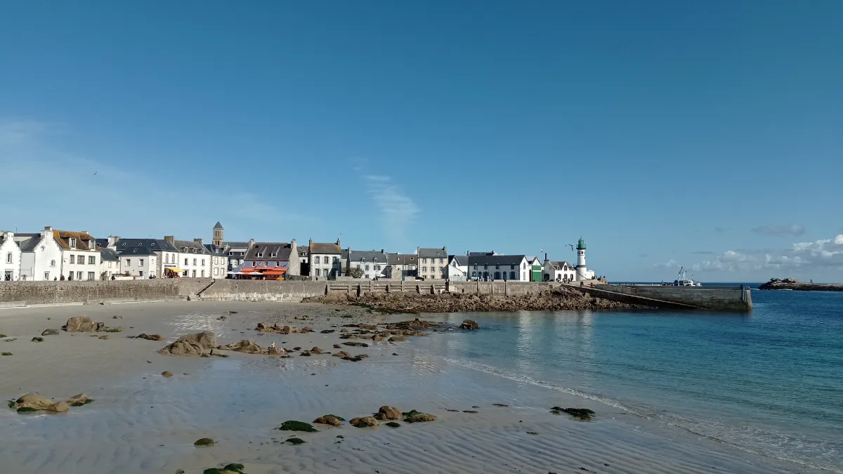
Sein almost feels like a challenge to geography itself. The island is around 1.8 kilometres long, and its highest point rises only a few metres above the sea. There are no great cliffs to offer protection, just houses, low stone walls and bare ground facing the wind and storms head-on.
That apparent fragility hides an extraordinary human determination. Despite flooding and difficult living conditions, generations of islanders have remained deeply attached to this tiny piece of land. The houses crowd together, almost as though the village itself were trying to form a barrier against the sea.
Sein also holds an exceptional place in the history of the Second World War. In June 1940, many of the island’s men left their families to join the Free French Forces in Britain. Sein was later made a Companion of the Liberation, an honour awarded to only five French communities.
In the distance, Ar Men Lighthouse rises from the reefs. It took fourteen years to build because the sea made every operation so dangerous. Its former keepers called it “the hell of hells”.
FERRY
Company 1
BreizhGo Penn Ar Bed
Duration (one-way) 1h (from Audierne)
Price (round-trip) €33.50 Low Season – €39.80 High Season
📍 From Audierne
📍 From Brest
📍 From Camaret
⚙️ Schedules & Prices (Official Website – Fr)
Company 2
Finist’Mer
Duration (one-way) 1h
Price (round-trip) €30 Low Season – €38 High Season
📍 From Audierne
⚙️ Schedules & Prices (Official Website – Fr)
SOUTH
| Name | Top+ | Top | Ferry (one-way) | Price (round-trip) | Peak m (ft) | Size km (mi) |
|---|---|---|---|---|---|---|
| St-Nicolas des Glénan | ☑️ | 1h | €39 | Flat | 0.7 x 0.3 (0.43 x 0.19) | |
| Groix | ☑️ | 45m | €41 | 48 (157) | 8.0 x 3.0 (5.0 x 1.9) | |
| Saint-Cado | Footbridge | 0 | Flat | 0.08 x 0.05 (0.05 x 0.03) | ||
| Belle-Île | ✅ | 50m | €41 | 71 (233) | 20.0 x 9.0 (12.4 x 5.6) | |
| Houat | 40m | €41 | 42 (138) | 4.5 x 1.2 (2.8 x 0.7) | ||
| Hoëdic | 1h | €41 | 22 (72) | 2.5 x 0.8 (1.6 x 0.5) | ||
| Moines | 5m | €6.80 | 31 (102) | 7.0 x 3.5 (4.3 x 2.2) | ||
| Arz | 20m | €13 | 17 (56) | 3.0 x 3.0 (1.9 x 1.9) |
Saint-Nicolas des Glénan
In Our Top ☑️
Full Name
Île Saint-Nicolas des Glénan
Size 0.7 x 0.3 km (0.43 x 0.19 mi)
Peak Flat
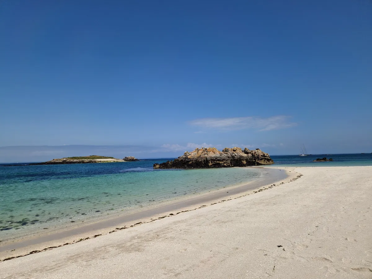
Almost white sand, crystal-clear turquoise water and tiny islands scattered across the horizon, at first sight, Saint-Nicolas can feel like an atoll. But this is still the Breton Atlantic, with cold water, shifting winds and an extremely fragile ecosystem.
The main island of the Glénan archipelago is particularly famous for one small white flower, the Glénan narcissus. It grows naturally nowhere else in the world. Once threatened with extinction, it has been protected since 1974 within a tiny 1.53-hectare nature reserve.
The unusual colour of the water comes largely from shell-rich sand and the pale seabed. Beneath the surface are also beds of maerl, a calcareous algae that grows incredibly slowly.
Saint-Nicolas brings together everything that makes the Glénan so unusual, scenery that looks almost tropical above the water, extremely vulnerable biodiversity below it, and a few weeks each spring when tiny narcissus flowers dot the grass with white.
FERRY
Company
Vedettes de l’Odet
Duration (one-way) 1h (from Bénodet)
Price (round-trip) €39
📍 From Bénodet
📍 From Concarneau
📍 From Loctudy
📍 From Beg Meil
📍 From La Forêt-Fouesnant
⚙️ Schedules & Prices (Official Website)
Groix
In Our Top ☑️
Full Name
Île de Groix
Size 8.0 x 3.0 km (5.0 x 1.9 mi)
Peak 48m (157ft)
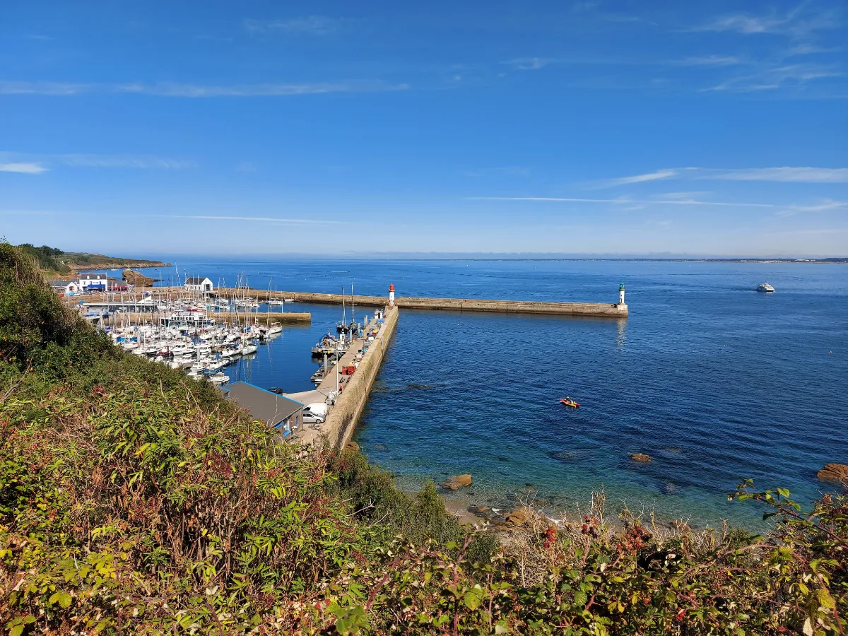
Groix begins with a geological surprise. Unlike much of Brittany, the island is not mainly made of granite. Its metamorphic rocks contain an extraordinary range of minerals, including blue glaucophane and garnet, which is why Groix is sometimes known as “the island of garnets”.
You can see that geological diversity directly in the landscape. The west is more rugged, with cliffs, heathland and powerful seas, while the east is gentler, with beaches and more vegetation. On some shores, tiny garnets even give the sand a reddish tint.
Groix was also once a major tuna-fishing island. During the 19th and early 20th centuries, its boats sailed across the Atlantic, giving the island an exceptionally strong maritime culture. Low houses, old maritime structures and family memories still carry traces of that past.
Grands Sables beach adds another rare curiosity. Its shoreline is convex, curving out towards the sea, and its sand gradually shifts under the influence of the currents. It’s one of Groix’s most iconic landscapes.
Elsewhere, heather, gorse and small valleys quickly bring you back to a much more rural Brittany, until a gap between two houses suddenly reveals the ocean again.
FERRY
Company 1
BreizhGo Océane
Duration (one-way) 45min
Price (round-trip) €37.80 Low Season – €41 High Season
📍 From Lorient
⚙️ Schedules & Prices (Official Website)
Company 2
Escal’Ouest
Duration (one-way) 45min
Price (round-trip) €30
📍 From Lorient
📍 From Port Louis
⚙️ Schedules & Prices (Official Website)
Company 3
Laïta Croisières
Duration (one-way) 20min
Price (round-trip) €29
Saint-Cado
Full Name
Île de Saint-Cado
Size 0.08 x 0.05 km (0.05 x 0.03 mi)
Peak Flat
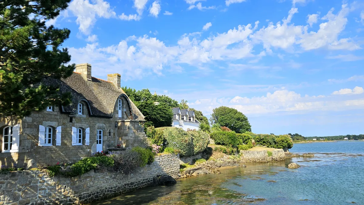
Saint-Cado is tiny, but few Breton islands offer such an instantly recognisable scene. A handful of fishermen’s houses cluster around an old Romanesque chapel, surrounded by a landscape where the tide rises between mudflats, rocks and oyster farms.
Most of the chapel dates from the 12th century and keeps alive the memory of the saint who gave the island its name. Just opposite, a tiny fisherman’s house with colourful shutters, standing alone on its own little islet, has become one of the most photographed sights in Brittany.
Sardine fishing, followed by oyster farming, shaped this tiny community for generations. At low tide, the landscape opens up dramatically, while at high tide, the houses and chapel seem to float in the middle of the water.
Access on foot via a small footbridge.
Belle-Île
In Our Top+ ✅
Full Name
Belle-Île-en-Mer
Size 20.0 x 9.0 km (12.4 x 5.6 mi)
Peak 71m (233ft)
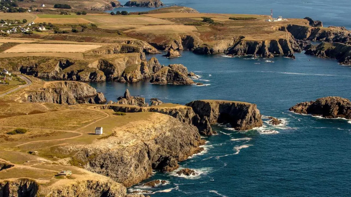
Belle-Île certainly lives up to its name, but its scenery is anything but uniform. Brittany’s largest island has two very different faces, a sheltered coast that is softer and greener, and a western side exposed to the Atlantic, with cliffs, caves, dark rocks and sea spray.
Inland, the landscape becomes surprisingly pastoral, with fields, valleys, hedges and small villages of low houses. You can almost forget you’re on an island, until a road suddenly drops towards a cove or a patch of ocean appears between two hills.
Its history has been eventful. Fortified for centuries because of its strategic position, the island was occupied by the British from 1761 to 1763. Soon afterwards, Acadian families expelled from North America settled here, adding an unexpected chapter to the island’s history.
Belle-Île was especially loved by artists. Claude Monet stayed for more than two months in 1886, painting the wild coastline over and over again, particularly the Aiguilles de Port-Coton, where rocks and waves become almost abstract under his brush.
A few years later, Sarah Bernhardt fell in love with the Pointe des Poulains. She bought an old fort there in 1894 and returned almost every summer until 1922, surrounded by artists, friends and much of the Parisian cultural scene of the time.
FERRY
Company 1
BreizhGo Océane
Duration (one-way) 50min
Price (round-trip) €38 Low Season – €41 High Season
📍 From Quiberon
⚙️ Schedules & Prices (Official Website)
Duration (one-way) 30min
Price (round-trip) €37.80 Low Season – €41 High Season
📍 From Quiberon
⚙️ Schedules & Prices (Official Website)
Company 2
Navix
Duration (one-way) 1h (from Port Navalo)
Price (round-trip) €36.60
📍 From Port Navalo
📍 From Locmariaquer
📍 From Vannes
📍 From La Trinité-sur-Mer
📍 From La Turballe
📍 From Le Croisic
⚙️ Schedules & Prices (Official Website – Fr)
Company 3
Compagnie du Golfe
Duration (one-way) 1h
Price (round-trip) €35.90
📍 From Port Navalo
📍 From Vannes
⚙️ Schedules & Prices (Official Website – Fr)
Houat
Full Name
Île d’Houat
Size 4.5 x 1.2 km (2.8 x 0.7 mi)
Peak 42m (138ft)
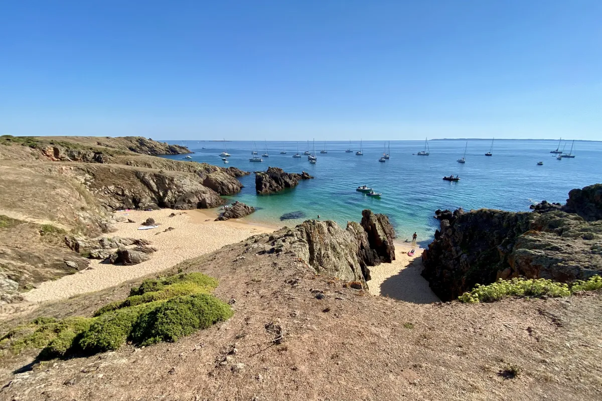
Houat stretches for around 4 to 5 kilometres, large enough for the scenery to change, but small enough for the sea to remain constantly in the back of your mind. The centre forms a plateau covered in heathland, while the coastline alternates between low cliffs, rocky headlands, dunes and coves.
Fishing is deeply rooted in the island’s identity. Lobster pots, boats and simple houses recall a community that for generations lived almost entirely from the sea, supplemented by a little farming. Even the wind shaped the architecture, with firmly secured roofs, low buildings and sheltered lanes.
The Grande Plage, Treac’h er Goured, is its most spectacular sight, a huge sweep of pale sand curving around crystal-clear water. Marram grass and sea daffodils grow behind the dunes, while the opposite coast is rougher, broken up by small cliffs.
The name Houat is thought to come from the Breton word for “duck”, which would make its little neighbour Hoëdic the “duckling”.
FERRY
Company 1
BreizhGo Océane
Duration (one-way) 40min (from Quiberon)
Price (round-trip) €37.80 Low Season – €41 High Season
📍 From Quiberon
📍 From Hoëdic Island
⚙️ Schedules & Prices (Official Website)
Company 2
Navix
Duration (one-way) 45min (from Port Navalo)
Price (round-trip) €36 – €43.60 (Depending on the departure point)
📍 From Port Navalo
📍 From Locmariaquer
📍 From Vannes
📍 From La Trinité-sur-Mer
📍 From La Turballe
📍 From Le Croisic
⚙️ Schedules & Prices (Official Website – Fr)
Company 3
Compagnie du Golfe
Duration (one-way) 45min
Price (round-trip) €29
📍 From Belle-Île Island (Le Palais)
⚙️ Schedules & Prices (Official Website – Fr)
Hoëdic
Full Name
Île d’Hoëdic
Size 2.5 x 0.8 km (1.6 x 0.5 mi)
Peak 22m (72ft)
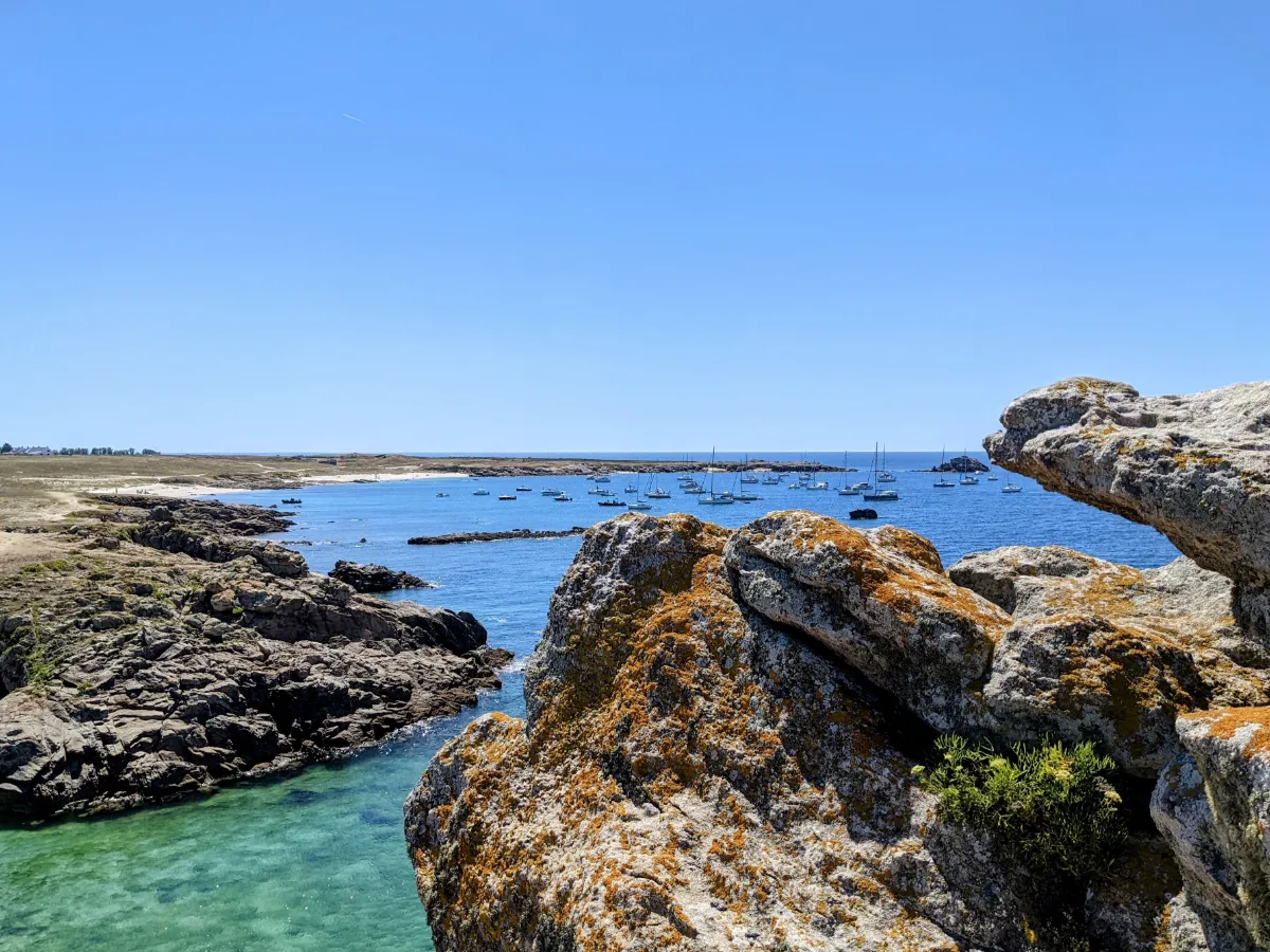
Hoëdic feels like an island in miniature. Around 2.5 kilometres long and 1 kilometre wide, with very little elevation, a compact village and a coastline of sand, rocks and small coves, you can almost take in the whole landscape at a glance.
And yet people have lived here since prehistoric times, as shown by the standing stones and ancient graves found across the island. After centuries of fishing, livestock farming and small-scale agriculture, this tiny community even developed its own collective rules to organise life in what was, for a long time, an extremely isolated place.
A large 19th-century fort is another reminder of the military importance of these islands during the naval rivalry between France and Britain. Considered almost useless as soon as it was completed, it later found a second purpose as a place to store seaweed.
Around it, low heathland, stone walls and beaches give Hoëdic a stripped-back character. There’s nothing monumental here, just a few trees, a huge amount of sky and the Atlantic appearing almost everywhere beyond the rooftops.
FERRY
Company 1
BreizhGo Océane
Duration (one-way) 1h (from Quiberon)
Price (round-trip) €37.80 Low Season – €41 High Season
📍 From Quiberon
📍 From Houat Island
⚙️ Schedules & Prices (Official Website)
Company 2
Navix
Duration (one-way) 1h (from Port Navalo)
Price (round-trip) €36 – €40.50 (Depending on the departure point)
📍 From Port Navalo
📍 From Locmariaquer
📍 From Vannes
📍 From La Turballe
📍 From Le Croisic
⚙️ Schedules & Prices (Official Website – Fr)
Company 3
Compagnie du Golfe
Duration (one-way) 50min
Price (round-trip) €29
📍 From Belle-Île Island (Le Palais)
⚙️ Schedules & Prices (Official Website – Fr)
Moines
Full Name
Île aux Moines
Size 7.0 x 3.5 km (4.3 x 2.2 mi)
Peak 31m (102ft)
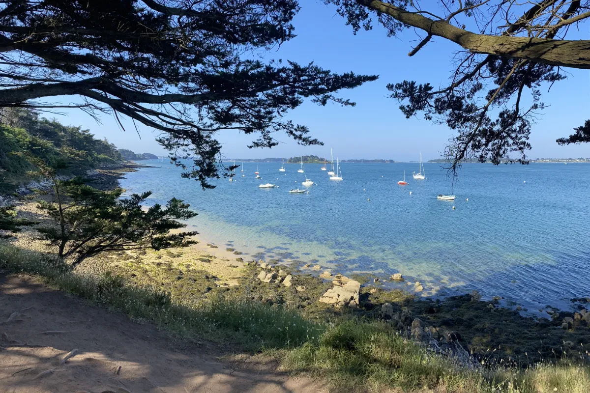
At 7 kilometres long and with its unusual cross-like shape, Île aux Moines is the largest island in the Gulf of Morbihan. It’s also one of the most wooded, with pine and oak trees, gardens and lanes lined with pale houses, a world away from the stark landscapes of islands farther out at sea.
Its microclimate adds an almost southern touch. Camellias, mimosa, palm trees, orange trees and even a few olive trees thrive alongside more typical Breton vegetation. More than 350 plant species have been recorded on the island.
But this inhabited garden has a much older history. Stone monuments several thousand years old show just how long people have been living here. Its present name comes from the monks who were given the island in the 9th century.
The shoreline is constantly changing, with small rocky headlands, sheltered bays, beaches uncovered by the tide and paths lined with pine trees. The Gulf itself feels more like a vast inland sea than a true stretch of ocean.
Summer brings huge numbers of visitors, sometimes making the island feel very far from the idea of a deserted escape. Away from the crowds, though, its gardens, old walls and footpaths recover their much more intimate atmosphere.
FERRY
Company 1
Izenah Croisières
Duration (one-way) 5min
Price (round-trip) €6.80
📍 From Port Blanc
⚙️ Schedules & Prices (Official Website – Fr)
Company 2
Compagnie du Golfe
Duration (one-way) 45min
Price (round-trip) €17.20
Arz
Full Name
Île d’Arz
Size 3.0 x 3.0 km (1.9 x 1.9 mi)
Peak 17m (56ft)
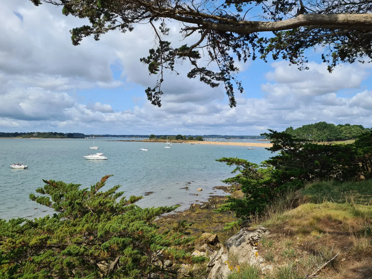
Arz is the other large island in the Gulf, but it feels very different from Île aux Moines. Flatter, less wooded and more open to fields and tides, it has an almost rural simplicity, with hedges, meadows, old houses and long views across an inland sea dotted with small islands.
It’s known as “the Island of Captains”. For generations, a remarkable proportion of its men became long-distance sailors, naval officers or merchant captains. During their long absences, women largely kept the farms and everyday island life running.
That relationship with the water can even be seen in the Berno tidal mill, a restored 16th-century mill. It simply used the difference in water level between high and low tide to power its machinery.
As the tide goes out, Arz seems to grow. Vast mudflats appear, channels gleam in the light and birds search the newly exposed ground for food, before the water gradually returns and blue once again surrounds the fields.
FERRY
Company 1
Izenah Croisières
Duration (one-way) 20min
Price (round-trip) €13
📍 From Port Blanc
⚙️ Schedules & Prices (Official Website – Fr)
Company 2
BreizhGo Île d’Arz
Duration (one-way) 10min (from Séné)
Price (round-trip) €13.80
📍 From Séné
📍 From Vannes
⚙️ Schedules & Prices (Official Website – Fr)