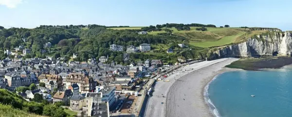



YOUTUBE VIDEO (11:57)
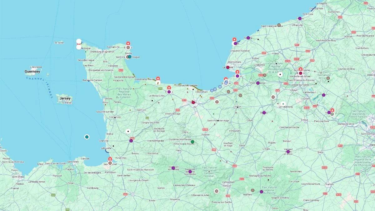
INTERACTIVE MAP
Click on the icon  in the top-right corner to view the map in full screen.
Show/Hide layers as needed.
After clicking on the image,
click on the icon  in the top-left corner to display the map legend.
Show/Hide layers as needed.
ALL
Overview Table
| Name | Type |
|---|---|
| Monet's Gardens | Garden & House Museum |
| Rouen | City |
| Etretat Cliffs | Cliffs |
| Honfleur | Coastal Town |
| Deauville-sur-Mer | Seaside Resort Town |
| Bayeux | Town |
| American Cemetery | D-Day Cemetery |
| Barfleur | Coastal Village |
| Cap de La Hague | Headland |
| Mont Saint-Michel | Bay‚ Village‚ Abbey |
Monet's House & Gardens

Type Garden & House Museum
Price €13
Full Name
Maison et Jardins de Claude Monet
Claude Monet’s House and Gardens immerse you in the painter’s private world. The pink house with its green shutters still feels deeply personal, with colorful rooms, a bright yellow dining room, a kitchen covered in blue tiles, furnished bedrooms, and an impressive collection of Japanese prints.
The biggest highlight, though, is the gardens. Right next to the house, you walk through a large flower garden designed like a living composition of colors. Depending on the season, the flower beds burst with different shades, giving the feeling that every path was arranged to catch the light.
On the other side, a small passage leads to the water garden, which feels quieter and more dreamlike. This is where you discover the famous lily pond, the reflections, the foliage, and the almost Japanese atmosphere that inspired some of Monet’s most celebrated paintings.
The visit is not really about seeing original artworks, but about experiencing the setting that shaped his vision. You get a much better sense of how Monet observed light, colors, and the subtle changes from one hour to the next, and why this garden feels almost like a living painting.
Rouen
Type City
Population 120 000
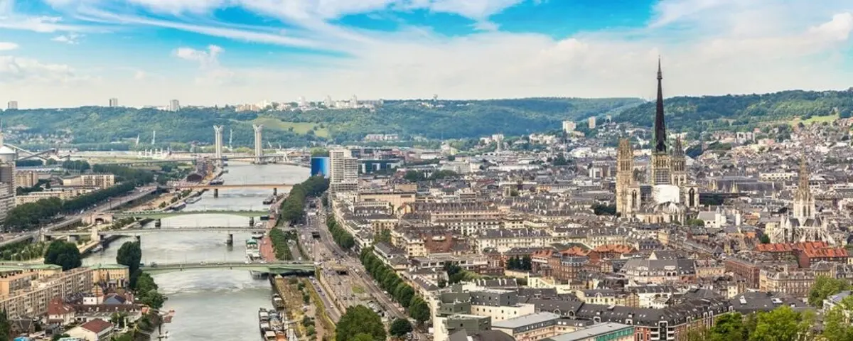
Rouen is a dense city, shaped by stone, timber, the Seine, and a history that’s impossible to miss. In the center, you can go from a lively street to a narrower alley lined with old houses where the wooden framework is still visible. Some facades are elegant, others seem to lean slightly, giving the city an uneven, lively feel that’s almost theatrical.
The huge silhouette of the cathedral dominates the whole area. It’s not just a landmark, it also reflects Rouen’s importance as a major religious, commercial, and artistic center. Around it, several churches, inner courtyards, and richly decorated buildings reveal the wealth accumulated when the port handled salt, fish, wool, and goods brought from far away.
Rouen also carries a darker memory. Joan of Arc was tried and burned there, and the city was hit very hard during WW2. Fires, bombings, and destruction wiped out many old houses, but the center still retains a strong visual continuity.
As you walk around, you see a city that was rebuilt without erasing its past: carved details, blackened stones, tightly packed roofs, pedestrian streets, and views opening up onto the major monuments.
Etretat Cliffs
Type Coastal Path
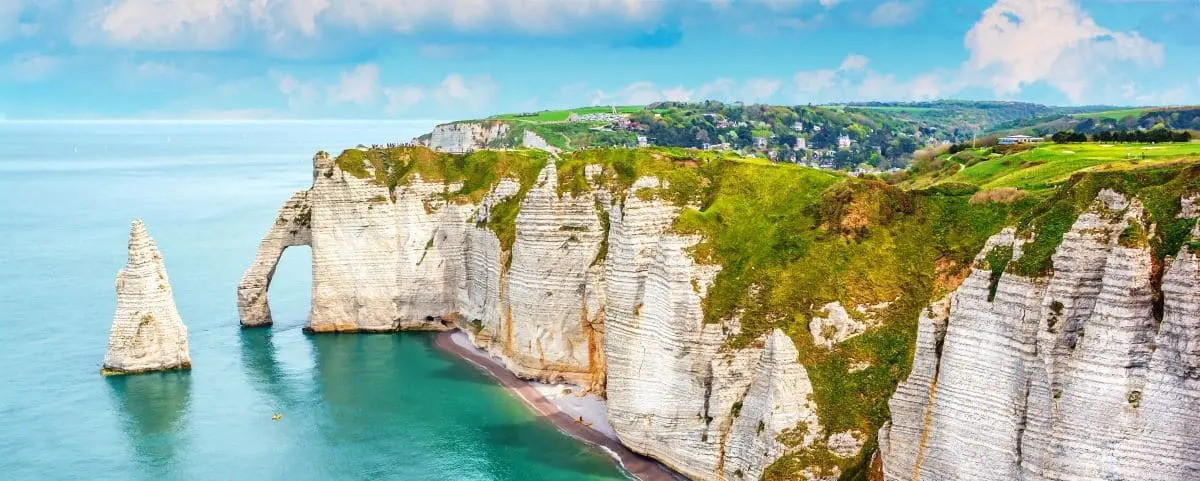
The cliffs of Étretat are among the most famous sights on the Alabaster Coast. You can admire them under constantly changing light, which transforms the colours of the chalk and the sea throughout the day.
To the left of the beach, the Aval Cliff rises to 71 metres. Its summit is connected to the spectacular GR 21 trail, which follows the coastline between Le Havre and Le Tréport. All around, the wide open views over the English Channel make the landscape feel even more dramatic.
The famous Aval Arch, considered one of the area’s greatest natural wonders, forms a remarkably delicate arch. Behind it stands the Needle, a 42 metre rock stack shaped by erosion. Further along, the Manneporte reveals even more imposing proportions and inspired several painters.
Honfleur
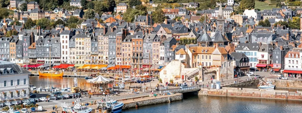
Type Coastal Town
Honfleur is an instantly recognizable harbor town, packed tightly around its inner basins. You see old boats, sturdy fishing vessels, old slate covered houses, and uneven little streets that give the town a very distinctive shape and feel.
The town has long attracted artists. In the 19th century, writers, musicians, and painters came here looking for the shifting light of the Seine estuary, between water, sky, low hills, and nearby countryside.
You also sense a town with two rhythms: more local during the week, busier on weekends and holidays. Despite the crowds, Honfleur keeps a dense, intimate, almost theatrical atmosphere, with its unusual bell tower, quays, tightly packed facades, and constant connection to the sea and the river.
Deauville-sur-Mer
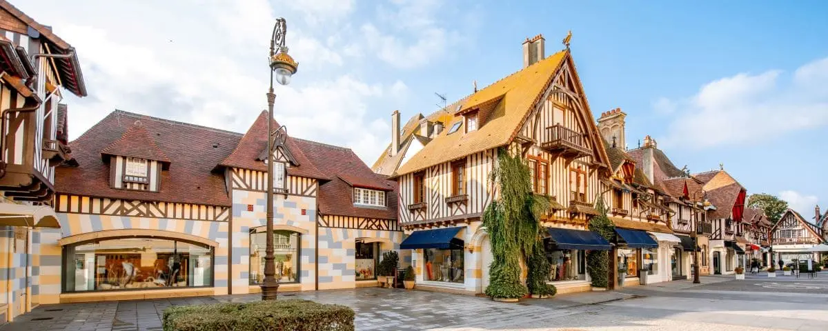
Type Seaside Resort Town
Deauville belongs to the stretch of coast shaped by the 19th century fashion for sea bathing. You’ll find an elegant seaside resort designed for beach stays, with its villas, casino, grand hotels, pale sand, and an atmosphere that feels more chic than wild.
As you walk around, you sense a town built around spectacle: the seafront, sporting events, photography, music, and above all American cinema, celebrated every year in early September. It can get very busy, but Deauville keeps its image as a fashionable resort, open to the beach and major social events.
The town is also closely linked to horses. Racing played a big part in making it famous, with a season that starts in summer and continues into autumn, sometimes even into winter.
Bayeux
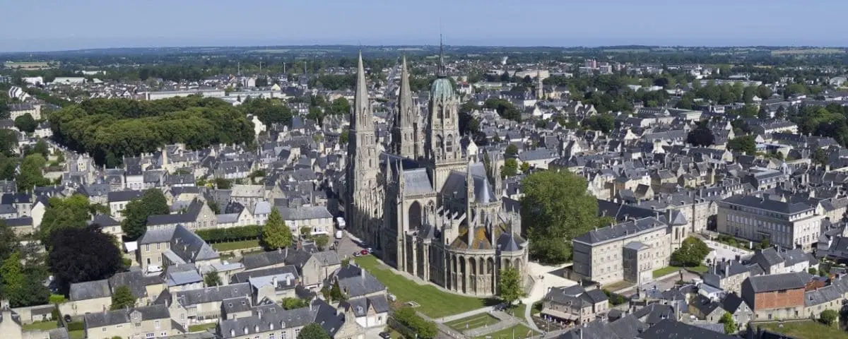
Type Town
Bayeux is an old town that’s very pleasant to explore on foot. Since it was largely spared from WW2 bombing, you still move between exposed timber houses and grand classical mansions, with quiet streets and a center that has kept a lot of character. The little Aure River runs through the town, with a paved walk that feels almost rural in places.
Bayeux also has a great 11th century cathedral, linked to Odo, William’s half brother. As soon as you step inside, you feel the scale of the building: a very long nave, a sculpted facade, ancient arches, fantastic animal motifs, and decorative details shaped by several influences.
The town is best known for its monumental 70 meter embroidery, listed in UNESCO’s Memory of the World Register. It tells the story of William the Conqueror’s conquest of England, with the visual power of an ancient comic strip.
Normandy American Cemetery

Type D-Day Cemetery
Price Free
Full Names
Normandy American Cemetery
Cimetière Américain de Normandie de Colleville-sur-Mer
The Normandy American Cemetery overlooks Omaha Beach, one of the deadliest landing sites of D,Day on June 6, 1944. Around 3,000 American soldiers were killed, wounded, or went missing during the assault. The site remains closely connected to that day and to the battle that followed across Normandy.
Your visit begins at the visitor center. Photographs, personal belongings, and individual stories help you understand the experiences of the soldiers before they reached the coast.
You then make your way to the memorial, with its large central statue and engraved spaces. Military maps explain how the Allied operations unfolded and place Omaha Beach within the wider context of the Normandy landings.
Farther on, the rows of white crosses and Stars of David create the cemetery’s most iconic image. More than 9,000 American soldiers are buried here. The simple, perfectly aligned headstones give a powerful sense of the scale of the losses suffered during the campaign.
At the far end of the site, the cliffs overlook Omaha Beach. Below, you can see the sand and the sea. The view creates a direct connection between the graves and the place where the landings took place.
Barfleur
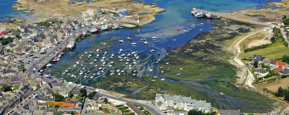
Type Village
Barfleur is a small harbor full of character, gathered tightly around its basin and facing the sea. It has a simple, deeply maritime atmosphere: boats, quays, granite houses, changing skies, and the cold northern light of the Channel.
The village is best explored slowly, on foot, through low streets where gray stone dominates. The whole place works through details: plain facades, openings onto the harbor, boat silhouettes, and reflections in the water.
Barfleur has a real visual coherence. Between the granite, the wind, the church, the quays, and the sea horizon, you feel an old, solid place shaped by the sea.
Cap de La Hague
Type Coastal Path
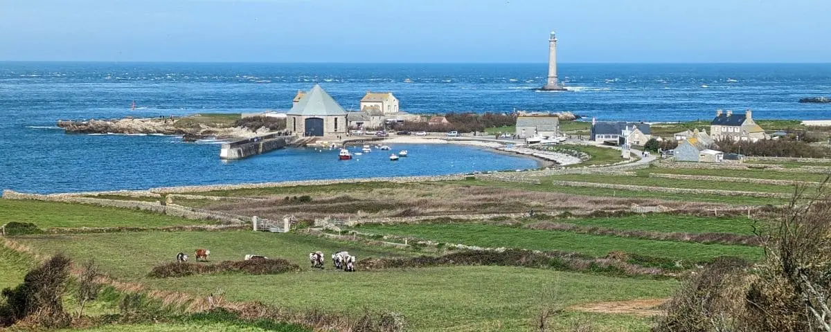
Cap de la Hague reveals wild and rugged landscapes, among the most spectacular in Normandy. Between small harbours, heathland and rocky shores, you discover an unspoilt coastline where the sea is everywhere.
Near Goury, the powerful currents of the Raz Blanchard create an impressive spectacle, especially during spring tides. The lighthouse overlooking this tip of the Cotentin Peninsula adds to the area’s rugged character.
Écalgrain Bay is known for its romantic atmosphere and its views over the English Channel. The coastal path winds through heather, meadows and gorse before reaching the Nez de Jobourg, whose cliffs rise to around 130 metres.
Mont Saint-Michel
In Our Top Picks ✅
Type Bay, Village, Abbey
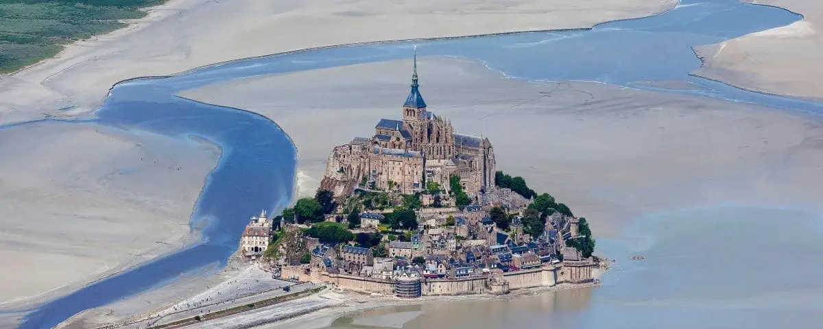
Mont Saint-Michel first appears like an almost unreal silhouette, set between sky, sea, and sand. From the fields and coasts around the bay, you see it change with the time of day, the light, and the color of the sky.
The village of Mont Saint Michel climbs straight up the rock. You move through narrow passages, stairways, sloping lanes, and houses packed tightly together. The place feels almost vertical: each level gives you a different view, sometimes toward the walls, sometimes toward the bay, sometimes toward the abbey rising above everything.
This concentration gives the village a very distinctive atmosphere, but it also gets very crowded. At peak times, you can quickly find yourself caught in a steady flow of visitors.
The abbey sits at the top of the Mont, like a structure built against the rock and above the void. You don’t discover one single building, but a whole set of stacked rooms, connected by stairways, passages, and changes in level.
The visit gives a sense of power and ingenuity. Some spaces were used for prayer, others for welcoming visitors, work, or the monks’ daily life. In places, the granite of the rock still appears, reminding you that everything was built on a difficult site, between sea, wind, and slope.
The bay can also be part of the experience. Even in the Middle Ages, pilgrims crossed these wide open stretches to reach the Mont. Today, approaching it on foot can still feel magical: you walk through the sand, sometimes through water up to your knees, with the Mont slowly growing larger in front of you. This crossing should always be done with a guide, because the terrain and tides can be dangerous.
Village
Abbey
Price €13 Low Season / €16 High Season
⚙️ Hours & Prices (Official Website)
Bay