


MAP
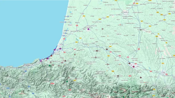
Basque Country
Interactive Map
Basque Country
Interactive Map
Click on the icon  in the top-left corner to display the map legend.
Show/Hide layers as needed.
Click on the arrow icons (v) to display the sublayers.
WEST
| Name | Top+ | Top |
|---|---|---|
| Ascain | ||
| Sare | ☑️ | |
| Ainhoa | ☑️ | |
| Espelette | ☑️ | |
| Bastide-Clairence | ☑️ | |
| Saint-Étienne-de-Baïgorry | ||
| Saint-Jean-Pied-de-Port | ✅ |
Ascain
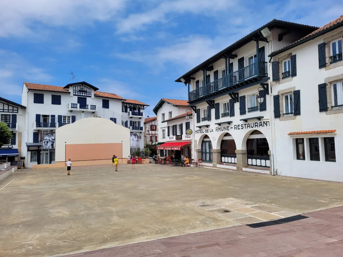
In Ascain, grand traditional Basque houses stand against the backdrop of La Rhune, the mountain that dominates the surrounding landscape. Around the village square, the church, the pelota court and the houses with colourful shutters give the place its traditional look. But you only have to follow the nearby paths to find meadows, small farms and wooded hills.
Ascain is also one of the starting points for hiking up La Rhune, a climb that takes a fair bit of effort. Down by the water, the Nivelle River and its old bridge add another lovely touch to a walk around the village.
Sare
In Our Top ☑️
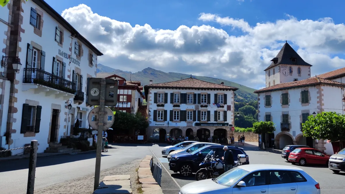
The traditional Basque houses in Sare are a beautiful sight, with their broad white façades, colourful shutters and roofs extending well beyond the walls. The village sits in a green valley, almost at the foot of La Rhune and close to the Spanish border. Just a few kilometres from the centre, the Caves of Sare reveal impressive underground galleries that were already inhabited by humans in prehistoric times. Between forests, meadows and rocky landscapes, the scenery changes surprisingly quickly.
Ainhoa
In Our Top ☑️
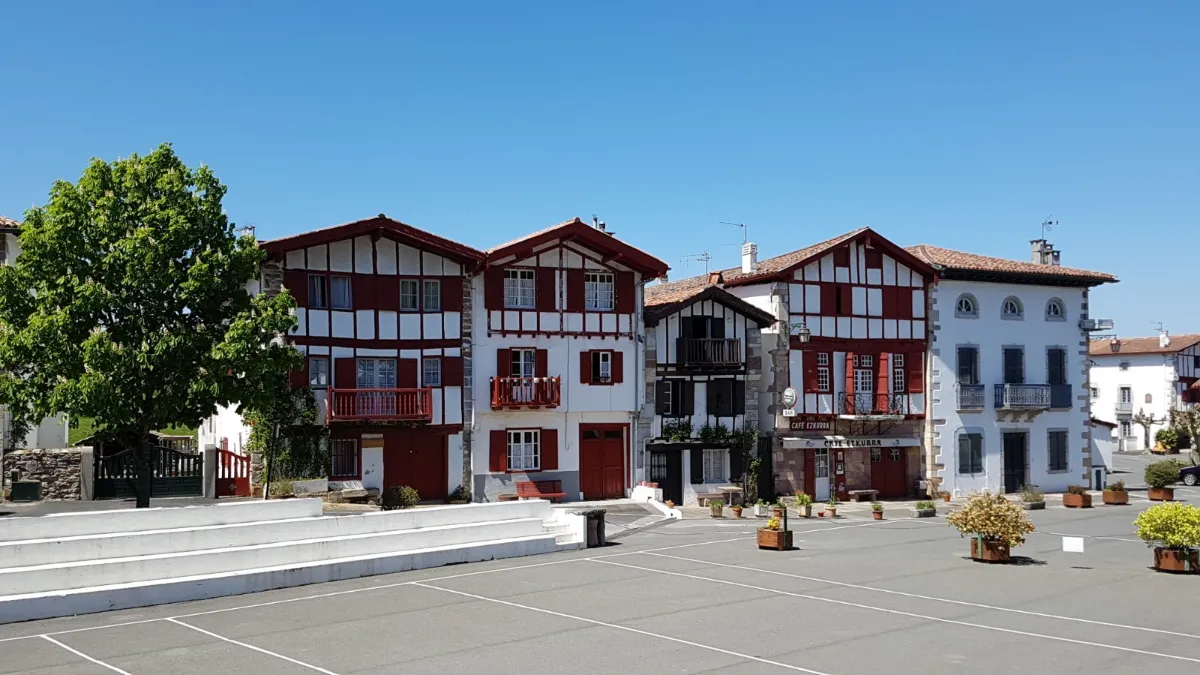
Just one main street, more or less, and what a sight! Ainhoa is lined with beautiful white houses, their red or green timber framing and shutters creating a remarkably harmonious row of façades. Behind these lovely buildings, the gardens and hills remind you that this is a real farming village, not a film set.
Founded in the 13th century along a route into Spain, Ainhoa also welcomed pilgrims heading to Santiago de Compostela. Its church, surrounded by old graves with carved stones, tells part of that long story. Take a closer look at the inscriptions on the houses. Some still display the dates and names of the people who built them.
Espelette
In Our Top ☑️
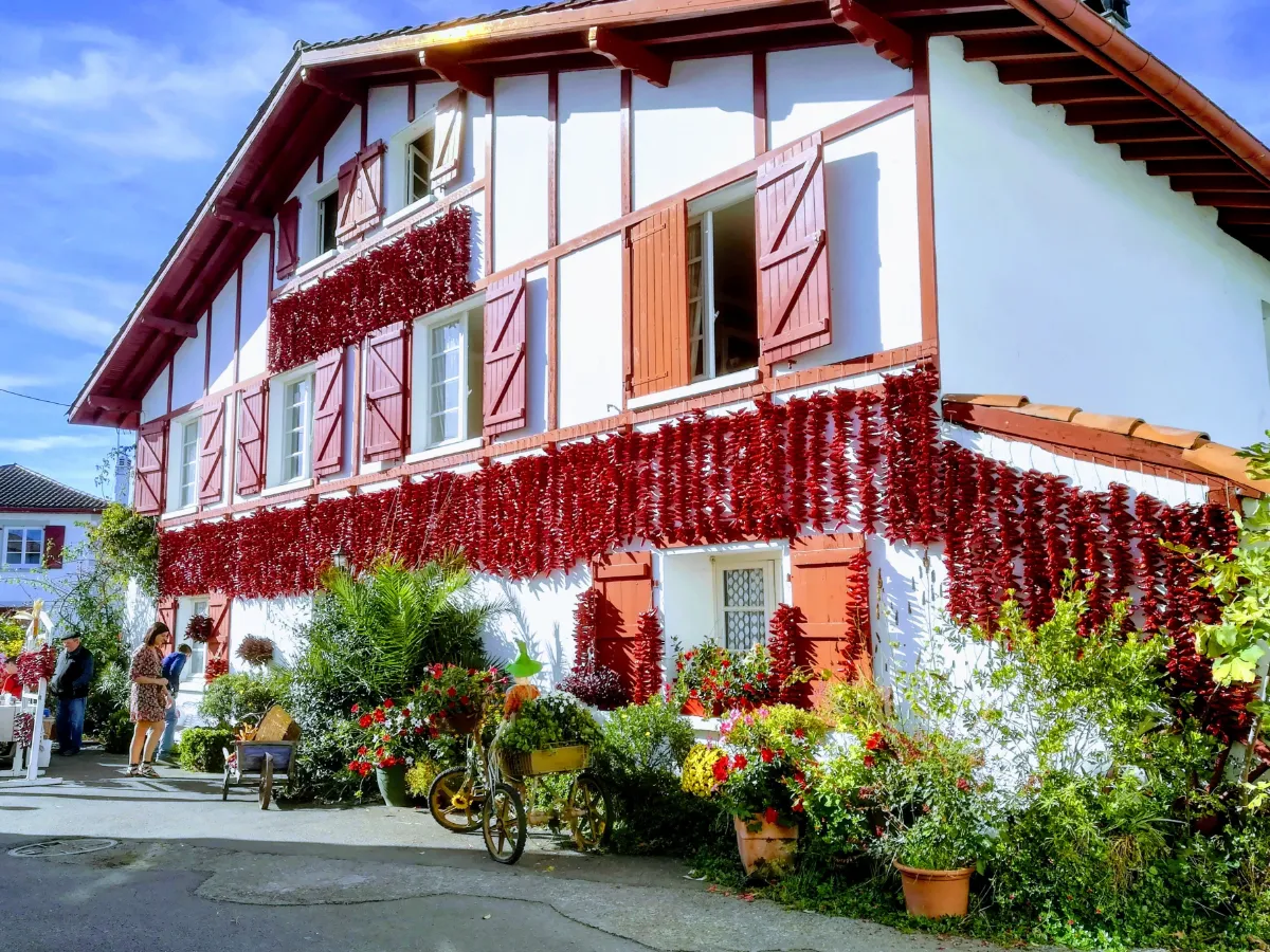
In Espelette, even the walls have a bit of a kick! From late summer onwards, strings of red peppers hang out to dry on the white façades, adding another splash of colour to the traditional Basque houses. Grown in the surrounding countryside, these fragrant peppers have become a real source of local pride, celebrated with a big festival at the end of October.
But there’s more to the village than its famous peppers. Streets lined with traditional houses lead towards an old castle, while green hills peek out between the rooftops. On festival days, songs and dancing are a reminder that Basque culture is much more than something for tourists to photograph.
Bastide-Clairence
In Our Top ☑️
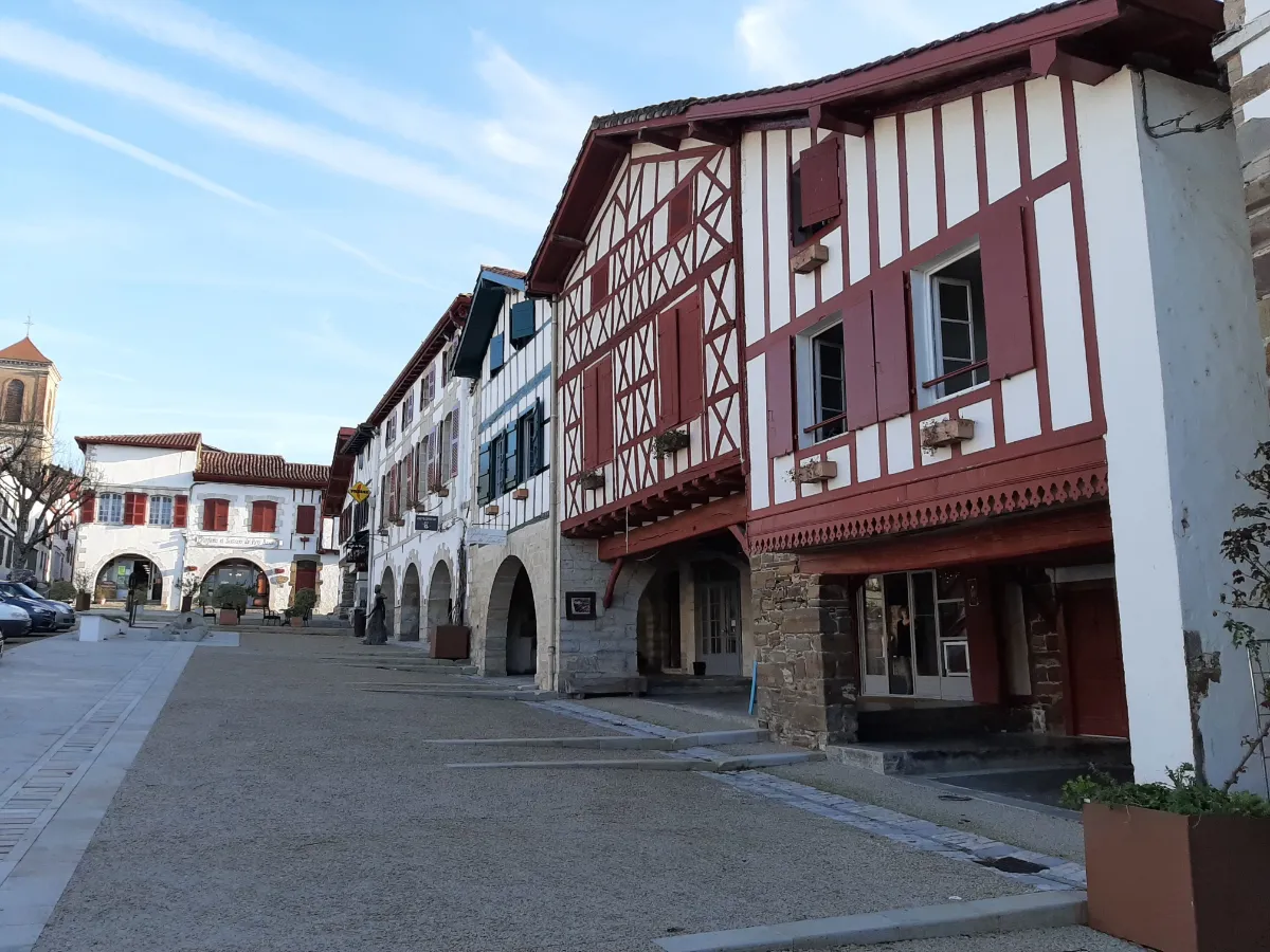
La Bastide-Clairence looks a little different from other Basque villages. Founded in the 14th century, it’s laid out around an arcaded square, with streets branching off in a fairly regular pattern. Its large timber-framed houses, covered passageways and gardens give it an understated charm that’s especially noticeable when the streets are quiet.
Over the centuries, the village was home to a Jewish community, whose old cemetery can still be seen today. The church, with its wooden galleries, tells another part of the story. Despite these different layers of history, the old buildings retain a lovely sense of harmony, while the village still feels like a place where people actually live.
Saint-Étienne-de-Baïgorry
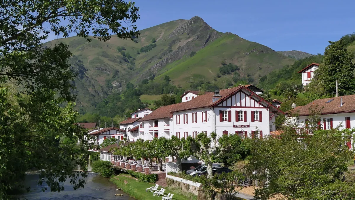
Saint-Étienne-de-Baïgorry stretches along the bottom of a valley surrounded by steep mountains. The old stone bridge, red-shuttered houses and river create a picture-perfect Basque scene, but it’s when you look up that you really get a feel for the place. The hillsides are a patchwork of meadows, woodland and vineyards.
This is where Irouléguy wines are produced, on slopes so steep that you can’t help wondering how anyone manages to work on them. Higher up, the Iparla ridges attract experienced hikers. Down in the village, life remains closely tied to mountain traditions, livestock farming and the Basque language.
Saint-Jean-Pied-de-Port
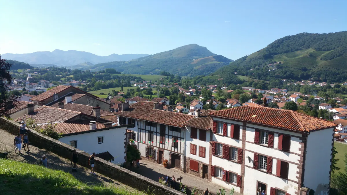
In Our Top+ ✅
Quiet mornings are something of a rarity in Saint-Jean-Pied-de-Port. Pilgrims prepare to cross the Pyrenees while visitors make their way up cobbled streets lined with flower-covered houses. The Nive River flows below the town, crossed by an old stone bridge, and the fortified gateways of this former border stronghold are never far away.
Above the rooftops, a citadel recalls the town’s military past. From its ramparts, you can take in the tightly packed streets below and the mountains stretching towards Spain.
EAST
| Name | Top+ | Top |
|---|---|---|
| Montfort-en-Chalosse | ||
| Aire-sur-l'Adour | ||
| Sauveterre-de-Béarn | ||
| Navarrenx | ||
| Lescun |
Montfort-en-Chalosse
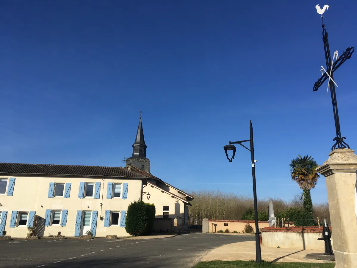
No endless beaches or pine forests stretching as far as the eye can see here. Montfort-en-Chalosse sits on a hill surrounded by rolling countryside, fields and small patches of woodland. The streets in the centre, laid out in the Middle Ages, surround a large covered market square where you can still sense the town’s agricultural past.
To get an idea of what life in this region used to be like, the Musée de la Chalosse recreates a 19th-century rural estate, complete with its buildings, everyday objects and traditional farming activities. A walk around the village also rewards you with sweeping views over the cultivated hillsides, a side of the Landes that’s a long way from the usual Atlantic coast postcards.
Aire-sur-l'Adour
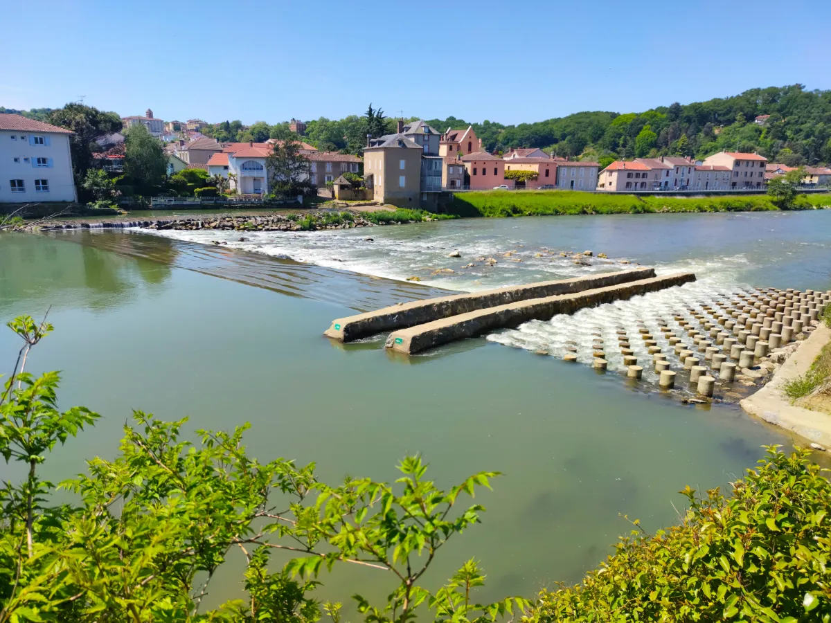
On the banks of the Adour, Aire-sur-l’Adour still bears traces of a history stretching back to ancient times. The old streets climb from the river towards the historic neighbourhoods, where stone houses and religious buildings recall the town’s importance on the pilgrimage routes to Spain. Saint-Jean-Baptiste Cathedral is a reminder of the many centuries of travellers passing through.
On a hill above the town, the Church of Sainte-Quitterie contains an ancient crypt and overlooks the rooftops. Pilgrims used to stop here before continuing their long journey. Down below, the riverbanks are perfect for an easy, flat walk, far from the steep streets of the old centre.
Sauveterre-de-Béarn
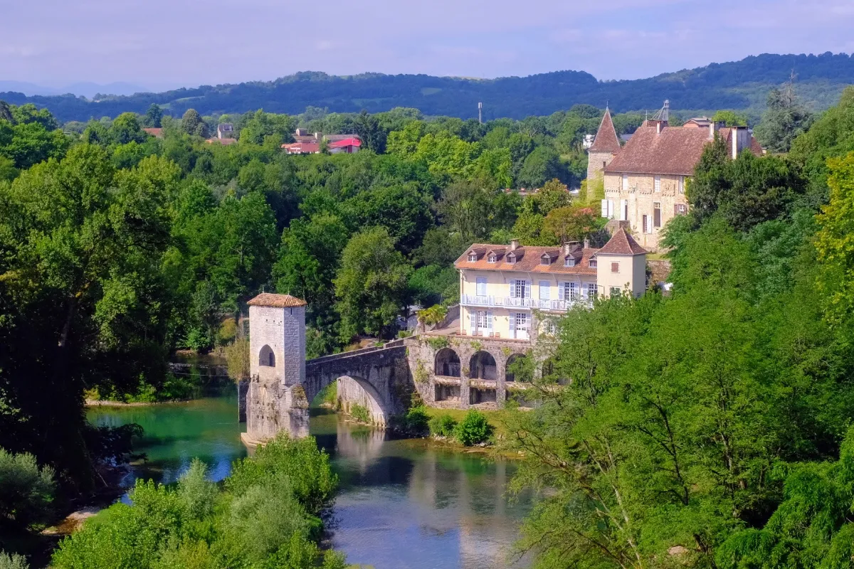
Sauveterre-de-Béarn looks down over its river from a rocky headland. In the Middle Ages, the town guarded a strategic crossing, and it’s easy to see why when you discover its fortified church, tall tower and the remains of its defences. Below, the Pont de la Légende stretches out towards the water without reaching the opposite bank, as though someone had stopped building it halfway across.
From the terraces of the old village, the view drops down to the pebbles, trees and flowing water below, creating a striking mix of ancient stonework and greenery.
Navarrenx
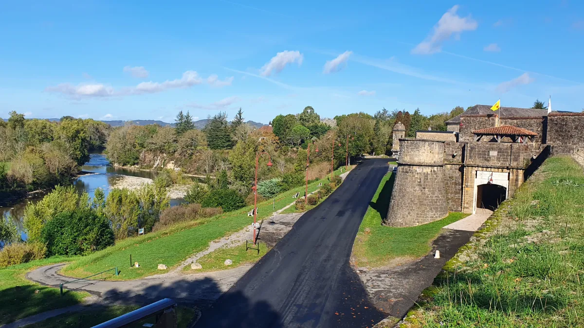
Navarrenx is no ordinary fortified village. In the 16th century, its defences were designed to withstand artillery fire. Wide, low ramparts reinforced with earth still surround its neatly laid-out streets. You can walk all the way around them and, from the top, appreciate both the thickness of the walls and the remarkably regular layout of the town.
Navarrenx is also an important stop on the pilgrimage route to Santiago de Compostela, bringing a little extra life to its otherwise peaceful streets. At the foot of the fortifications flows a fast-moving river that’s particularly popular with anglers and whitewater sports enthusiasts.
Lescun
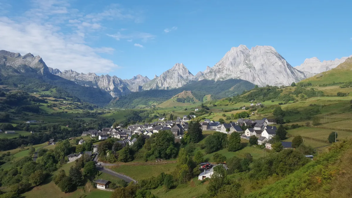
Lescun looks tiny compared with the mountains surrounding it. Perched above the Aspe Valley, the village nestles in the middle of an enormous natural amphitheatre of cliffs and jagged peaks. Pic d’Anie and the sharp spires of Ansabère cut into the skyline, and as the light changes, the rock faces shift from grey to ochre in just a few minutes.
Numerous trails lead through meadows and forests, sometimes reaching high valleys where herds graze. Vultures circle above the cliffs, riding the air currents. Some walks are easy, but routes leading up to the summits require solid mountain experience.