


MAP
Languedoc
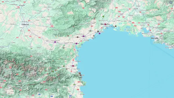
Interactive Map
Languedoc
Interactive Map
Click on the icon  in the top-left corner to display the map legend.
Show/Hide layers as needed.
Click on the arrow icons (v) to display the sublayers.
NORTH
| Name | Top+ | Top |
|---|---|---|
| Saint-Guilhem-le-Désert | ✅ | |
| Pézenas | ✅ | |
| Marseillan | ||
| Olargues | ||
| Minerve | ☑️ | |
| Lagrasse | ✅ |
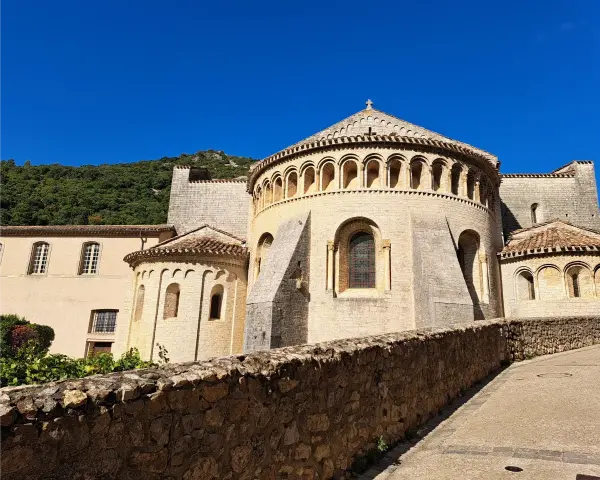
Saint-Guilhem-le-Désert
In Our Top+ ✅
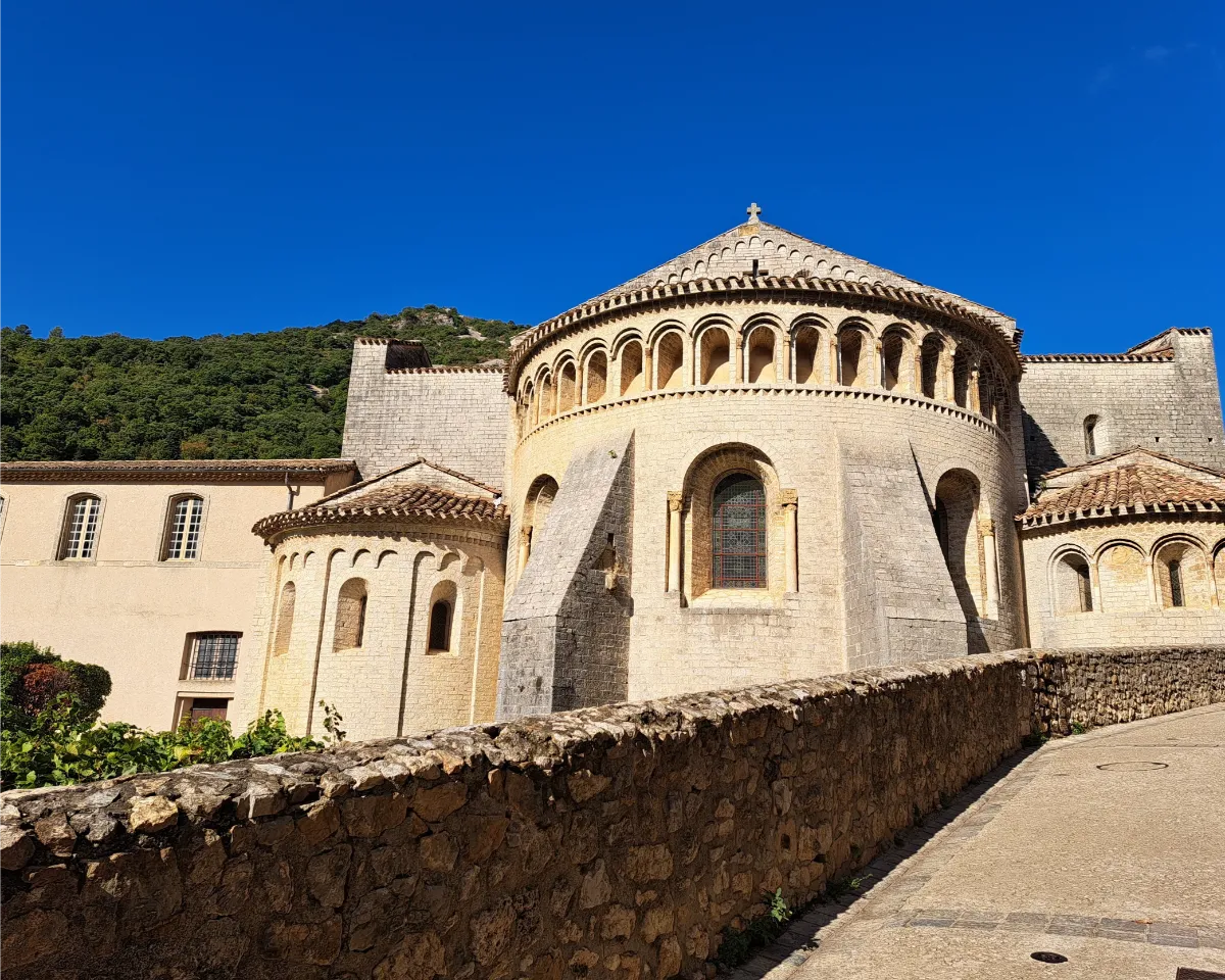
Tucked into a narrow valley beneath towering cliffs, Saint-Guilhem-le-Désert has a medieval charm that’s hard to resist. The village grew around Gellone Abbey, founded in 804 by Guilhem, a former companion of Charlemagne who became a monk.
Its cobbled streets, vaulted passageways and old stone houses cluster around the church, which for centuries welcomed pilgrims heading to Santiago de Compostela in Spain. Today, the village attracts plenty of visitors.
Pézenas
In Our Top+ ✅
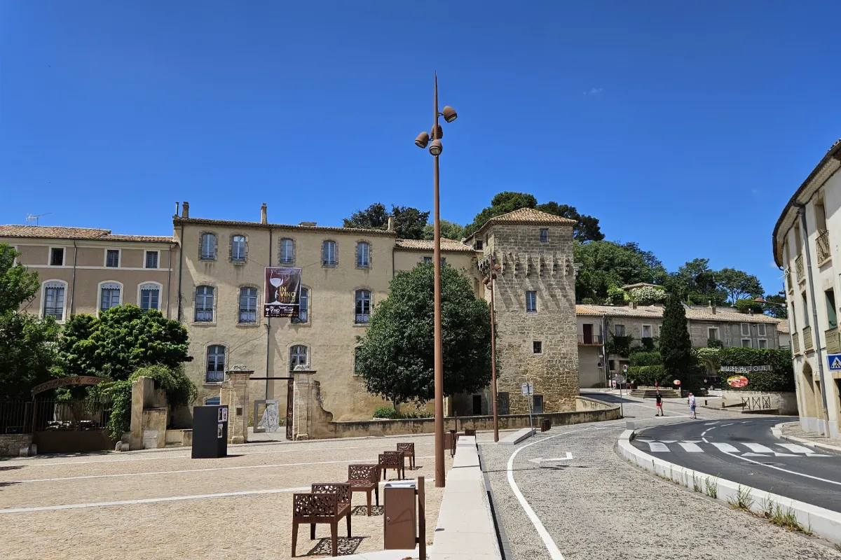
Pézenas has everything to delight anyone who loves historic architecture. Its old center is a maze of cobbled streets lined with grand 17th and 18th-century townhouses, where carved doorways sometimes hide magnificent inner courtyards. Back then, the town was home to powerful political figures and wealthy families.
Pézenas is best known for its connection to Molière, who stayed here several times during the 1650s with his theater troupe. His legacy is still celebrated today through performances and local festivals.
Marseillan
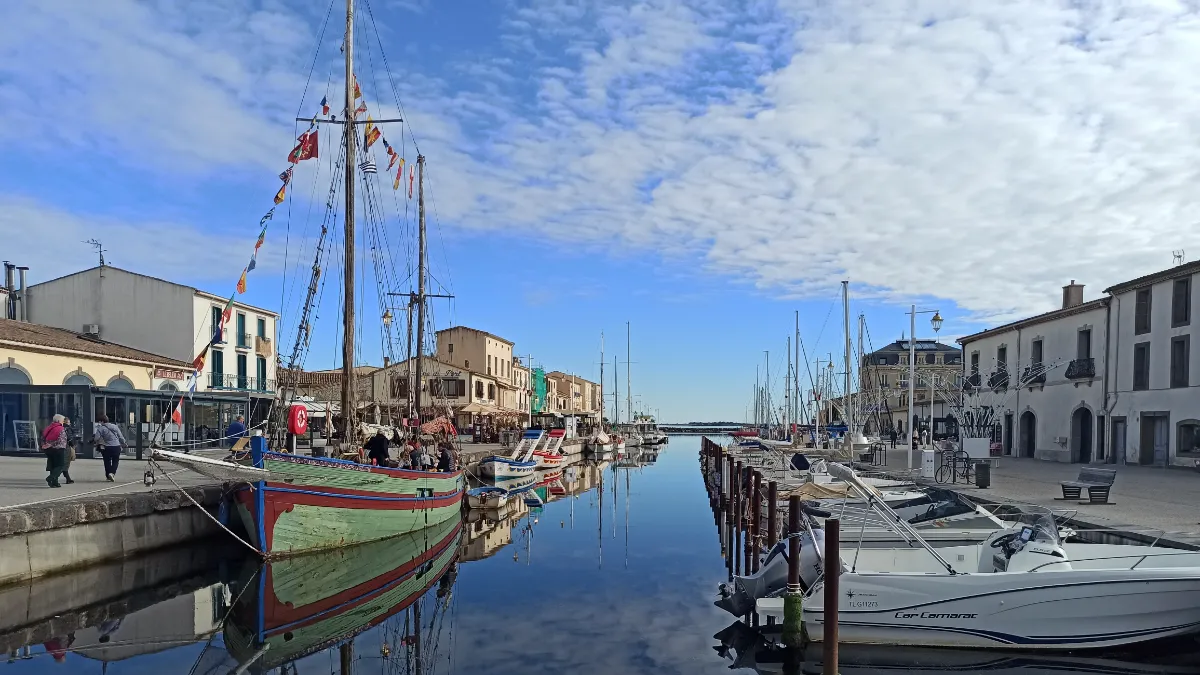
Sitting at the far end of the Thau Lagoon, Marseillan has a charming little harbor lined with dark stone quays and old houses. Fishing and shellfish farming still play an important role in local life, alongside winegrowing, which supported the surrounding area for generations.
This is also where the Canal du Midi finally reaches the lagoon, at Pointe des Onglous, after its long journey from Toulouse. Farther toward the sea, Marseillan-Plage stretches along kilometers of fine sandy beaches, offering a completely different landscape from the historic village.
Olargues
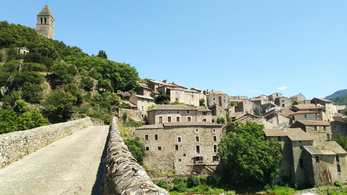
Almost completely surrounded by the Jaur River, Olargues clings to a rocky hill in the middle of forested mountains. Its stone houses, cobbled streets and narrow passageways climb toward the remains of an old castle, whose tower was turned into a bell tower. The village has kept much of its medieval character.
Down below, the Pont du Diable, or Devil’s Bridge, crosses the river in a graceful stone arch dating back to the Middle Ages. The surrounding slopes, covered in chestnut trees and Mediterranean vegetation, are full of lovely walking trails winding through hills and along streams.
Minerve
In Our Top ☑️
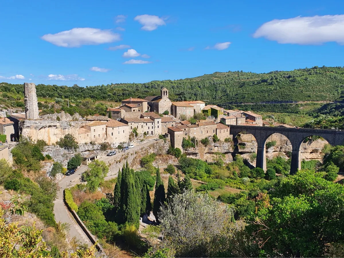
Minerve has a spectacular setting. The village sits on a limestone promontory between two deep gorges, surrounded by a wild landscape of hills and vineyards. In 1210, this fortified stronghold was besieged during the crusade against the Cathars, a Christian religious movement persecuted by the Catholic Church.
Stone houses and narrow passageways cluster around the ruins of the old castle, high above the cliffs. Down in the gorges, the Cesse River has carved remarkable natural tunnels through the rock, which you can admire from the walking paths. When the riverbed is dry, some of these passages can be explored on foot, depending on local conditions.
Lagrasse
In Our Top+ ✅
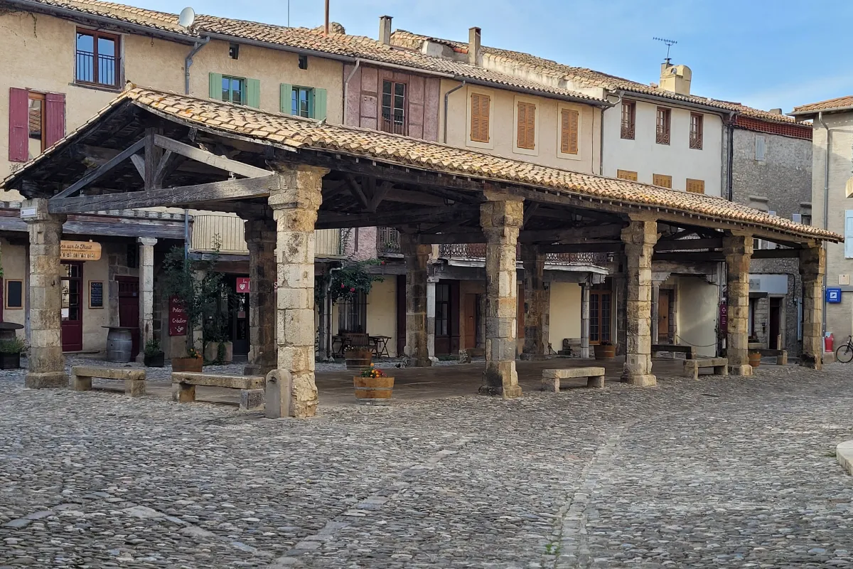
With its old stone bridge, medieval houses and narrow streets lined with historic façades, Lagrasse has an understated elegance. The village grew along the Orbieu River, opposite a powerful abbey founded in the 8th century, whose buildings tell a story spanning more than a thousand years.
At the heart of Lagrasse, a large medieval market hall recalls the importance of trade in this valley. Across the river, the abbey reveals its courtyards, galleries and former religious rooms. All around, the Corbières hills are a mix of vineyards, rocky outcrops and Mediterranean vegetation.
SOUTH
| Name | Top+ | Top |
|---|---|---|
| Collioure | ✅ | |
| Castelnou | ||
| Prats-de-Mollo-la-Preste | ||
| Eus | ☑️ | |
| Villefranche-de-Conflent | ✅ | |
| Évol | ||
| Mont-Louis | ||
| Les Angles |
Collioure
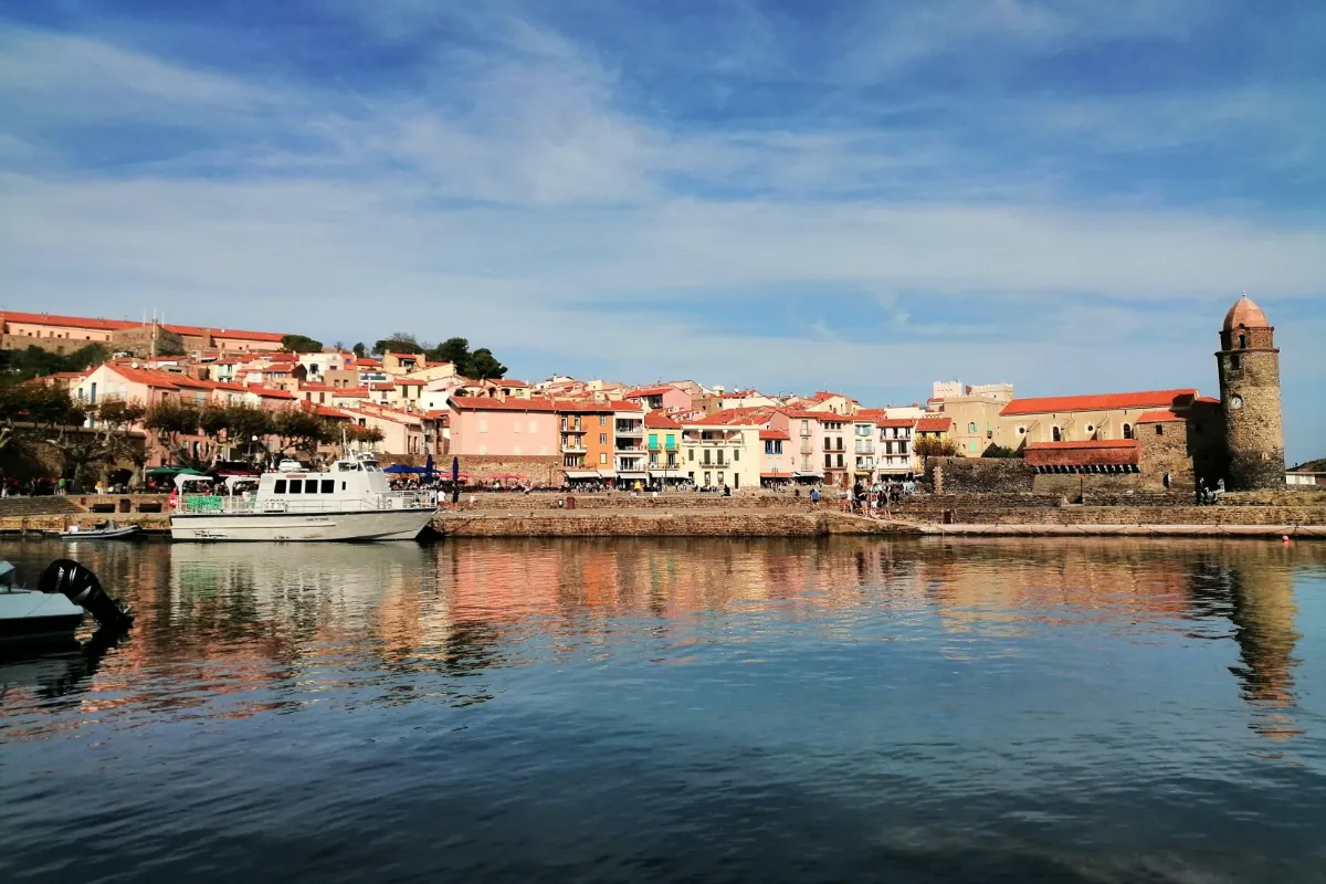
In Our Top+ ✅
With colorful houses clustered around two small bays, Collioure has the kind of Mediterranean charm that has inspired generations of artists. The Royal Castle, standing right on the waterfront, recalls the strategic importance of this Catalan port, long fought over by different kingdoms. Nearby, the Church of Notre-Dame-des-Anges seems to reach straight out into the sea.
In 1905, Matisse and Derain were captivated by Collioure’s light and helped develop Fauvism here, an artistic movement known for its bold, vibrant colors. Their paintings immortalized the narrow streets of the Mouré neighborhood, the fishing boats and the colorful façades running down to the waterfront.
Castelnou
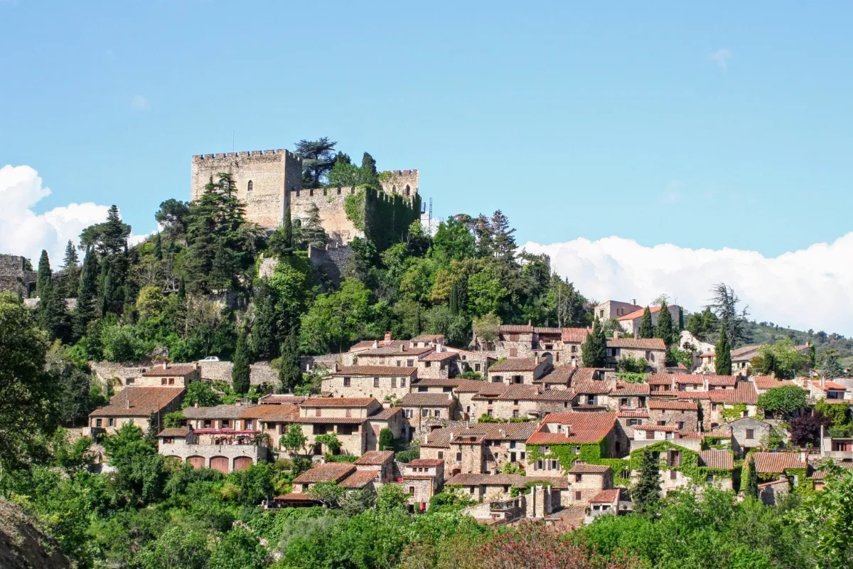
At the foot of the first foothills of the Pyrenees, Castelnou feels like a medieval village frozen in time. Its golden stone houses, topped with red tiled roofs, huddle behind old defensive walls beneath a castle whose origins go back to the 10th century.
For centuries, Castelnou was the center of a small territory ruled by a noble family, and plenty of reminders of its past remain, from cobbled streets and vaulted passageways to fortified gateways and houses with historic windows. From the higher parts of the village, you can look out over hills covered in Mediterranean vegetation, with the Canigó massif rising in the distance above the Catalan landscape.
Prats-de-Mollo-la-Preste
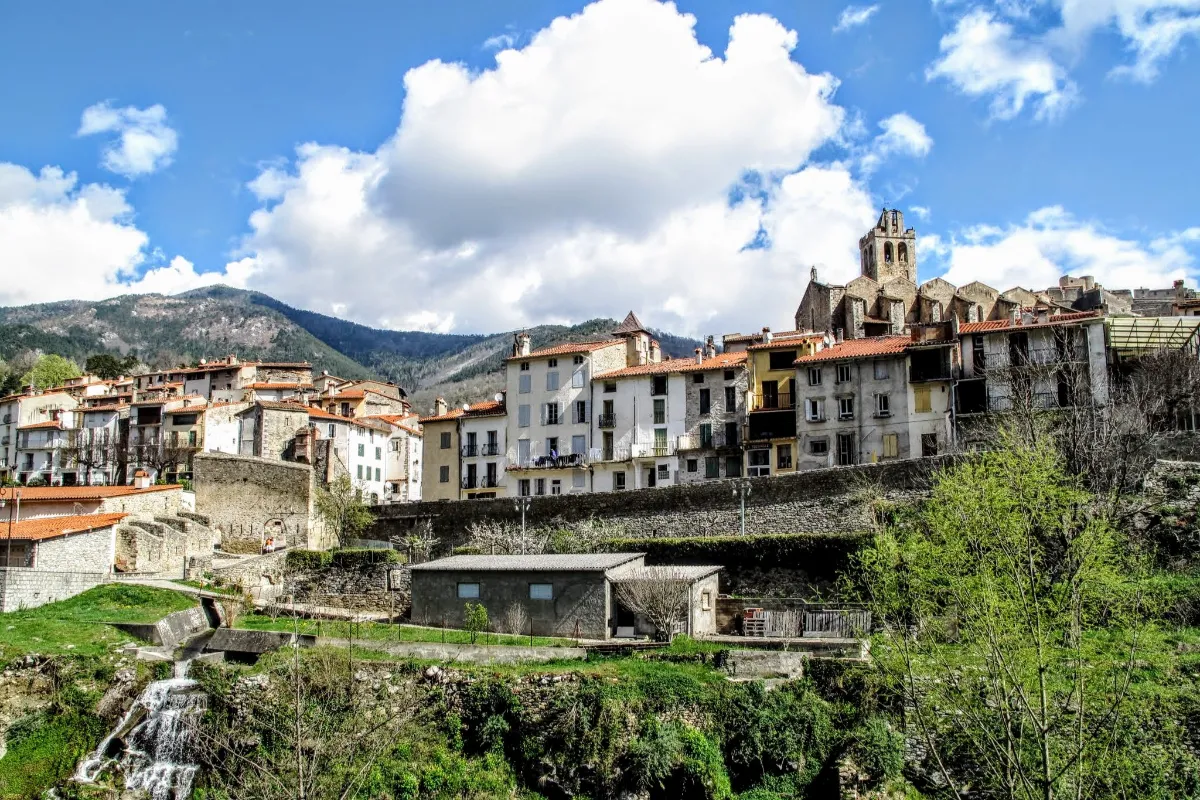
Hidden in a green valley in the Pyrenees, Prats-de-Mollo-la-Preste has preserved the appearance of a fortified mountain village. Narrow streets and stone houses are tucked behind defensive walls, while Fort Lagarde watches over the town from the heights above. Built and reinforced in the 17th and 18th centuries, the fort was designed to protect the border with Spain.
Catalan traditions remain very much alive here, especially during the Bear Festival, held in February. Locals dressed as bears roam the streets in an age-old ritual filled with chases, music and lively celebrations.
Eus
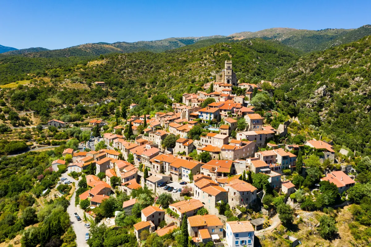
In Our Top ☑️
Perched on an especially sunny hillside above the Têt Valley, Eus is a picturesque jumble of red rooftops and pale stone houses. Cobbled lanes wind uphill toward Saint-Vincent Church, which dominates the village from the site of a former fortified castle.
Its elevated position once made it possible to keep watch over routes through the valley, a territory often contested by French and Catalan powers. Today, people come mainly for the charm of its stone staircases, narrow passageways and sun-drenched historic façades. Across the valley, the Canigó massif rises majestically against the horizon.
Villefranche-de-Conflent
In Our Top+ ✅
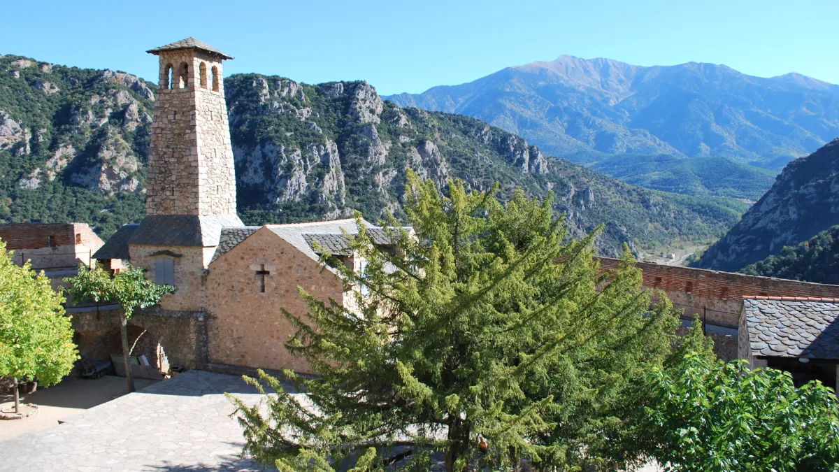
Surrounded by towering mountains, Villefranche-de-Conflent guards the entrance to several Pyrenean valleys. Founded in the 11th century, this small fortified town was extensively strengthened in the 17th century by Vauban, Louis XIV’s military engineer, after the French border shifted farther south.
Behind its walls, two main streets are lined with old houses and colorful façades. High above the town stands Fort Libéria, built to watch over this strategic passage. An impressive underground staircase with several hundred steps connects the fort to the town below. Vauban’s fortifications here are part of a UNESCO World Heritage Site.
Évol
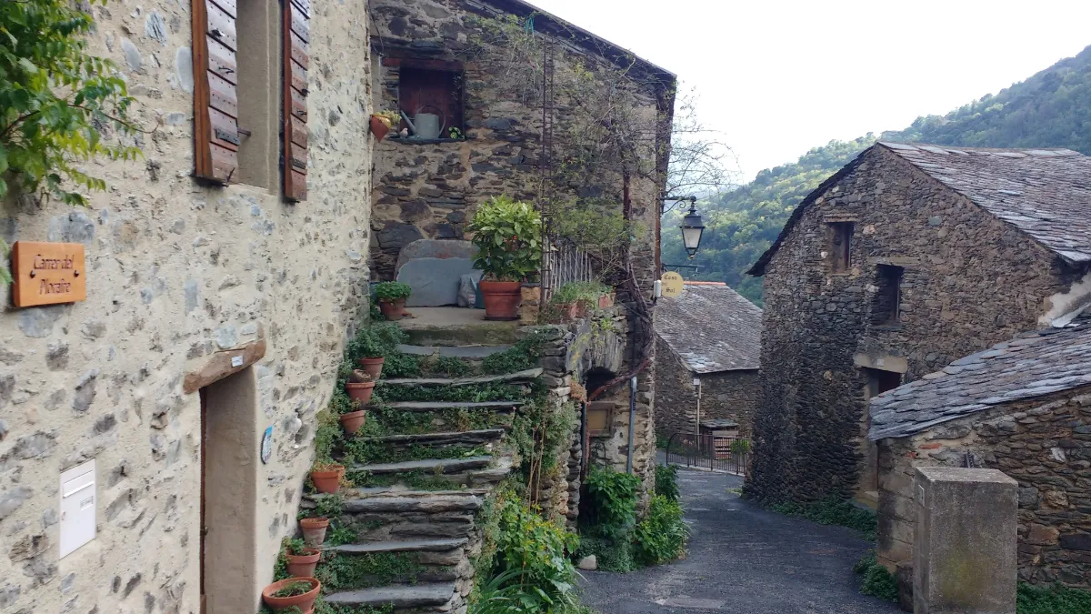
In Évol, the mountains are part of everything, even the houses themselves. The walls are built from dark stone and the roofs are covered with heavy slabs of rock, materials traditionally gathered from the surrounding area. Tucked into a Pyrenean valley, this tiny village has preserved a remarkably consistent architectural style.
Above the narrow streets, you can see the ruins of an old castle, while Saint-André Church recalls the village’s medieval origins. As you wander around, you’ll notice outdoor staircases, old bread ovens and small courtyards that offer a glimpse into rural life in the past. Forests and rocky slopes begin almost immediately beyond the last houses.
Mont-Louis
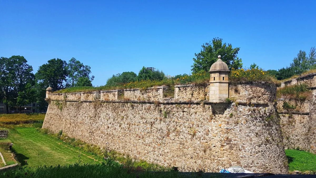
At nearly 1,600 meters above sea level, Mont-Louis has one of the most remarkable settings in the Catalan Pyrenees. This fortified town was built from 1679 onward on the orders of Louis XIV to watch over the border with Spain. Vauban designed its powerful geometric walls and military citadel, which is still in use today.
Beyond the fortified gateways, the straight streets and stone buildings reflect the town’s military origins. Mont-Louis and its fortifications are listed as a UNESCO World Heritage Site.
Les Angles
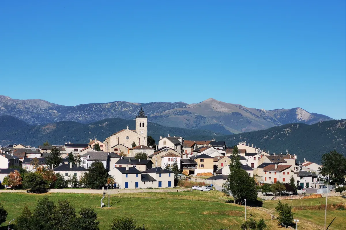
Les Angles is an old mountain village that has grown into a major ski resort without completely losing its traditional character. Historic houses cluster around the old center, while ski slopes descend from the surrounding mountains almost to the first homes, passing through vast pine forests.
The resort began developing in the 1960s, transforming local life. In summer, hiking trails take over from the snowy slopes, offering a chance to explore the landscapes of the Capcir region, especially around Lake Matemale. There’s also a wildlife park where you can see several species native to the Pyrenees, including wolves, bears and large herbivores.