INTERACTIVE MAP
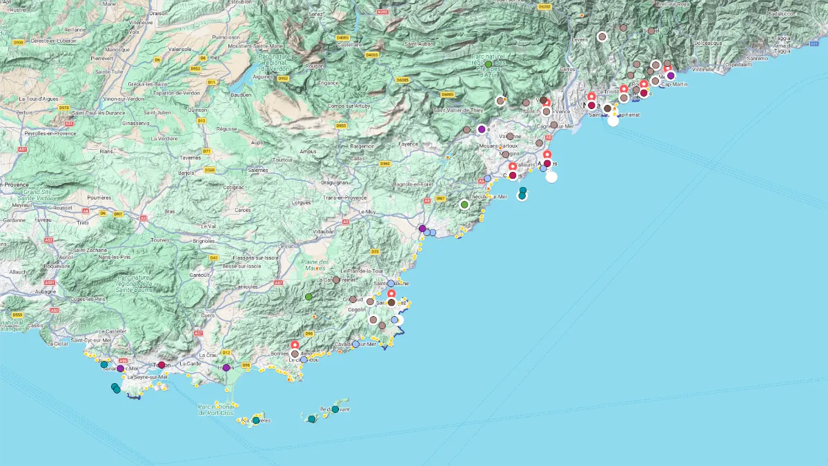
Click on the icon ![]() in the top-right corner to view the map in full screen.
in the top-right corner to view the map in full screen.
Show/Hide layers as needed.
After clicking on the image,
click on the icon ![]() in the top-left corner to display the map legend.
in the top-left corner to display the map legend.
Show/Hide layers as needed.
MOUNTAINS RANGES
Overview Table
| Name | Top Picks | Exp. Picks | Peak in m (ft) |
|---|---|---|---|
| Mercantour | ☑️ | 3143 (10314) | |
| Préalpes d'Azur | 1778 (5833) | ||
| Estérel | ☑️ | 614 (2014) | |
| Maures | 776 (2546) |
Mercantour

In Our Expanded Picks ☑️
Full Name
Parc National du Mercantour
Highest Peak 3143m (10,314ft) 📍Cime du Gélas
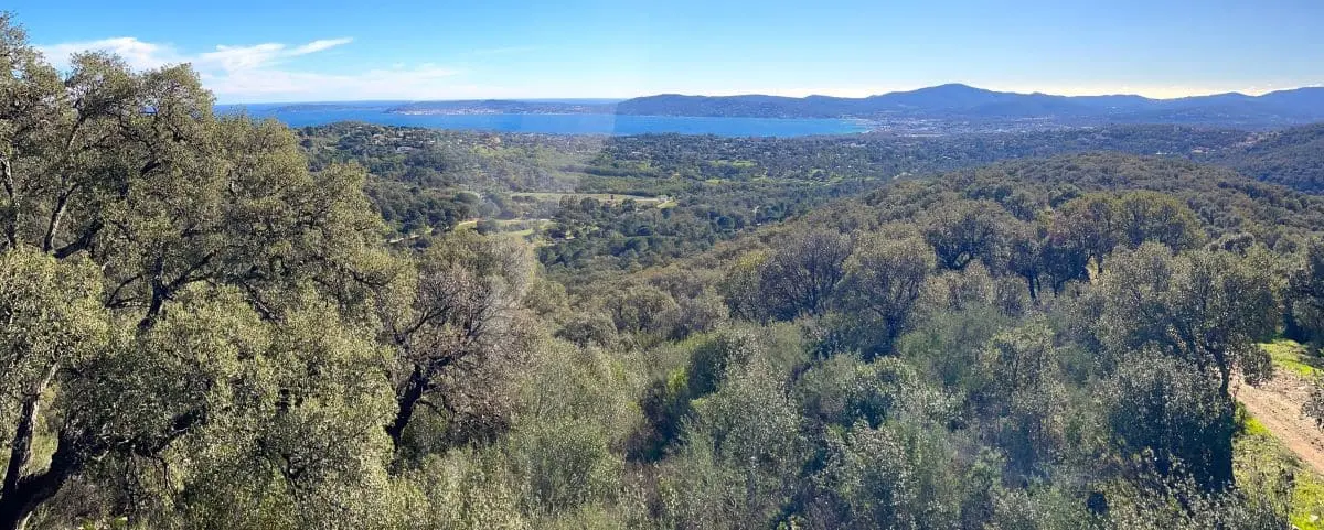
The Mercantour is a one-of-a-kind place tucked away in the far southeast corner of the French Alps, where the mountains practically dip into the Mediterranean. It’s one of the wildest and best-preserved national parks in France, a natural treasure full of snowy peaks, deep valleys, crystal-clear streams and little villages clinging to the hillsides.
The park’s made up of seven main valleys, like the Tinée, Vésubie, Var, Cians, Roya and Bévéra, and the variety of landscapes is pretty amazing. You’ve got the red gorges of Cians and Daluis, which look a bit like the canyons in Colorado, mixed in with larch forests and blooming alpine meadows. Along the trails, you might bump into ibexes, chamois, marmots and if you’re lucky, you could even catch a glimpse of a golden eagle or a bearded vulture.
Right in the heart of the area, there’s the Vallée des Merveilles, up near Tende, which is one of the biggest open-air rock art sites in Europe. There are over 40,000 prehistoric carvings there, more than 5,000 years old, etched into the rocks at the foot of Mont Bégo. Hiking through this valley, or the nearby Fontanalba one, gives you this mix of raw natural beauty and ancient art. To keep the place protected, you can only check out the carvings with a guide.
Préalpes d'Azur
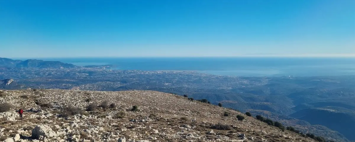
Full Name
Parc Naturel Régional des Préalpes d’Azur
Highest Peak 1778m (5,833ft) 📍Montagne du Cheiron
Just over an hour from Cannes, the Préalpes d’Azur show you a completely different side of the Côte d’Azur, quieter and wilder. This area, now a designated Regional Natural Park, feels like a giant balcony between the sea and the mountains, with deep valleys, limestone plateaus, panoramic ridgelines, and untouched little villages. Out here, glitter gets swapped for hiking boots, crowds for sheep, and palm trees for oaks and lavender. It’s your chance to discover a higher-altitude Provence that still flies under the radar.
At the south of the park, the mountains above Tourrettes-sur-Loup offer stunning views and a real sense of being immersed in nature. Two main peaks define the skyline: the Puy de Tourrettes and the Pic des Courmettes.
The Puy de Tourrettes, standing over 1,200 meters high, looks like a huge limestone wave rising above the coast. The hike takes you through alpine meadows sprinkled with wildflowers in spring, and you’ll get sweeping views almost from the start. At the top, the panorama is incredible: to the west, the wooded hills of the Grasse backcountry; to the south, the sparkling Mediterranean all the way to the horizon; and to the north, the snow-capped peaks of the Alps, even when it’s not winter.
A bit further south, the Pic des Courmettes gives you equally jaw-dropping views. Perfect for spotting high-altitude Mediterranean plants and wildlife, the trail climbs through oak and pine woods, then opens onto a wide plateau where the summit stands tall. From up there, you can look out over the coastline from Nice to the Estérel, and on a super clear day, you might even catch a glimpse of Corsica.
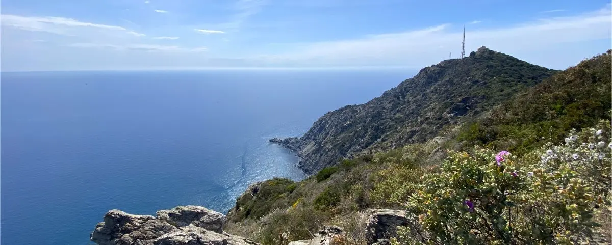
Estérel
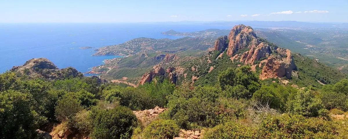
In Our Expanded Picks ☑️
Full Name
Massif de l’Estérel
Highest Peak 614m (2,014ft) 📍Mont Vinaigre
Just a stone’s throw from Cannes, the Estérel Massif offers a breathtaking escape where sky, sea, and fiery red rock come together. This ancient volcanic range, ripped from its original base during the formation of the Mediterranean, unfolds a dramatic landscape of jagged ridges, steep cliffs, dense forests, and fragrant scrubland. But what really grabs you first is the color, deep, glowing shades of red and orange that pop against the intense blue of the sea. The contrast is just stunning.
To really take in the full beauty of the Estérel, though, you’ve got to head inland and gain some altitude.
Not far from the coast, the Pic de l’Ours is one of the massif’s most iconic peaks. You can hike up to it on gorgeous trails, and once you’re at the top, the view is unforgettable, you’ll see the whole coastline laid out before you: the Estérel hills, the Lérins Islands, the bays of Cannes and Saint-Raphaël, and on a clear day, even the Mercantour mountains or Corsica in the distance.
Close by, the Dent de l’Ours peack adds to the drama. This razor-sharp ridge, bristling with jagged red rocks, looks wild and sculptural, like nature’s own art installation.
Between the two, the trails wind through classic Mediterranean vegetation, holm oaks, Aleppo pines, heather, rockrose, and mastic trees, filling the air with resinous scents and salty breezes.
Maures
Full Name
Massif des Maures
Highest Peak 776m (2,546ft) 📍Signal de la Sauvette
The Maures massif stretches for about sixty kilometers between Hyères and Fréjus, with its dark, thick forests covering rolling hills. Its name comes from the Provençal word “mauro”, meaning “dark,” a nod to the deep shades of its oak and chestnut trees.
This mountain range stayed pretty isolated for a long time and wasn’t really accessible until the late 1800s.
The highest point in the massif gives you stunning views over the Gulf of Saint-Tropez, the Mediterranean and the Îles d’Or. One of the best hikes takes you up to the Notre-Dame-des-Anges chapel, perched on a ridge with views that stretch all the way to Porquerolles on a clear day. Whether you’re on the ridgelines or tucked away in the woods, the Maures offer a real wild nature experience, with stripped cork oaks, forgotten trails and quiet wildlife.
To the north, the Maures plain connects the schist landscapes of the massif to the limestone plateaus further inland in Provence.
And then, between land and sea, the massif literally drops into the Mediterranean, forming the Corniche des Maures, a scenic road clinging to the cliffs between Bormes-les-Mimosas and Cavalaire. It overlooks white coves and wooded capes, where the forest almost dips its toes into the waves.
COASTAL PATHS
Overview Table
| Name | Top Picks | Exp. Picks |
|---|---|---|
| Cap Martin | ||
| Cap d'Ail | ||
| Cap Ferrat | ✅ | ☑️ |
| Promenade Rouvier | ||
| Cap de Nice | ||
| Cap d'Antibes | ☑️ | |
| Cap Dramont | ||
| Presqu'île St-Tropez | ||
| Cap Sicié |
Cap Martin
Full Names
Sentier du Corbusier
Sentier Massolin
The Cap Martin path gives you a mix of wild and well-kept scenery, with Mediterranean plants all around and villas hidden behind their walls. You’re walking right by the sea, with pines and agaves leaning toward the waves, and the rocks shaping a raw, rugged shoreline.
Cap d'Ail
Full Names
Sentier du Cap d’Ail
Sentier du Bord de Mer
The Cap d’Ail trail starts (or ends) at Mala Beach, tucked between cliffs in a turquoise setting. From there, it hugs the coastline right at the foot of the rocks, brushing past stunning villas hidden behind lush gardens. You’ll walk past palm trees, fig trees, and all kinds of Mediterranean flowers.
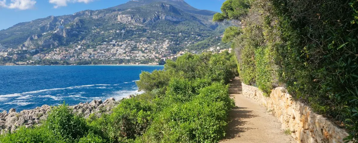
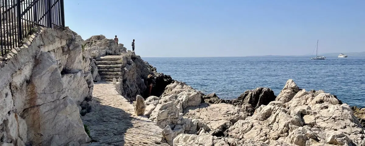
Cap Ferrat
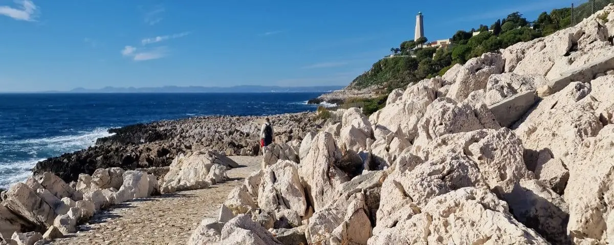
In Our Top Picks ✅
Full Names
Sentier du Littoral
Sentier de Saint-Jean-Cap-Ferrat
Chemin des Douaniers
This trail takes you along a wild coastline shaped by wind and waves. You’ll see chalky cliffs, hidden coves, an old quarry, and this stunning rocky landscape at Pointe Causinière. The sea can get pretty loud and rough here. Along the way, you’ll spot the lighthouse in this dramatic, remote Riviera vibe.
Promenade Rouvier
Full Name
Promenade Maurice Rouvier
This walk links the town of Beaulieu-sur-Mer to the port of Saint-Jean-Cap-Ferrat. It follows the coastline, edged with pines and cypresses, and gives you some sea views all along the way.
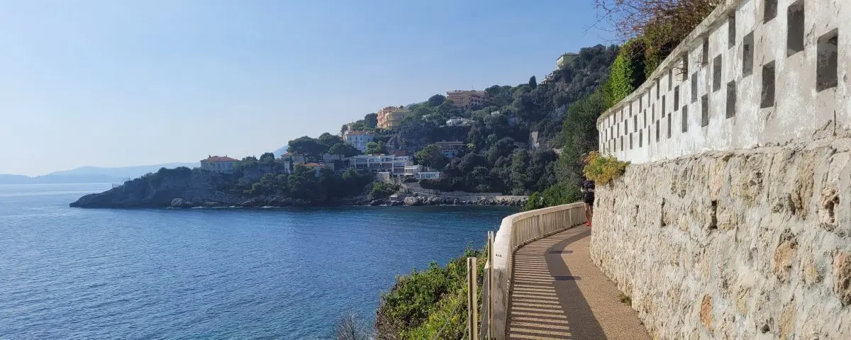
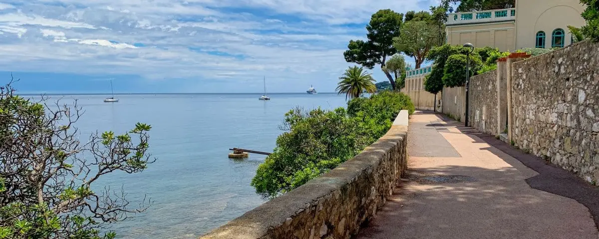
Cap de Nice
Full Name
Sentier du Littoral
This part of the coastal path starts at Coco Beach, at the far end of Nice’s port, and winds its way between rocks and pine trees all the way to the nearby town of Villefranche-sur-Mer. It’s one of the prettiest walks in the area, with steel-blue sea, quiet little coves, white cliffs, and the curves of the bay in the distance. The trail sticks close to the Mediterranean, sometimes narrow, sometimes steep.
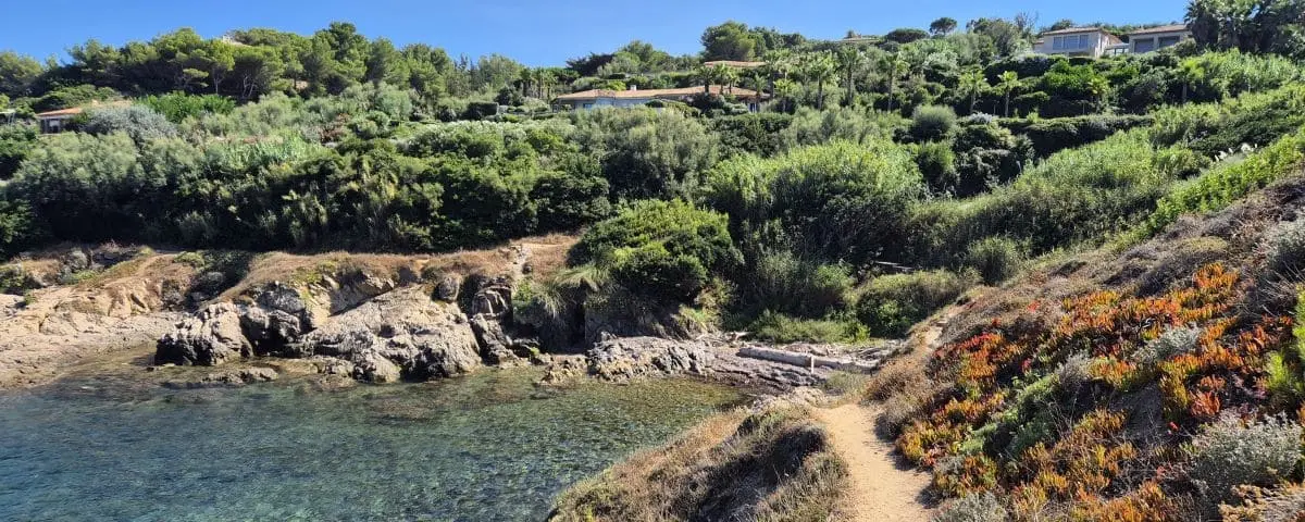
Cap d'Antibes
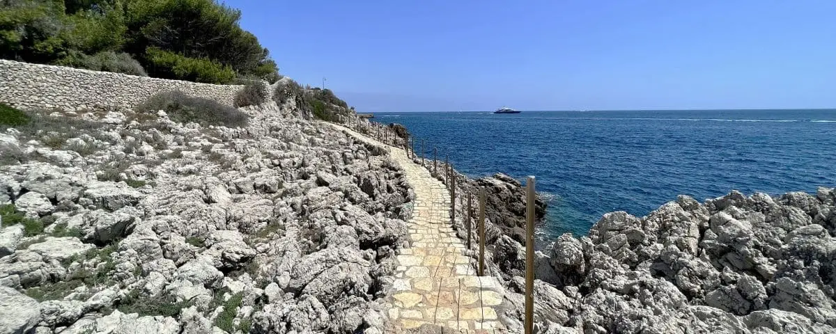
In Our Expanded Picks ☑️
Full Names
Sentier du Littoral
Sentier Tirepoil
You’ll wind your way through pine trees, past luxury hotels and villas tucked behind high walls. The path hugs tiny coves, loops around the tip of the cape, and follows a rocky shoreline lined with umbrella pines. Down below, the sea gently laps at the rocks. It’s a walk where understated luxury meets Mediterranean nature.
Cap Dramont
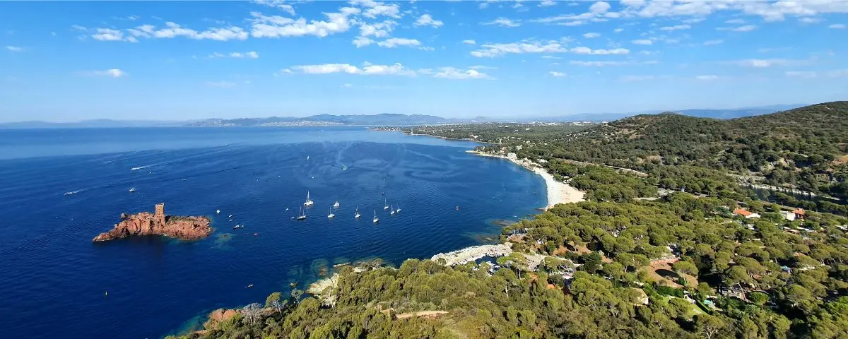
Full Name
Sentier du Littoral du Cap Dramont
This walk wraps around Cap Dramont in a raw and dramatic atmosphere. The red rocks of the Estérel mountains plunge straight into deep blue waters. You’ll spot leaning pines, fig trees, and mastic shrubs growing out of cracks. Offshore, the Île d’Or looks like it’s floating on the sea, with its proud little tower standing alone.
Presqu'île St-Tropez
Full Name
Sentier du Littoral
This path shows you a whole different side of Saint-Tropez, far from yachts and buzzing streets. You’ll walk through fragrant pine forests, emerald coves, rugged rocks, and secret little passages. The air smells like cistus and eucalyptus. It feels like a wilder, more intimate Riviera, one that’s almost forgotten in all the clichés.
Cap Sicié
Full Name
Sentier du Littoral Notre-Dame du Mai
You’ll hike through dark rocks, twisted pines, and dry heather. The path climbs up the hillside, with views over unreachable coves, and crosses a forest rich in wild scents. Sometimes, the sea suddenly spreads out wide, revealing distant capes, islands or silhouettes. The route takes you to the chapel of Notre-Dame-du-Mai, perched in a rugged setting, a peaceful spot overlooking the sea.