


INTERACTIVE MAP
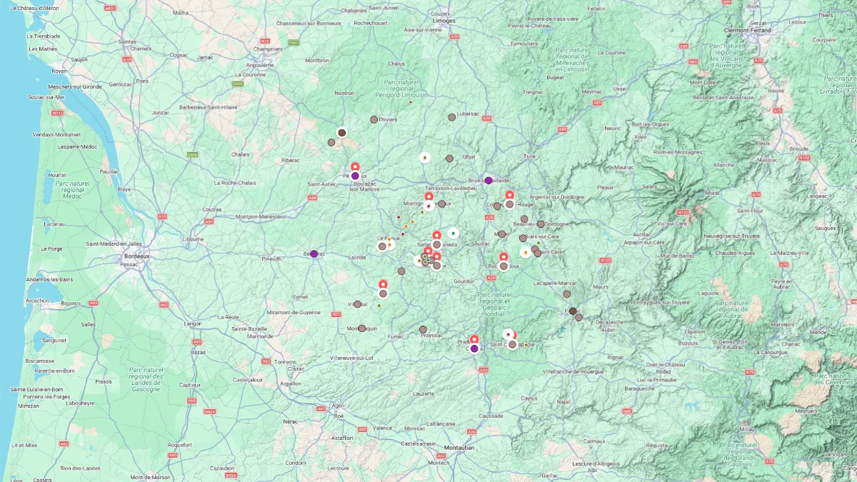
Click on the icon  in the top-right corner to view the map in full screen.
Show/Hide layers as needed.
After clicking on the image,
click on the icon  in the top-left corner to display the map legend.
Show/Hide layers as needed.
ALL
Overview Table
| Name | Type |
|---|---|
| Périgueux | Town |
| Lascaux | Parietal Art |
| Sarlat-la-Canéda | Small Town |
| Marqueyssac Garden | Garden |
| Domme | Village |
| Monpazier | Village |
| Collonges-la-Rouge | Village |
| Rocamadour | Village |
| Saint-Cirq-Lapopie | Village |
| Cahors | Town |
Périgueux
Type Town
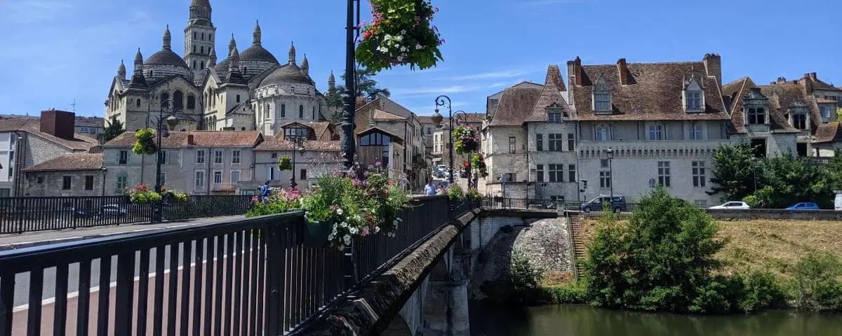
Périgueux feels like a city built in layers, where each period of its history is still easy to see without going far. The center is easy to explore on foot, between ancient stone buildings, narrow streets, impressive religious landmarks, and traces of the Roman city.
In the Vésone district, Périgueux reveals its Roman roots. This is where Vesunna once stood, the ancient city whose remains are now showcased in the Vesunna Gallo-Roman Museum.
The atmosphere changes in the medieval center. Around the Saint Front district, the streets become narrow, winding, and often pedestrian only. You walk past stone facades, hidden passageways, and small openings onto the city, with the Mataguerre Tower serving as both a landmark and a viewpoint.
The Périgueux Cathedral dominates the city with its large white domes. Its appearance is striking, very different from the tall, vertical churches people often picture when they think of France. Begun in the 11th century, expanded in the 12th, and restored in the 19th, it remains the city’s most iconic landmark.
Lascaux
Type Parietal Art
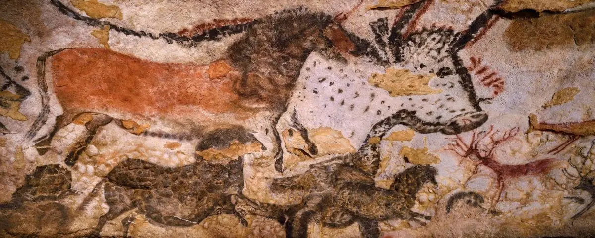
Lascaux Cave discovered in 1940 is a UNESCO World Heritage site renowned for its extraordinary Paleolithic cave paintings. The cave contains some of the best-preserved and most complex depictions of prehistoric art.
Today, there are 4 Lascaux sites, but only Lascaux II and IV are open to visitors.
Lascaux II and IV are close to each other, but visiting just one of them is enough.
- Lascaux I
The original cave, opened to the public in 1948, was definitively closed in 1963 due to deterioration caused by visitors.
- Lascaux II
Price €16 – Guided Visit only
This is an exact replica of the two main sections of the original cave. Opened in 1983, it was created to balance the need for conservation with public interest.
This site offers a more “natural” experience, similar to the original Lascaux I cave.
⚙️ Hours & Prices (Official Website)
- Lascaux III
Unlike the fixed replica of Lascaux II, Lascaux III consists of a traveling exhibition, showcasing reproductions of the cave’s art around the world.
- Lascaux IV
Price €23 – Guided Visit only
Opened in 2016, the International Centre for Cave Art, or Lascaux IV, offers a comprehensive digital and physical reproduction of the entire Lascaux cave system. It also includes extensive interpretative displays that explore the archaeological, artistic, and cultural significance of the site.
This site is more modern and larger, offering additional rooms (still related to cave art) along with the reproduction of the original Lascaux I cave.
(It’s also more accessible for people with reduced mobility).
Sarlat-la-Canéda

Type Small Town
Sarlat offers one of the most impressive historic townscapes in France. You walk through a small town of golden stone, with cobbled lanes, narrow passages, hidden courtyards, alleyways, and facades that give a strong impression of an intact historic setting.
After the Hundred Years’ War, wealthy families built many fine houses. This mix of medieval and Renaissance architecture gives the center its dense character: carved windows, dark roofs, staircases, towers, and grand facades.
Saint-Sacerdos Cathedral, begun in the 14th century, shows several styles because its construction lasted for a very long time. Its bell tower porch comes from an older church.
In the 1960s, Sarlat became a French model for urban restoration: facades were cleaned, roofs redone, wires hidden, and cobblestones put back in place. More than 250 buildings, monuments, and sites were saved.
Marqueyssac
Type Garden
Full Name
Jardins de Marqueyssac
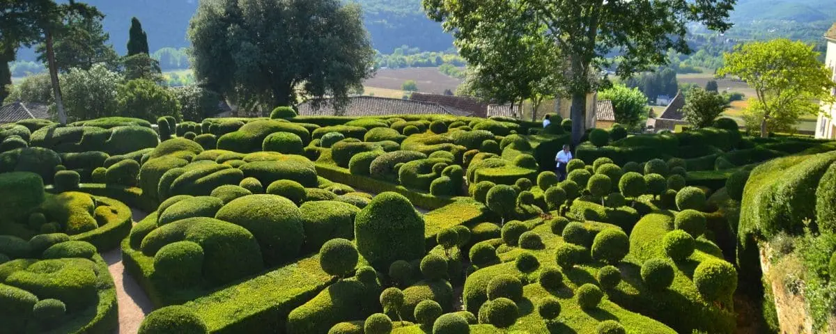
Marqueyssac Garden occupies a rocky ridge above the Dordogne River. You follow paths lined with clipped boxwood shaped into rounded forms that seem almost to ripple across the landscape.
The walk leads to a spectacular panorama over the valley, its castles, and the villages set between cliffs and riverbanks. The site combines a romantic atmosphere, lush vegetation, and sweeping views.
Domme

Type Village
Domme stands high above the Dordogne River. You enter through old fortified gates, then make your way between stone houses, small squares, and sweeping views across the valley.
Beneath the village, a large cave has been opened to visitors, with a 400 metre gallery lined with stalactites, stalagmites, columns, and pools of water. At the exit, the Jubilee Terrace offers a direct view toward Beynac and La Roque-Gageac.
Monpazier
Type Village
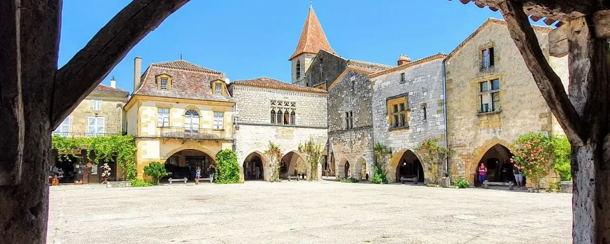
Monpazier is a fortified medieval village built according to a remarkably regular plan. You walk along straight, almost geometric streets that lead to a large central square surrounded by arcades.
The Place des Cornières gives the village much of its character: houses of equal width, covered walkways, and corners cut away to allow horsemen to pass through. The whole village has retained a rare sense of harmony since the 13th century.
Collonges-la-Rouge
Type Village
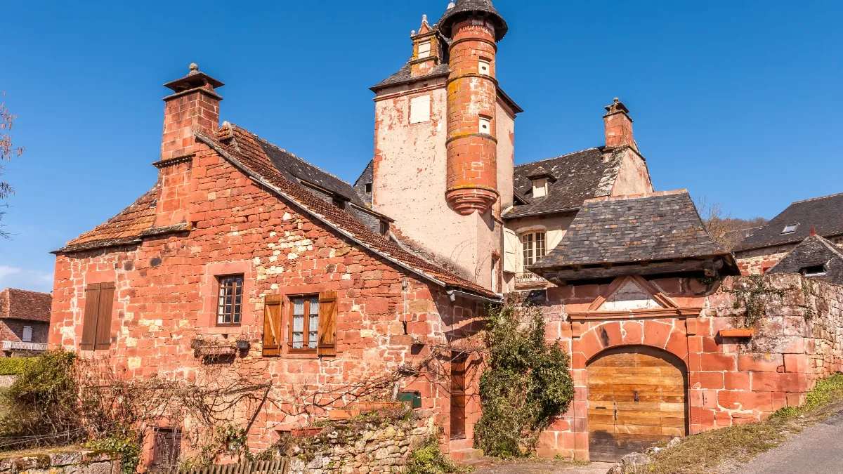
Collonges-la-Rouge immediately stands out because of its colour. The entire village seems to be built from red sandstone, a local stone that gives its walls, towers, and roofs a very distinctive character.
You walk among noble houses, small squares, turrets, vaulted passageways, and carved details. From the 16th century onward, the village attracted powerful families, which explains the richness of its architecture.
Rocamadour
Type Village
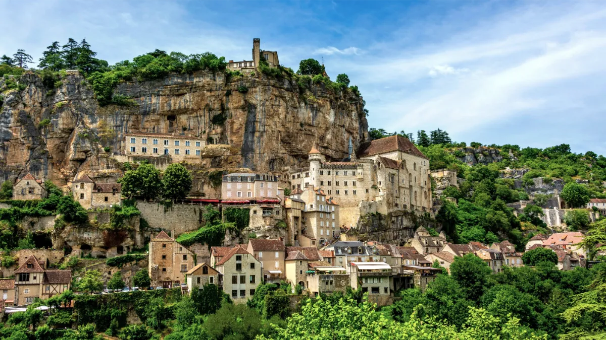
Rocamadour is striking for its almost impossible setting. Medieval houses and sanctuaries, religious pilgrimage buildings, cling to a vast cliff above a deep gorge.
You make your way up in stages, between the main street, staircases, and chapels. The site has been famous for centuries, but it remains above all spectacular for its balance of stone, empty space, verticality, and landscape.
Saint-Cirq-Lapopie
Type Village
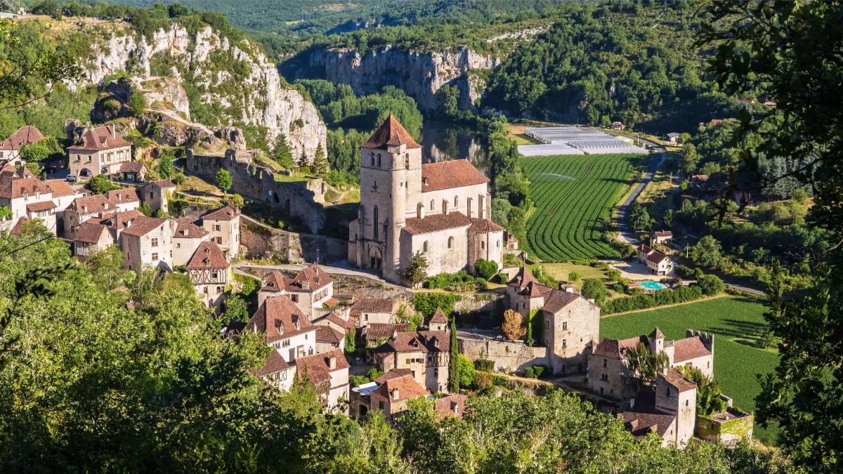
Saint-Cirq-Lapopie clings to a hillside 100 metres above the river. You’ll see tightly packed houses, steep roofs, and warm colours, with grey stone, ochre tones, and touches of flowers.
For a long time, the village had a defensive role, dominated by several castles and fortified houses. In the 13th century, it was also home to many craftsmen, including barrel tap makers, coppersmiths, and leather workers.
Cahors
Type Town
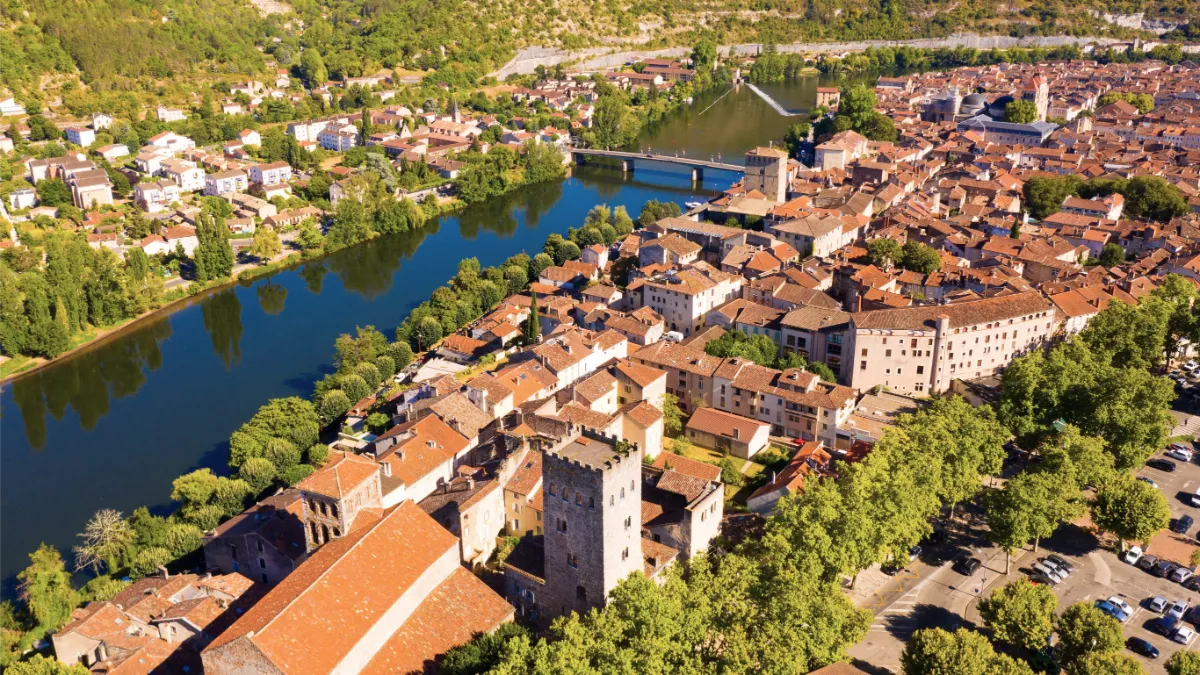
Cahors developed within a wide bend of the Lot River, giving it almost the appearance of a peninsula. Here, you discover an old town shaped by the Middle Ages, with narrow streets, small squares, and stone houses.
As you walk toward the riverbanks, you reach the Pont Valentré, a large fortified bridge dating from the 14th century, with its tall towers and reflection in the water. Set slightly away from the town center, it remains Cahors’ most iconic landmark.
Saint-Étienne Cathedral is another reminder of the city’s religious importance during the Middle Ages.