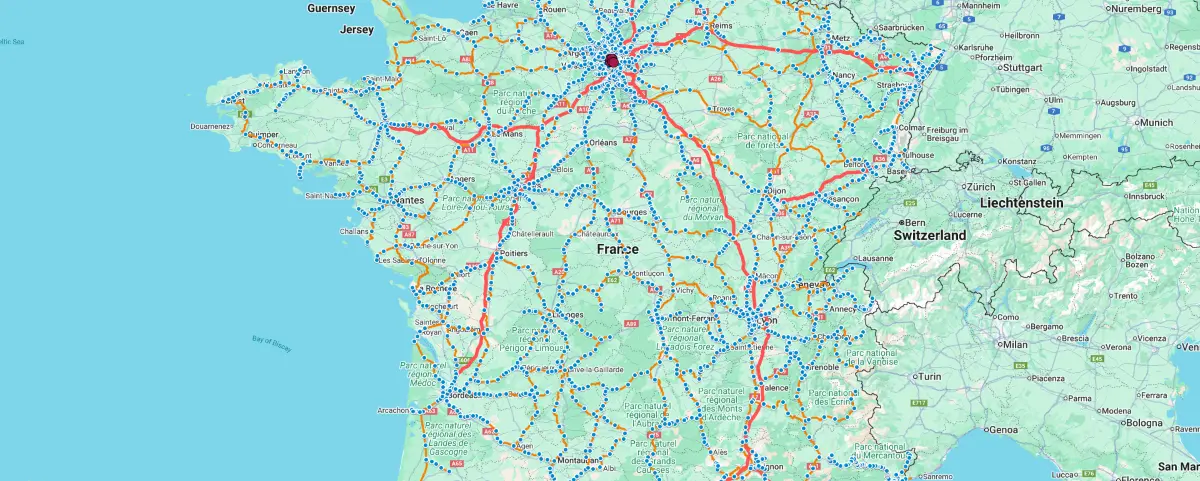
FRANCE TRAIN MAP
Click on the icon ![]() in the top-right corner to view the map in full screen.
in the top-right corner to view the map in full screen.
After clicking on the image,
click on the icon ![]() in the top-left corner to display the map legend.
in the top-left corner to display the map legend.
What
This map shows the rail network and stations in France that can be used by passengers (TGV, TER, Ouigo, etc).
Lines and stations dedicated solely to freight, as well as those no longer in use, are intentionally not displayed.
How to use
Zoom in on the desired area.
This map lets you see if there are stations and connections between the places you want to travel to.
⚠️ If there are, it doesn’t necessarily mean the journey is available on the day you plan to travel.
You’ll need to check that, and also find out the price and buy your ticket.
– You can use the official French railway page: SNCF Website
– Another way to check this information is through the Trainline platform (which is available for France and other European countries)
– For checking the journey only, you can also use Google Maps, which is 99% reliable.
Paris Region
It includes RER (suburban train) and Transilien (regional train) lines and stations.
It does not include Metro or Tram lines.
For this area, it’s better to use the map below, which is more detailed.
Clicking on items
– By clicking on a station, you can see its name.
– Clicking on a line has no use, as these are just track outlines (except for Non-SNCF Lines).
Night Trains
Hide the layers and show the last two.
Up-to-date
The map data is based on the latest update provided by SNCF, dated April 2026.
Data Source: SNCF Réseau (Fr)
PARIS REGION TRANSPORT MAP
If you’re looking to get around the Paris Region, it’s best to use this interactive map, which is Google Maps with the “Transit” layer enabled.
It includes: Metro, RER, Transilien, Tramway lines and stations.